

Aerial Archaeology in Ireland - The Heritage Council
Aerial Archaeology in Ireland - The Heritage Council
Aerial Archaeology in Ireland - The Heritage Council

You also want an ePaper? Increase the reach of your titles
YUMPU automatically turns print PDFs into web optimized ePapers that Google loves.
72<br />
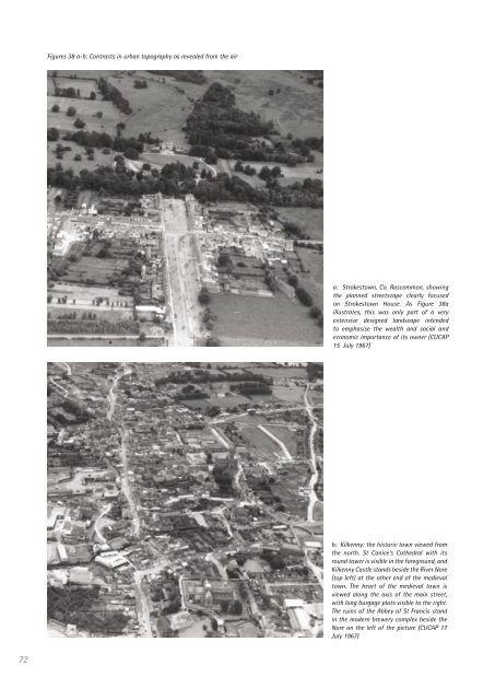
Figures 38 a-b: Contrasts <strong>in</strong> urban topography as revealed from the air<br />
a: Strokestown, Co. Roscommon, show<strong>in</strong>g<br />
the planned streetscape clearly focused<br />
on Strokestown House. As Figure 38a<br />
illustrates, this was only part of a very<br />
extensive designed landscape <strong>in</strong>tended<br />
to emphasise the wealth and social and<br />
economic importance of its owner (CUCAP<br />
15 July 1967)<br />
b: Kilkenny: the historic town viewed from<br />
the north. St Canice’s Cathedral with its<br />
round tower is visible <strong>in</strong> the foreground, and<br />
Kilkenny Castle stands beside the River Nore<br />
(top left) at the other end of the medieval<br />
town. <strong>The</strong> heart of the medieval town is<br />
viewed along the axis of the ma<strong>in</strong> street,<br />
with long burgage plots visible to the right.<br />
<strong>The</strong> ru<strong>in</strong>s of the Abbey of St Francis stand<br />
<strong>in</strong> the modern brewery complex beside the<br />
Nore on the left of the picture (CUCAP 17<br />
July 1967)


