Agricultural Drought Indices - US Department of Agriculture
Agricultural Drought Indices - US Department of Agriculture
Agricultural Drought Indices - US Department of Agriculture
You also want an ePaper? Increase the reach of your titles
YUMPU automatically turns print PDFs into web optimized ePapers that Google loves.
United States is sent to the Secretary’s <strong>of</strong>fice. Furthermore, alerts <strong>of</strong> anomalous weather<br />
conditions impacting agriculture around the globe are included in a daily report <strong>of</strong> agricultural<br />
developments that is sent to <strong>US</strong>DA policy makers each afternoon.<br />
Inputs from JAWF are integrated into <strong>US</strong>DA’s monthly foreign crop production estimates. JAWF<br />
provides an objective procedure for translating the flow <strong>of</strong> global weather information into<br />
assessments <strong>of</strong> crop-yield potentials, which are then integrated into <strong>US</strong>DA’s analytical process for<br />
estimation <strong>of</strong> global area, yield, and production statistics. These data are in turn used to evaluate<br />
global supply use estimates. The evaluation <strong>of</strong> a crop’s yield response is based upon the<br />
cumulative effects <strong>of</strong> weather during crop development. The crop’s response to anomalous<br />
weather is a function <strong>of</strong> crop type and growth stages.<br />
JAWF serves as the <strong>US</strong>DA focal point for weather data received from the Global Observing<br />
System, a worldwide network <strong>of</strong> nearly 8,000 meteorological reporting stations managed by the<br />
World Meteorological Organization (WMO). The WMO data are stored and maintained at JAWF in<br />
a sophisticated data warehouse that utilizes advanced database technology. These data are used<br />
at JAWF and other <strong>US</strong>DA agencies for a number <strong>of</strong> agricultural applications. The agricultural<br />
meteorologists <strong>of</strong> OCE/WAOB/JAWF merge these weather data with climatological analyses and<br />
global agronomic data to determine the weather’s impact on crop development and yield potential.<br />
A major source <strong>of</strong> domestic weather and climate data that are <strong>of</strong>ten used in special operational<br />
crop and weather analyses for the United States comes from the NWS’s Cooperative Observer<br />
(COOP) Network <strong>of</strong> more than 3,500 daily reporting stations.<br />
Weekly Weather and Crop Bulletin (WWCB) and other <strong>US</strong>DA Publications<br />
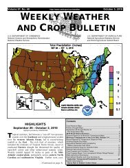
Weekly domestic and international crop-weather assessments are published in the Weekly<br />
Weather and Crop Bulletin (WWCB), which is JAWF’s flagship publication (Motha and<br />
Heddinghaus 1986). The WWCB is jointly produced by <strong>US</strong>DA/OCE/WAOB, <strong>US</strong>DA/National<br />
<strong>Agricultural</strong> Statistics Service (NASS), and the DOC/NOAA/NWS/NCEP/CPC. First published in<br />
1872 as the Weekly Weather Chronicle, the publication has evolved over the past 138 years into<br />
one that provides a vital source <strong>of</strong> information on weather, climate, and agricultural developments<br />
worldwide. The publication is a unique example <strong>of</strong> how two major departments (<strong>US</strong>DA and DOC)<br />
within the federal government can cooperate, combining meteorology and agriculture to provide a<br />
service that benefits the economic well-being <strong>of</strong> the nation. Data and information contained within<br />
the WWCB are generated by the efforts <strong>of</strong> thousands <strong>of</strong> people, including about 3,000 county<br />
extension agents, NASS crop reporters, field <strong>of</strong>fice personnel, state universities, National Weather<br />
Service Forecast Offices, and more than 5,000 weather observers, mostly volunteer, working with<br />
the NWS. The WWCB highlights weekly meteorological and agricultural developments on a state,<br />
national, and international scale, providing written summaries <strong>of</strong> weather and climate conditions<br />
affecting agriculture as well as detailed maps and tables <strong>of</strong> agrometeorological information that is<br />
appropriate for the season.<br />
The WWCB emphasizes the cumulative influence <strong>of</strong> weather on crop growth and development.<br />
Weather conditions influence important farming operations such as planting and harvesting, and<br />
greatly influence yield at critical stages <strong>of</strong> crop development. The WWCB also provides timely<br />
weather and crop information between the monthly Crop Production and World <strong>Agricultural</strong> Supply<br />
and Demand Estimates reports, issued by <strong>US</strong>DA/NASS and <strong>US</strong>DA/OCE/WAOB, respectively.<br />
The WWCB is available in electronic form from the OCE web site at<br />
http://www.usda.gov/oce/weather/index.htm.<br />
The main users <strong>of</strong> the WWCB include crop and livestock producers, farm organizations,<br />
agribusinesses, state and national farm policy makers, and government agencies. Information<br />
contained in the WWCB keeps farmers, commodity analysts, economists, and producers up-todate<br />
on worldwide weather related developments and their effects on crops and livestock. The<br />
WWCB provides critical information to decision makers formulating crop production forecasts and<br />
trade policy. <strong>Agricultural</strong> statistics are used to plan and administer other related federal and state<br />
programs in such areas as consumer protection, conservation, foreign trade, education, and<br />
recreation. Crop and weather reports are especially important in farming areas. A dry or wet<br />
40


