(Blue Diamond Road) Corridor Study - Regional Transportation ...
(Blue Diamond Road) Corridor Study - Regional Transportation ...
(Blue Diamond Road) Corridor Study - Regional Transportation ...

You also want an ePaper? Increase the reach of your titles
YUMPU automatically turns print PDFs into web optimized ePapers that Google loves.
6. SR-160 <strong>Corridor</strong> Improvement Plan RTC SR-160 <strong>Corridor</strong> <strong>Study</strong><br />
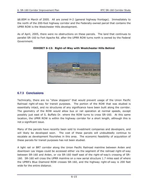
$8.85M in March of 2005. All are zoned H-2 (general highway frontage). Immediately to<br />
the north of the 200-foot highway corridor and the Federally-owned parcel that contains the<br />
UPRR ROW is the Westchester Hills development.<br />
As of April, 2005, there were no obstructions on these parcels. The land that continues to<br />
parallel SR-160 to Fort Apache Rd. after the UPRR ROW turns north is owned by the Federal<br />
Government.<br />
EXHIBIT 6-13: Right-of-Way with Westchester Hills Behind<br />
6.7.3 Conclusions<br />
Technically, there are no “show stoppers” that would prevent usage of the Union Pacific<br />
Railroad right-of-way for transit purposes. The portion of the ROW that was studied is<br />
essentially intact, and no structures of any significance have been built along the corridor.<br />
The geometry of the ROW would allow bus or rail operation at normal speeds, except<br />
possibly just east of S. Buffalo Dr. where the ROW turns to cross SR-160. At this same<br />
location, the UPRR ROW is within the highway corridor for a short length, although this is<br />
not a significant issue.<br />
Many of the parcels have recently been sold to investment companies and developers, and<br />
will likely be developed soon. The cost of these parcels will undoubtedly continue to<br />
escalate as development flourishes in this area. The economic feasibility of acquisition of<br />
these parcels for transit purposes has not been studied.<br />
A light rail or BRT corridor along the Union Pacific Railroad mainline between Arden and<br />
downtown Las Vegas could be accessed either via the segment of the railroad right-of-way<br />
between SR-160 and Arden, or via SR-160 itself east of the right-of-way’s crossing of SR-<br />
160. SR-160 will cross the UPRR mainline on a new aerial structure 1.7 miles east of where<br />
the UPRR’s <strong>Blue</strong> <strong>Diamond</strong> ROW crosses SR-160, and the highway right-of-way is 200 feet<br />
wide for the entire distance.<br />
6-15