

Planetary Geology pdf - NASA
Planetary Geology pdf - NASA
Planetary Geology pdf - NASA

You also want an ePaper? Increase the reach of your titles
YUMPU automatically turns print PDFs into web optimized ePapers that Google loves.
words, for a rock unit that is faulted, the rock is<br />
older than the faulting event. Embayment states that<br />
a unit Òflooding intoÓ (embaying) another unit must<br />
be younger. On planetary surfaces, impact crater<br />
frequency is also used in determining stratigraphic<br />
relations. In general, older units show more craters,<br />
larger craters, and more degraded (eroded) craters<br />
than younger units.<br />
Once the stratigraphic relations have been determined,<br />
the units are listed on the map in order from<br />
oldest (at the bottom) to youngest (at the top). This<br />
is called the stratigraphic column. The final task,<br />
and the primary objective in preparing the photogeologic<br />
map, is to derive a general geologic history of<br />
the region being mapped. The geologic history synthesizes,<br />
in written format, the events that formed<br />
the surface seen in the photo -- including interpretation<br />
of the processes in the formation of rock units<br />
and events that have modified the units -- and is<br />
presented in chronological order from oldest to<br />
youngest.<br />
Figure 15.1 shows a sample geologic map, including<br />
its unit descriptions and stratigraphic column.<br />
The relative ages were determined in the following<br />
The Near Side of the Moon<br />
Questions<br />
186<br />
manner: The cratered terrain has more (and larger)<br />
craters than the smooth plains unit -- indicating that<br />
the cratered terrain unit is older. In addition, fault 1<br />
cuts across the cratered terrain, but does not continue<br />
across the smooth plains. Faulting occurred after<br />
the formation of the cratered terrain and prior to the<br />
formation of the smooth plains -- indicating that the<br />
smooth plains unit is younger than the cratered terrain<br />
and fault 1. The crater and its ejecta unit occurs<br />
on top of the smooth plains unit, and thus is<br />
younger. Finally, fault 2 cuts across all the units,<br />
including the crater and its ejecta unit, and is thus<br />
the youngest event in the region. The geologic history<br />
that could be derived from this map would be<br />
similar to the following:<br />
ÒThis region was cratered and then faulted by<br />
tectonic activity. After the tectonic activity, a plains<br />
unit was emplaced. Cratering continued after the<br />
emplacement of the smooth plains unit, as seen by<br />
the craters superposed on the smooth plains and the<br />
large, young crater mapped as its own unit. Finally,<br />
there has been a continuation (or reactivation) of<br />
tectonic activity, indicated by the major fault which<br />
postdates the young crater. Ò<br />
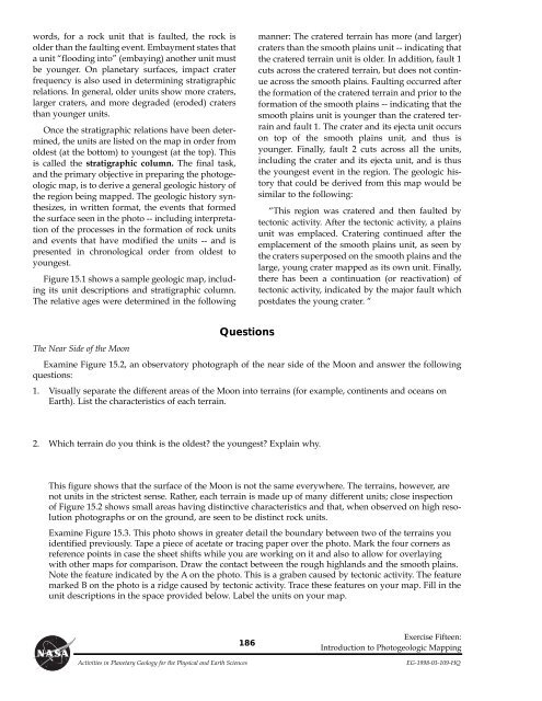
Examine Figure 15.2, an observatory photograph of the near side of the Moon and answer the following<br />
questions:<br />
1. Visually separate the different areas of the Moon into terrains (for example, continents and oceans on<br />
Earth). List the characteristics of each terrain.<br />
2. Which terrain do you think is the oldest? the youngest? Explain why.<br />
This figure shows that the surface of the Moon is not the same everywhere. The terrains, however, are<br />
not units in the strictest sense. Rather, each terrain is made up of many different units; close inspection<br />
of Figure 15.2 shows small areas having distinctive characteristics and that, when observed on high resolution<br />
photographs or on the ground, are seen to be distinct rock units.<br />
Examine Figure 15.3. This photo shows in greater detail the boundary between two of the terrains you<br />
identified previously. Tape a piece of acetate or tracing paper over the photo. Mark the four corners as<br />
reference points in case the sheet shifts while you are working on it and also to allow for overlaying<br />
with other maps for comparison. Draw the contact between the rough highlands and the smooth plains.<br />
Note the feature indicated by the A on the photo. This is a graben caused by tectonic activity. The feature<br />
marked B on the photo is a ridge caused by tectonic activity. Trace these features on your map. Fill in the<br />
unit descriptions in the space provided below. Label the units on your map.<br />
Exercise Fifteen:<br />
Introduction to Photogeologic Mapping<br />
Activities in <strong>Planetary</strong> <strong>Geology</strong> for the Physical and Earth Sciences EG-1998-03-109-HQ


