

Planetary Geology pdf - NASA
Planetary Geology pdf - NASA
Planetary Geology pdf - NASA

You also want an ePaper? Increase the reach of your titles
YUMPU automatically turns print PDFs into web optimized ePapers that Google loves.
Exercise<br />
Three<br />
Purpose<br />
By using stereoscopic pairs of aerial photographs,<br />
you will learn to recognize some of the landforms<br />
that result from the four major geologic processes:<br />
volcanism, gradation, tectonism, and impact cratering.<br />
Materials<br />
Stereoscope, protractor, ruler, calculator.<br />
Introduction<br />
Because our eyes are separated by a short distance,<br />
we view the world from two slightly different<br />
perspectives simultaneously. This enables us to perceive<br />
a scene in three dimensions. In other words,<br />
we are able to perceive the distances to objects and<br />
depth within them. When you look at a photograph,<br />
your eyes see the distance to the flat photo, rather<br />
than the relative distances of objects within the<br />
Figure 3.1. Stereoscopic photographs are typically<br />
obtained from airplanes. The farther apart two photographs<br />
are obtained, the greater the vertical exaggeration<br />
of the resulting stereoscopic images.<br />
Exercise Three: Geologic Landforms<br />
Seen on Stereoscopic Photos<br />
Name<br />
Geologic<br />
Landforms Seen on<br />
Stereoscopic Photos<br />
35<br />
image. The photo appears flat, even though it is an<br />
image of the three-dimensional world. To perceive<br />
apparent depth in photographs, geologists obtain two<br />
pictures of the same object or region from slightly different<br />
perspectives,<br />
as illustrated in<br />
Figure 3.1. When the<br />
images are viewed<br />
simultaneously, one<br />
with each eye, a<br />
Òthree-dimensional,Ó<br />
or stereoscopic,<br />
effect results.<br />
This perception of<br />
vertical relief in aerial<br />
photos can greatly<br />
aid the geologic<br />
interpretation of<br />
landforms in the<br />
image. Most stereoscopic<br />
photographs<br />
are obtained from<br />
aircraft. Because<br />
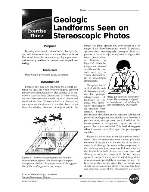
Figure 3.2. Using the pocket stereoscope.<br />
The stereoscope is aligned<br />
horizontally and centered along the<br />
seam separating the image pairs.<br />
the distance the plane moves between subsequent<br />
photos is much greater than the distance between a<br />
personÕs eyes, the apparent vertical relief of the<br />
stereo photos is exaggerated, appearing much<br />
greater than the actual relief. This vertical exaggeration<br />
increases the farther apart the photographs<br />
are taken.<br />
Figure 3.2 shows how to set up a pocket stereoscope.<br />
Place the stereoscope over a stereo pair with<br />
the seam of the photos in the middle of the stereoscope.<br />
Look through the lenses at the two photos, so<br />
that each eye sees just one photo. Pick out a feature<br />
that is visible in both photos, relax your eyes, and<br />
allow your focus to change until the two images<br />
appear to merge. You may need to adjust the position<br />
of your stereoscope slightly as you look through it to<br />
help the photos merge. When they do merge, you<br />
should see a stereoscopic effect. This may take time<br />
and patience. Some of the photographs are stereo<br />
EG-1998-03-109-HQ Activities in <strong>Planetary</strong> <strong>Geology</strong> for the Physical and Earth Sciences


