Create successful ePaper yourself
Turn your PDF publications into a flip-book with our unique Google optimized e-Paper software.
WPS<br />
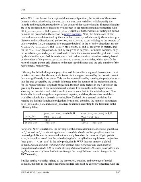
When <strong>WRF</strong> is to be run for a regional domain configuration, the location of the coarse<br />
domain is determined using the ref_lat and ref_lon variables, which specify the<br />
latitude and longitude, respectively, of the center of the coarse domain. If nested domains<br />
are to be processed, their locations with respect to the parent domain are specified with<br />
the i_parent_start and j_parent_start variables; further details of setting up nested<br />
domains are provided in the section on nested domains. Next, the dimensions of the<br />
coarse domain are determined by the variables dx and dy, which specify the nominal grid<br />
distance in the x-direction and y-direction, and e_we and e_sn, which give the number of<br />
velocity points (i.e., u-staggered or v-staggered points) in the x- and y-directions; for the<br />
'lambert', 'mercator', and 'polar' projections, dx and dy are given in meters, and<br />
for the 'lat-lon' projection, dx and dy are given in degrees. For nested domains, only<br />
the variables e_we and e_sn are used to determine the dimensions of the grid, and dx and<br />
dy should not be specified for nests, since their values are determined recursively based<br />
on the values of the parent_grid_ratio and parent_id variables, which specify the<br />
ratio of a nest's parent grid distance to the nest's grid distance and the grid number of the<br />
nest's parent, respectively.<br />
If the regular latitude-longitude projection will be used for a regional domain, care must<br />
be taken to ensure that the map scale factors in the region covered by the domain do not<br />
deviate significantly from unity. This can be accomplished by rotating the projection such<br />
that the area covered by the domain is located near the equator of the projection, since,<br />
for the regular latitude-longitude projection, the map scale factors in the x-direction are<br />
given by the cosine of the computational latitude. For example, in the figure above<br />
showing the unrotated and rotated earth, it can be seen that, in the rotated aspect, New<br />
Zealand is located along the computational equator, and thus, the rotation used there<br />
would be suitable for a domain covering New Zealand. As a general guideline for<br />
rotating the latitude-longitude projection for regional domains, the namelist parameters<br />
pole_lat, pole_lon, and stand_lon may be chosen according to the formulas in the<br />
following table.<br />
(ref_lat, ref_lon) in N.H. (ref_lat, ref_lon) in S.H.<br />
pole_lat 90.0 - ref_lat 90.0 + ref_lat<br />
pole_lon 180.0 0.0<br />
stand_lon -ref_lon 180.0 - ref_lon<br />
For global <strong>WRF</strong> simulations, the coverage of the coarse domain is, of course, global, so<br />
ref_lat and ref_lon do not apply, and dx and dy should not be specified, since the<br />
nominal grid distance is computed automatically based on the number of grid points.<br />
Also, it should be noted that the latitude-longitude, or cylindrical equidistant, projection<br />
(map_proj = 'lat-lon') is the only projection in <strong>WRF</strong> that can support a global<br />
domain. Nested domains within a global domain must not cover any area north of<br />
computational latitude +45 or south of computational latitude -45, since polar filters are<br />
applied poleward of these latitudes (although the cutoff latitude can be changed in the<br />
<strong>WRF</strong> namelist).<br />
Besides setting variables related to the projection, location, and coverage of model<br />
domains, the path to the static geographical data sets must be correctly specified with the<br />
<strong>WRF</strong>-<strong>ARW</strong> V3: User’s <strong>Guide</strong> 3-12


