
Create successful ePaper yourself
Turn your PDF publications into a flip-book with our unique Google optimized e-Paper software.
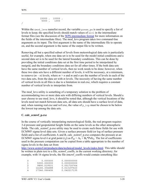
WPS<br />
/<br />
15000 , 10000 ,<br />
5000 , 1000<br />
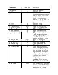
Within the &mod_levs namelist record, the variable press_pa is used to specify a list of<br />
levels to keep; the specified levels should match values of xlvl in the intermediate<br />
format files (see the discussion of the WPS intermediate format for more information on<br />
the fields of the intermediate files). The mod_levs program takes two command-line<br />
arguments as its input. The first argument is the name of the intermediate file to operate<br />
on, and the second argument is the name of the output file to be written.<br />
Removing all but a specified subset of levels from meteorological data sets is particularly<br />
useful, for example, when one data set is to be used for the model initial conditions and a<br />
second data set is to be used for the lateral boundary conditions. This can be done by<br />
providing the initial conditions data set at the first time period to be interpolated by<br />
metgrid, and the boundary conditions data set for all other times. If the both data sets<br />
have the same number of vertical levels, then no work needs to be done; however, when<br />
these two data sets have a different number of levels, it will be necessary, at a minimum,<br />
to remove (m – n) levels, where m > n and m and n are the number of levels in each of the<br />
two data sets, from the data set with m levels. The necessity of having the same number<br />
of vertical levels in all files is due to a limitation in real.exe, which requires a constant<br />
number of vertical levels to interpolate from.<br />
The mod_levs utility is something of a temporary solution to the problem of<br />
accommodating two or more data sets with differing numbers of vertical levels. Should a<br />
user choose to use mod_levs, it should be noted that, although the vertical locations of the<br />
levels need not match between data sets, all data sets should have a surface level of data,<br />
and, when running real.exe and wrf.exe, the value of p_top must be chosen to be below<br />
the lowest top among the data sets.<br />
C. calc_ecmwf_p.exe<br />
In the course of vertically interpolating meteorological fields, the real program requires<br />
3-d pressure and geopotential height fields on the same levels as the other atmospheric<br />
fields. The calc_ecmwf_p.exe utility may be used to create such these fields for use with<br />
ECMWF sigma-level data sets. Given a surface pressure field (or log of surface pressure<br />
field) and a list of coefficients A and B, calc_ecmwf_p.exe computes the pressure at an<br />
ECMWF sigma level k at grid point (i,j) as Pijk = Ak + Bk*Psfcij. The list of coefficients<br />
used in the pressure computation can be copied from a table appropriate to the number of<br />
sigma levels in the data set from<br />
http://www.ecmwf.int/products/data/technical/model_levels/index.html. This table should<br />
be written in plain text to a file, ecmwf_coeffs, in the current working directory; for<br />
example, with 16 sigma levels, the file emcwf_coeffs would contain something like:<br />
0 0.000000 0.000000000<br />
1 5000.000000 0.000000000<br />
2 9890.519531 0.001720764<br />
3 14166.304688 0.013197623<br />
4 17346.066406 0.042217135<br />
<strong>WRF</strong>-<strong>ARW</strong> V3: User’s <strong>Guide</strong> 3-28