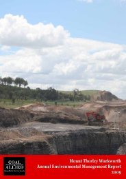
HVO 2009 Annual Environmental Management Report - Final
HVO 2009 Annual Environmental Management Report - Final
HVO 2009 Annual Environmental Management Report - Final

Create successful ePaper yourself
Turn your PDF publications into a flip-book with our unique Google optimized e-Paper software.
Coal & Allied – Hunter Valley Operations<br />
CGW49<br />
CGW49 is located in alluvium north and upslope of CGW6 on the western side of Carrington.<br />
The pH at CGW49 averaged 7.5 in <strong>2009</strong>. A spike in pH values was noted from CGW49 (pH. 8.1) in<br />
September <strong>2009</strong>, however this spike was consistent with bores in the vicinity and within historical ranges for<br />
groundwater located in this alluvium area.<br />
CGW49 EC levels averaged 3,647μS/cm for the <strong>2009</strong> reporting period. CGW49 EC levels trended around<br />
7,000μS/cm before the flood event of June 2007. Subsequent sampling results indicate that the EC values<br />
have levelled out to approximately 4,000μS/cm. This indicates some mixing with the lower EC water from<br />
upslope aquifer recharge after the flood event.<br />
Water levels at CGW49 where recorded at an average depth of 9.07m (61.4m AHD). The water level<br />
remained consistent throughout <strong>2009</strong>.<br />
CGW51A<br />
The pH at CGW51A averaged 7.2 in <strong>2009</strong>. This value is consistent with historical data that since 2006 which<br />
recorded pH values between 6.8 and 7.7.<br />
CGW51A EC levels averaged 11,185μS/cm for the <strong>2009</strong> reporting period. This value is closely aligned with<br />
historical EC data (around 13,000μS/cm) prior to the flood events of June 2007 and suggests aquifer water<br />
quality is returning to normal conditions. The minimum EC of 6,980μS/cm was recorded in the last quarter of<br />
<strong>2009</strong>.<br />
Water levels at CGW51A where recorded at an average depth of 13.97m (55.4m AHD) through <strong>2009</strong>.<br />
CGW52<br />
CGW52 is targeted to follow groundwater levels associated with the Broonie 1 coal seam.<br />
The mean pH at CGW52 was 7.2 in <strong>2009</strong>. This value is consistent with historical data that since 2006 which<br />
recorded pH values between 6.8 and 7.7.<br />
CGW52 EC levels decreased from 6,120μS/cm at the start of the reporting period to 2,450μS/cm at the end of<br />
the reporting period. It is unknown whether this drop is an anomaly or represents a change in groundwater<br />
source.<br />
The standing water level in CGW52 has trended downwards from 15.4m (54.9m AHD) in 2005 to 24.96m<br />
(45.3m AHD) in <strong>2009</strong>. During the <strong>2009</strong> reporting period this trend continued with water levels falling to a<br />
maximum of 26.04m (44.1m AHD) possibly influenced by closer mining activity.<br />
CGW52A<br />
The pH at CGW52A averaged 7.6 in <strong>2009</strong>. This value is consistent with historical data since 2006 with pH<br />
values between 6.8 and 7.7.<br />
CGW52A EC levels have trended down from a high of 9,090μS/cm February 2007 to an average value of<br />
3,887μS/cm for the <strong>2009</strong> reporting period. This gradual trend downward may be influenced by continued river<br />
seepage following initial flushing of salts from the 2007 flood event.<br />
Water level recovered from 12.1m (58.2m AHD) to around 11.4m (58.8m AHD) after the out of bank flood<br />
event of June 2007. This level held steady until January <strong>2009</strong> when a decline commenced to reach a<br />
minimum of 11.97m (58.3 mADH) in July <strong>2009</strong>. The reason for a rise to 9.94 m (60.3 mAHD) in January 2010<br />
is unknown.<br />
CGW45<br />
Recorded as dry and reported to maximum available depth. No samples were able to be extracted.<br />
CGW46<br />
Recorded as dry and reported to maximum available depth. No samples were able to be extracted.<br />
AEMR <strong>2009</strong> 99