HVO 2009 Annual Environmental Management Report - Final
HVO 2009 Annual Environmental Management Report - Final
HVO 2009 Annual Environmental Management Report - Final

You also want an ePaper? Increase the reach of your titles
YUMPU automatically turns print PDFs into web optimized ePapers that Google loves.
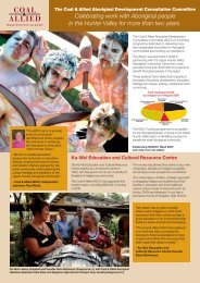
Coal & Allied – Hunter Valley Operations<br />
The results of the Coal & Allied lands assessment survey have been incorporated into the Xstrata<br />
Ravensworth Extension Project Aboriginal heritage assessment report prepared by Umwelt Australia for<br />
Xstrata Coal. Coal & Allied are managing the sites recorded on their lands during the survey and it is<br />
envisaged that these lands will be acquired by Xstrata Coal in the near future.<br />
Riverview Pit <strong>HVO</strong> South salvage programme (AHIP s90 #1102084):<br />
In August <strong>2009</strong>, MCH was commissioned by Coal & Allied Operations to supervise and report on cultural<br />
salvage mitigation activities associated with mining operations at the <strong>HVO</strong> South Riverview Pit under AHIP<br />
s90 #1102084. The salvage mitigation work was conducted over one day with a field team of six Aboriginal<br />
community field officers, a technical advisor (MCH), Coal & Allied data management officer and site<br />
supervisor. A total of 24 sites were salvaged resulting in the collection, cataloguing and storage of 66<br />
artefacts. A salvage report was compiled by MCH and submitted to DECCW in October <strong>2009</strong>.<br />
Carrington Pit, Hunter Valley Operations:<br />
In June <strong>2009</strong>, Coal & Allied Operations announced its intention to seek environmental approval to extend<br />
mining operations at the <strong>HVO</strong> North Carrington Pit covering an additional area of 142ha. Coal & Allied<br />
commissioned the extension assessment work under the modification of the development consent DA 450-<br />
10-2003, clause 8(J)8 (EP&A Act) 2000 and Section 75W 1979 (EP&A Act 1979).<br />
In September <strong>2009</strong> MCH was commissioned by Coal & Allied Operations to conduct an Aboriginal cultural<br />
heritage assessment of the previously un-assessed portion of the proposed Carrington West Extension Area.<br />
An area of approximately 120ha was comprehensively surveyed with a series of 100m wide pedestrian<br />
transects. The fieldwork was conducted over two days with a field team of six Aboriginal community field<br />
officers, a technical advisor (MCH), Coal & Allied data management officer and site supervisor The study<br />
identified five isolated artefact sites (<strong>HVO</strong>-1121 to 1125) and one Potential Archaeological Deposit. Further<br />
assessments are planned for early 2010 and the results of the Carrington Extension surveys will be<br />
incorporated into the Carrington Extension Project <strong>Environmental</strong> Assessment Aboriginal heritage<br />
assessment report.<br />
3.12.4 Historic Heritage<br />
Rio Tinto Coal Australia has adopted a precautionary management principle for all potential historic heritage<br />
features until such time as these sites have been properly assessed and appropriate management regimes<br />
established.<br />
In late 2005, Rio Tinto Coal Australia commissioned <strong>Environmental</strong> Resources <strong>Management</strong> Australia (ERM)<br />
to report and provide guidance on the nature, condition, potential significance and management of all known<br />
historic heritage places located on Rio Tinto Coal Australia owned lands in the Hunter Valley. However, there<br />
are no known historic heritage sites listed in either the Rio Tinto Coal Australia Historic Heritage Places<br />
register or NSW Heritage Register located within <strong>HVO</strong> operational areas.<br />
Two historic heritage investigations were conducted during <strong>2009</strong>. In March <strong>2009</strong> Georadar Research Pty Ltd<br />
was commissioned by Coal & Allied Operations to conduct a geophysical investigation involving GPR at the<br />
Barellan Farm area located in <strong>HVO</strong> South. The purpose of the GPR survey was to assess the possible<br />
location of an historic cemetery on a hill behind the old homestead site. The work was conducted over one<br />
day with a field team consisting of two geo-physicists, two Aboriginal community field officers, a Coal & Allied<br />
archaeologist/data management officer and site supervisor.<br />
The cemetery study grid was comprised of three 70m and five 40m long transects conducted using a handcart<br />
mounted GSSI SIR -3000 GPR unit to collect the geophysical data. The GPR data found no conclusive<br />
evidence of human burials, however, two features were identified and have been classified as targets of<br />
archaeological potential and may be subject to further archaeological investigation in the future. Stock proof<br />
fencing has been installed around a 300m x 150m protection buffer area established around the cemetery<br />
area.<br />
During late May and early June an historic heritage assessment was conducted in conjunction with a<br />
comprehensive Aboriginal cultural heritage assessment survey over approximately 340ha of Coal & Allied<br />
owned lands as part of the Xstrata Ravensworth Extension Project heritage assessment managed by Umwelt<br />
Australia Pty Ltd on behalf of Xstrata Coal. Under a land access agreement between Coal & Allied and<br />
AEMR <strong>2009</strong> 143