HVO 2009 Annual Environmental Management Report - Final
HVO 2009 Annual Environmental Management Report - Final
HVO 2009 Annual Environmental Management Report - Final

Create successful ePaper yourself
Turn your PDF publications into a flip-book with our unique Google optimized e-Paper software.
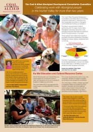
Coal & Allied – Hunter Valley Operations<br />
A GPR survey was also conducted to assess the sub-surface archaeological potential of Aboriginal site<br />
Barellan Open Site 37-5-0041. The GPR survey grid was conducted along three 300m long and eight 60m<br />
long transects across the area to map the underlying soil structure and presence of sub-surface<br />
archaeological deposits and to confirm the general extent of the site. This information will assist in planning<br />
for any future excavation of the site if subject to future development activities.<br />
Barellan Open Site (AHIMS 37-5-0041)<br />
In April <strong>2009</strong>, McCardle Cultural Heritage Pty Ltd (MCH) was commissioned by Coal & Allied Operations to<br />
conduct an Aboriginal cultural heritage assessment of farming land around an existing Aboriginal<br />
archaeological site Barellan Open Site (AHIMS 37-5-0041) following the GPR surveys to assess potential<br />
impact and management requirements for a proposed mine water dam and relocation of existing electrical<br />
transmission lines and sub-station. An area of approximately 40ha was comprehensively surveyed with a<br />
series of 100m wide pedestrian transects. The fieldwork was conducted over one day with a field team of six<br />
Aboriginal community field officers, a technical advisor (MCH), Coal & Allied data management officer and<br />
site supervisor.<br />
A total of six sites were recorded (four isolated finds and two artefact scatters) one of which had been<br />
previously recorded as Barellan Open Site (37-5-0041). Two Potential Archaeological Deposits (PADs) were<br />
also identified, including the Barellan Open Site:<br />
<br />
<br />
PAD 1 (Transect 90): Horizon A remains intact with little disturbance; and<br />
PAD 2 (Transect 86, including Open sites <strong>HVO</strong>-981 & <strong>HVO</strong>-982 - 37-5-0041): extends along the creek for<br />
more than 225m x 80m. This area is relatively undisturbed.<br />
A 500m x 150m buffer area has been fenced off around the Barellan Open Site (37-5-0041). MCH submitted<br />
an assessment report to DECCW in September <strong>2009</strong>.<br />
Plashett Pipeline Assessment: <strong>HVO</strong> West Pit:<br />
In April <strong>2009</strong> MCH was commissioned by Coal & Allied Operations to conduct an Aboriginal cultural heritage<br />
assessment of a proposed over-ground poly-pipeline from <strong>HVO</strong> Parnells Dam to Plashett Dam on behalf of<br />
Coal & Allied and Macquarie Generation. The pipeline easement assessment involved the pedestrian survey<br />
of a 1.3km x 40m wide transect to find a suitable route that would not disturb any cultural heritage sites. The<br />
fieldwork was conducted over one day with a field team of three Aboriginal community field officers, a<br />
technical advisor (MCH), Coal & Allied data management officer and site supervisor.<br />
The aim of the assessment survey was to identify and avoid disturbing Aboriginal cultural heritage sites,<br />
implement zones of management for sensitive areas, and mitigate impacts where avoidance or management<br />
is not possible. If avoidance is not possible a s90 consent application will be submitted to DECCW by<br />
Macquarie Generation for salvage of the site/s. Sites within close proximity to the proposed route will be<br />
barricaded and signposted to mitigate, any potential impacts from the proposed development. A new artefact<br />
scatter, identified as site <strong>HVO</strong>-986, was recorded within the study area. MCH recorded 50 artefacts, including<br />
flakes and cores within the extent of site <strong>HVO</strong>-986. The alignment and installation of the over-ground polypipeline<br />
is too conducted to avoid impacting site <strong>HVO</strong>-986.<br />
Xstrata Ravensworth Extension Assessment – Coal & Allied Lands, <strong>HVO</strong> North:<br />
During late May and early June <strong>2009</strong> a comprehensive Aboriginal cultural heritage assessment survey was<br />
conducted over approximately 340ha of Coal & Allied owned lands as part of the Xstrata Ravensworth<br />
Extension Project Aboriginal heritage assessment was managed by Umwelt Australia Pty Ltd on behalf of<br />
Xstrata Coal. Under a land access agreement between Coal & Allied and Xstrata Coal, Umwelt’s sampling<br />
survey methodology was modified to ensure compliance with Rio Tinto Coal Australia CHMS procedures that<br />
require 100 per cent survey coverage for areas surveyed on Coal & Allied owned lands.<br />
The Umwelt survey over the Coal & Allied lands was conducted over 10 days and involved a field team of six<br />
Aboriginal community field officers, two archaeologists (Umwelt), a Coal & Allied data management officer<br />
and a site supervisor. A total of 133 archaeological sites were recorded within the Coal & Allied land study<br />
area which included several scarred trees and artefact scatters, with the greater majority of sites being<br />
isolated artefacts.<br />
AEMR <strong>2009</strong> 142