Becas de Posgrado dirigidas a Profesionales de PaÃses en ... - Daad
Becas de Posgrado dirigidas a Profesionales de PaÃses en ... - Daad
Becas de Posgrado dirigidas a Profesionales de PaÃses en ... - Daad

Create successful ePaper yourself
Turn your PDF publications into a flip-book with our unique Google optimized e-Paper software.
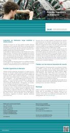
Engineering and Related Sci<strong>en</strong>cesPhotogrammetry and GeoinformaticsInstitutionLocationCourse focusTarget groupCourse languageHochschule für Technik Stuttgart(Stuttgart University of Applied Sci<strong>en</strong>ces)Stuttgart is a vibrant, fascinating city and the state capital ofBa<strong>de</strong>n-Wuerttemberg. It is the economic, cultural, sporting and socialhub of a region in the heart of Europe with more than 2.5 millioninhabitants. The city is surroun<strong>de</strong>d by beautiful countrysi<strong>de</strong>; the BlackForest and Lake Constance are highlights in southern Germany andare not far away. The University of Applied Sci<strong>en</strong>ces (UAS) is locatedin the heart of Stuttgart. The UAS has a long history with a rich traditionin <strong>en</strong>gineering education since 1832.The M.Sc. course aims at educating future <strong>de</strong>cision makers ands<strong>en</strong>ior <strong>en</strong>gineers of information and land managem<strong>en</strong>t projects,national authorities for mapping, photogrammetry, land consolidation,cadastre, forestry, agriculture, rural and urban planning or <strong>en</strong>vironm<strong>en</strong>tmonitoring.-and geoinformatics. An important objective is the transfer of up-to-datetechniques to practice un<strong>de</strong>r differ<strong>en</strong>t technological conditions.Photogrammetric technology is trained on mo<strong>de</strong>rn digital workstationsincluding sophisticated analytical systems. Focus is on processingaerial photographs, from scanning, automated aero triangulation andacquisition of digital elevation mo<strong>de</strong>ls, to orthoimage g<strong>en</strong>eration andtopographic and thematic mapping. Gaining experi<strong>en</strong>ce in workingwith alternative data sources of increasing importance, like high resolutionremote s<strong>en</strong>sing satellites and radar and airborne laser scanning,round off mo<strong>de</strong>rn photogrammetric education.acquisition, storage, analysis, retrieval and display of spatial relateddata, concerning both earth’s physical features and the man-ma<strong>de</strong><strong>en</strong>vironm<strong>en</strong>t. Studying the methods for data mo<strong>de</strong>lling in geoinformationsystems, <strong>de</strong>sign and handling of diverse databases, GIS-data formats,GIS customisation including programming, all accompanied byint<strong>en</strong>sive training are important parts of the postgraduate course. Mostrec<strong>en</strong>t <strong>de</strong>velopm<strong>en</strong>ts like world wi<strong>de</strong> web technologies, 3D-visualisationand integration of GIS and photogrammetry prepare course participantsfor the future.A full-time research project aiming at the elaboration of a Master’s thesiswithin six months conclu<strong>de</strong>s the programme.The course is <strong>de</strong>signed for all kinds of professional producers or usersof geo-data (e.g., in photogrammetry, geo<strong>de</strong>sy, civil <strong>en</strong>gineering, landsurveying, agriculture, cartography, forestry, geography, geology), inparticular from <strong>de</strong>veloping countries, who are involved as <strong>de</strong>cisionmakers or project <strong>en</strong>gineers in the acquisition, administration and useof geo-data in the context of geoinformation systems, photogrammetryand remote s<strong>en</strong>sing.English52