Wirtschaftsstandort Oldenburg

Create successful ePaper yourself
Turn your PDF publications into a flip-book with our unique Google optimized e-Paper software.
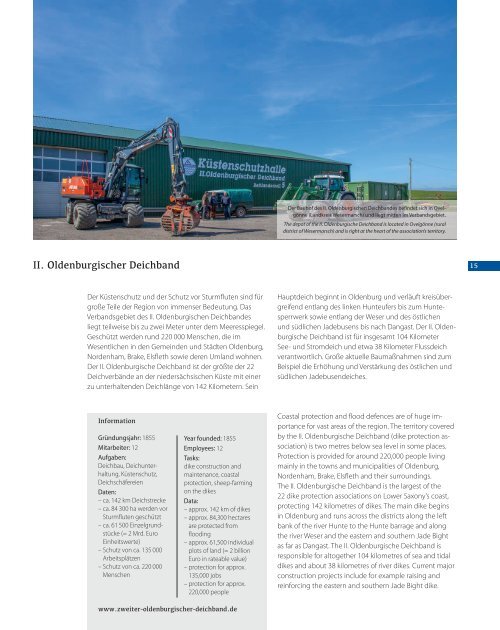
Der Bauhof des II. <strong>Oldenburg</strong>ischen Deichbandes befindet sich in Ovelgönne<br />
(Landkreis Wesermarsch) und liegt mitten im Verbandsgebiet.<br />
The depot of the II. <strong>Oldenburg</strong>ische Deichband is located in Ovelgönne (rural<br />
district of Wesermarsch) and is right at the heart of the association’s territory.<br />
II. <strong>Oldenburg</strong>ischer Deichband<br />
15<br />
Der Küstenschutz und der Schutz vor Sturmfluten sind für<br />
große Teile der Region von immenser Bedeutung. Das<br />
Verbandsgebiet des II. <strong>Oldenburg</strong>ischen Deichbandes<br />
liegt teilweise bis zu zwei Meter unter dem Meeresspiegel.<br />
Geschützt werden rund 220 000 Menschen, die im<br />
Wesent lichen in den Gemeinden und Städten <strong>Oldenburg</strong>,<br />
Nordenham, Brake, Elsfleth sowie deren Umland wohnen.<br />
Der II. <strong>Oldenburg</strong>ische Deichband ist der größte der 22<br />
Deichverbände an der niedersächsischen Küste mit einer<br />
zu unterhaltenden Deichlänge von 142 Kilometern. Sein<br />
Hauptdeich beginnt in <strong>Oldenburg</strong> und verläuft kreisübergreifend<br />
entlang des linken Hunteufers bis zum Hunte -<br />
sperrwerk sowie entlang der Weser und des östlichen<br />
und südlichen Jadebusens bis nach Dangast. Der II. <strong>Oldenburg</strong>ische<br />
Deichband ist für insgesamt 104 Kilometer<br />
See- und Stromdeich und etwa 38 Kilometer Flussdeich<br />
verantwortlich. Große aktuelle Baumaßnahmen sind zum<br />
Beispiel die Erhöhung und Verstärkung des östlichen und<br />
südlichen Jadebusendeiches.<br />
Information<br />
Gründungsjahr: 1855<br />
Mitarbeiter: 12<br />
Aufgaben:<br />
Deichbau, Deichunter -<br />
haltung, Küstenschutz,<br />
Deichschäfereien<br />
Daten:<br />
– ca. 142 km Deichstrecke<br />
– ca. 84 300 ha werden vor<br />
Sturmfluten geschützt<br />
– ca. 61 500 Einzelgrundstücke<br />
(= 2 Mrd. Euro<br />
Einheitswerte)<br />
– Schutz von ca. 135 000<br />
Arbeitsplätzen<br />
– Schutz von ca. 220 000<br />
Menschen<br />
Year founded: 1855<br />
Employees: 12<br />
Tasks:<br />
dike construction and<br />
maintenance, coastal<br />
protection, sheep-farming<br />
on the dikes<br />
Data:<br />
– approx. 142 km of dikes<br />
– approx. 84,300 hectares<br />
are protected from<br />
flooding<br />
– approx. 61,500 individual<br />
plots of land (= 2 billion<br />
Euro in rateable value)<br />
– protection for approx.<br />
135,000 jobs<br />
– protection for approx.<br />
220,000 people<br />
Coastal protection and flood defences are of huge im -<br />
portance for vast areas of the region. The territory covered<br />
by the II. <strong>Oldenburg</strong>ische Deichband (dike protection association)<br />
is two metres below sea level in some places.<br />
Protection is provided for around 220,000 people living<br />
mainly in the towns and municipalities of <strong>Oldenburg</strong>,<br />
Nordenham, Brake, Elsfleth and their surroundings.<br />
The II. <strong>Oldenburg</strong>ische Deichband is the largest of the<br />
22 dike protection associations on Lower Saxony’s coast,<br />
protecting 142 kilometres of dikes. The main dike begins<br />
in <strong>Oldenburg</strong> and runs across the districts along the left<br />
bank of the river Hunte to the Hunte barrage and along<br />
the river Weser and the eastern and southern Jade Bight<br />
as far as Dangast. The II. <strong>Oldenburg</strong>ische Deichband is<br />
responsible for altogether 104 kilometres of sea and tidal<br />
dikes and about 38 kilometres of river dikes. Current major<br />
construction projects include for example raising and<br />
rein forcing the eastern and southern Jade Bight dike.<br />
www.zweiter-oldenburgischer-deichband.de