State Planning Policy 2/07 Guideline - Queensland Mining and Safety
State Planning Policy 2/07 Guideline - Queensland Mining and Safety
State Planning Policy 2/07 Guideline - Queensland Mining and Safety
You also want an ePaper? Increase the reach of your titles
YUMPU automatically turns print PDFs into web optimized ePapers that Google loves.
112<br />
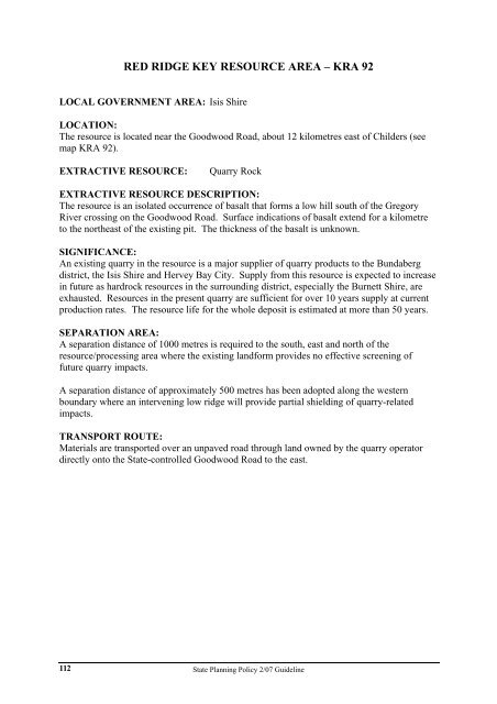
RED RIDGE KEY RESOURCE AREA – KRA 92<br />
LOCAL GOVERNMENT AREA: Isis Shire<br />
LOCATION:<br />
The resource is located near the Goodwood Road, about 12 kilometres east of Childers (see<br />
map KRA 92).<br />
EXTRACTIVE RESOURCE: Quarry Rock<br />
EXTRACTIVE RESOURCE DESCRIPTION:<br />
The resource is an isolated occurrence of basalt that forms a low hill south of the Gregory<br />
River crossing on the Goodwood Road. Surface indications of basalt extend for a kilometre<br />
to the northeast of the existing pit. The thickness of the basalt is unknown.<br />
SIGNIFICANCE:<br />
An existing quarry in the resource is a major supplier of quarry products to the Bundaberg<br />
district, the Isis Shire <strong>and</strong> Hervey Bay City. Supply from this resource is expected to increase<br />
in future as hardrock resources in the surrounding district, especially the Burnett Shire, are<br />
exhausted. Resources in the present quarry are sufficient for over 10 years supply at current<br />
production rates. The resource life for the whole deposit is estimated at more than 50 years.<br />
SEPARATION AREA:<br />
A separation distance of 1000 metres is required to the south, east <strong>and</strong> north of the<br />
resource/processing area where the existing l<strong>and</strong>form provides no effective screening of<br />
future quarry impacts.<br />
A separation distance of approximately 500 metres has been adopted along the western<br />
boundary where an intervening low ridge will provide partial shielding of quarry-related<br />
impacts.<br />
TRANSPORT ROUTE:<br />
Materials are transported over an unpaved road through l<strong>and</strong> owned by the quarry operator<br />
directly onto the <strong>State</strong>-controlled Goodwood Road to the east.<br />
<strong>State</strong> <strong>Planning</strong> <strong>Policy</strong> 2/<strong>07</strong> <strong>Guideline</strong>


