State Planning Policy 2/07 Guideline - Queensland Mining and Safety
State Planning Policy 2/07 Guideline - Queensland Mining and Safety
State Planning Policy 2/07 Guideline - Queensland Mining and Safety
You also want an ePaper? Increase the reach of your titles
YUMPU automatically turns print PDFs into web optimized ePapers that Google loves.
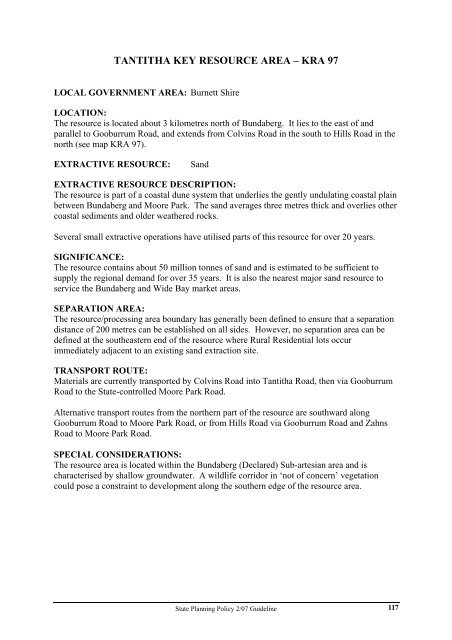
TANTITHA KEY RESOURCE AREA – KRA 97<br />
LOCAL GOVERNMENT AREA: Burnett Shire<br />
LOCATION:<br />
The resource is located about 3 kilometres north of Bundaberg. It lies to the east of <strong>and</strong><br />
parallel to Gooburrum Road, <strong>and</strong> extends from Colvins Road in the south to Hills Road in the<br />
north (see map KRA 97).<br />
EXTRACTIVE RESOURCE: S<strong>and</strong><br />
EXTRACTIVE RESOURCE DESCRIPTION:<br />
The resource is part of a coastal dune system that underlies the gently undulating coastal plain<br />
between Bundaberg <strong>and</strong> Moore Park. The s<strong>and</strong> averages three metres thick <strong>and</strong> overlies other<br />
coastal sediments <strong>and</strong> older weathered rocks.<br />
Several small extractive operations have utilised parts of this resource for over 20 years.<br />
SIGNIFICANCE:<br />
The resource contains about 50 million tonnes of s<strong>and</strong> <strong>and</strong> is estimated to be sufficient to<br />
supply the regional dem<strong>and</strong> for over 35 years. It is also the nearest major s<strong>and</strong> resource to<br />
service the Bundaberg <strong>and</strong> Wide Bay market areas.<br />
SEPARATION AREA:<br />
The resource/processing area boundary has generally been defined to ensure that a separation<br />
distance of 200 metres can be established on all sides. However, no separation area can be<br />
defined at the southeastern end of the resource where Rural Residential lots occur<br />
immediately adjacent to an existing s<strong>and</strong> extraction site.<br />
TRANSPORT ROUTE:<br />
Materials are currently transported by Colvins Road into Tantitha Road, then via Gooburrum<br />
Road to the <strong>State</strong>-controlled Moore Park Road.<br />
Alternative transport routes from the northern part of the resource are southward along<br />
Gooburrum Road to Moore Park Road, or from Hills Road via Gooburrum Road <strong>and</strong> Zahns<br />
Road to Moore Park Road.<br />
SPECIAL CONSIDERATIONS:<br />
The resource area is located within the Bundaberg (Declared) Sub-artesian area <strong>and</strong> is<br />
characterised by shallow groundwater. A wildlife corridor in ‘not of concern’ vegetation<br />
could pose a constraint to development along the southern edge of the resource area.<br />
<strong>State</strong> <strong>Planning</strong> <strong>Policy</strong> 2/<strong>07</strong> <strong>Guideline</strong><br />
117


