State Planning Policy 2/07 Guideline - Queensland Mining and Safety
State Planning Policy 2/07 Guideline - Queensland Mining and Safety
State Planning Policy 2/07 Guideline - Queensland Mining and Safety
Create successful ePaper yourself
Turn your PDF publications into a flip-book with our unique Google optimized e-Paper software.
62<br />
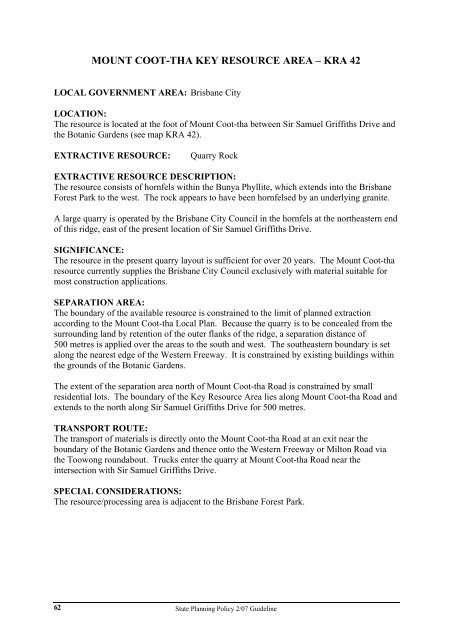
MOUNT COOT-THA KEY RESOURCE AREA – KRA 42<br />
LOCAL GOVERNMENT AREA: Brisbane City<br />
LOCATION:<br />
The resource is located at the foot of Mount Coot-tha between Sir Samuel Griffiths Drive <strong>and</strong><br />
the Botanic Gardens (see map KRA 42).<br />
EXTRACTIVE RESOURCE: Quarry Rock<br />
EXTRACTIVE RESOURCE DESCRIPTION:<br />
The resource consists of hornfels within the Bunya Phyllite, which extends into the Brisbane<br />
Forest Park to the west. The rock appears to have been hornfelsed by an underlying granite.<br />
A large quarry is operated by the Brisbane City Council in the hornfels at the northeastern end<br />
of this ridge, east of the present location of Sir Samuel Griffiths Drive.<br />
SIGNIFICANCE:<br />
The resource in the present quarry layout is sufficient for over 20 years. The Mount Coot-tha<br />
resource currently supplies the Brisbane City Council exclusively with material suitable for<br />
most construction applications.<br />
SEPARATION AREA:<br />
The boundary of the available resource is constrained to the limit of planned extraction<br />
according to the Mount Coot-tha Local Plan. Because the quarry is to be concealed from the<br />
surrounding l<strong>and</strong> by retention of the outer flanks of the ridge, a separation distance of<br />
500 metres is applied over the areas to the south <strong>and</strong> west. The southeastern boundary is set<br />
along the nearest edge of the Western Freeway. It is constrained by existing buildings within<br />
the grounds of the Botanic Gardens.<br />
The extent of the separation area north of Mount Coot-tha Road is constrained by small<br />
residential lots. The boundary of the Key Resource Area lies along Mount Coot-tha Road <strong>and</strong><br />
extends to the north along Sir Samuel Griffiths Drive for 500 metres.<br />
TRANSPORT ROUTE:<br />
The transport of materials is directly onto the Mount Coot-tha Road at an exit near the<br />
boundary of the Botanic Gardens <strong>and</strong> thence onto the Western Freeway or Milton Road via<br />
the Toowong roundabout. Trucks enter the quarry at Mount Coot-tha Road near the<br />
intersection with Sir Samuel Griffiths Drive.<br />
SPECIAL CONSIDERATIONS:<br />
The resource/processing area is adjacent to the Brisbane Forest Park.<br />
<strong>State</strong> <strong>Planning</strong> <strong>Policy</strong> 2/<strong>07</strong> <strong>Guideline</strong>


