State Planning Policy 2/07 Guideline - Queensland Mining and Safety
State Planning Policy 2/07 Guideline - Queensland Mining and Safety
State Planning Policy 2/07 Guideline - Queensland Mining and Safety
You also want an ePaper? Increase the reach of your titles
YUMPU automatically turns print PDFs into web optimized ePapers that Google loves.
78<br />
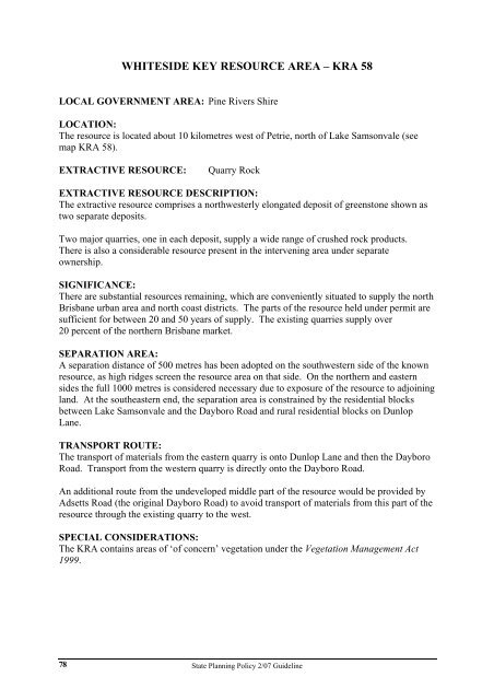
WHITESIDE KEY RESOURCE AREA – KRA 58<br />
LOCAL GOVERNMENT AREA: Pine Rivers Shire<br />
LOCATION:<br />
The resource is located about 10 kilometres west of Petrie, north of Lake Samsonvale (see<br />
map KRA 58).<br />
EXTRACTIVE RESOURCE: Quarry Rock<br />
EXTRACTIVE RESOURCE DESCRIPTION:<br />
The extractive resource comprises a northwesterly elongated deposit of greenstone shown as<br />
two separate deposits.<br />
Two major quarries, one in each deposit, supply a wide range of crushed rock products.<br />
There is also a considerable resource present in the intervening area under separate<br />
ownership.<br />
SIGNIFICANCE:<br />
There are substantial resources remaining, which are conveniently situated to supply the north<br />
Brisbane urban area <strong>and</strong> north coast districts. The parts of the resource held under permit are<br />
sufficient for between 20 <strong>and</strong> 50 years of supply. The existing quarries supply over<br />
20 percent of the northern Brisbane market.<br />
SEPARATION AREA:<br />
A separation distance of 500 metres has been adopted on the southwestern side of the known<br />
resource, as high ridges screen the resource area on that side. On the northern <strong>and</strong> eastern<br />
sides the full 1000 metres is considered necessary due to exposure of the resource to adjoining<br />
l<strong>and</strong>. At the southeastern end, the separation area is constrained by the residential blocks<br />
between Lake Samsonvale <strong>and</strong> the Dayboro Road <strong>and</strong> rural residential blocks on Dunlop<br />
Lane.<br />
TRANSPORT ROUTE:<br />
The transport of materials from the eastern quarry is onto Dunlop Lane <strong>and</strong> then the Dayboro<br />
Road. Transport from the western quarry is directly onto the Dayboro Road.<br />
An additional route from the undeveloped middle part of the resource would be provided by<br />
Adsetts Road (the original Dayboro Road) to avoid transport of materials from this part of the<br />
resource through the existing quarry to the west.<br />
SPECIAL CONSIDERATIONS:<br />
The KRA contains areas of ‘of concern’ vegetation under the Vegetation Management Act<br />
1999.<br />
<strong>State</strong> <strong>Planning</strong> <strong>Policy</strong> 2/<strong>07</strong> <strong>Guideline</strong>


