State Planning Policy 2/07 Guideline - Queensland Mining and Safety
State Planning Policy 2/07 Guideline - Queensland Mining and Safety
State Planning Policy 2/07 Guideline - Queensland Mining and Safety
Create successful ePaper yourself
Turn your PDF publications into a flip-book with our unique Google optimized e-Paper software.
88<br />
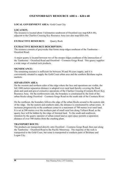
OXENFORD KEY RESOURCE AREA – KRA 68<br />
LOCAL GOVERNMENT AREA: Gold Coast City<br />
LOCATION:<br />
The resource is located about 3 kilometres southwest of Oxenford (see map KRA 68),<br />
adjacent to the Charlies Crossing Key Resource Area (see also map KRA 64).<br />
EXTRACTIVE RESOURCE: Quarry Rock<br />
EXTRACTIVE RESOURCE DESCRIPTION:<br />
The resource consists of greywacke that forms steep ridges southeast of the Tamborine –<br />
Oxenford Road.<br />
A major quarry is located between two of the steeper ridges southeast of the intersection of<br />
the Tamborine – Oxenford Road <strong>and</strong> Oxenford – Coomera Gorge Road. This quarry supplies<br />
a wide range of crushed rock products.<br />
SIGNIFICANCE:<br />
The remaining resource is sufficient for between 30 <strong>and</strong> 50 years supply, <strong>and</strong> it is<br />
conveniently situated to supply the Gold Coast urban area <strong>and</strong> the southern Brisbane region<br />
markets.<br />
SEPARATION AREA:<br />
On the western <strong>and</strong> northern sides of the ridge where the face <strong>and</strong> operations are visible, the<br />
full 1000 metres separation distance is adopted over rural l<strong>and</strong> thereby covering the flood<br />
plain <strong>and</strong> s<strong>and</strong> <strong>and</strong> gravel extractive operations of the Charlies Crossing (Coomera River) Key<br />
Resource Area. On the northwestern side, the boundary is constrained by the limit of the<br />
urban blocks along Oxenford – Coomera Gorge Road on the south side of the Coomera River.<br />
On the northeast, the boundary follows the edge of the urban blocks around to the eastern side<br />
of the ridge. On the eastern <strong>and</strong> southern sides, the distance is constrained by urban zones. It<br />
increases progressively to the southeast corner to a maximum of 700 metres over rural l<strong>and</strong>.<br />
It is set at 500 metres over the northern part of small rural lots along Yallaroi Road, as the<br />
quarry face will be hidden by the ridge of forested l<strong>and</strong>. To the south <strong>and</strong> southwest,<br />
retention by the quarry operator of urban-zoned l<strong>and</strong> as open space permits a separation<br />
distance of over 500 metres from the crushing plant.<br />
TRANSPORT ROUTE:<br />
The products are transported directly onto Oxenford – Coomera Gorge Road, then east along<br />
the Tamborine – Oxenford Road to the Pacific Motorway. The majority of the rock is<br />
transported to the Gold Coast, but some is transported to southern parts of Brisbane <strong>and</strong><br />
Logan City.<br />
<strong>State</strong> <strong>Planning</strong> <strong>Policy</strong> 2/<strong>07</strong> <strong>Guideline</strong>


