State Planning Policy 2/07 Guideline - Queensland Mining and Safety
State Planning Policy 2/07 Guideline - Queensland Mining and Safety
State Planning Policy 2/07 Guideline - Queensland Mining and Safety
You also want an ePaper? Increase the reach of your titles
YUMPU automatically turns print PDFs into web optimized ePapers that Google loves.
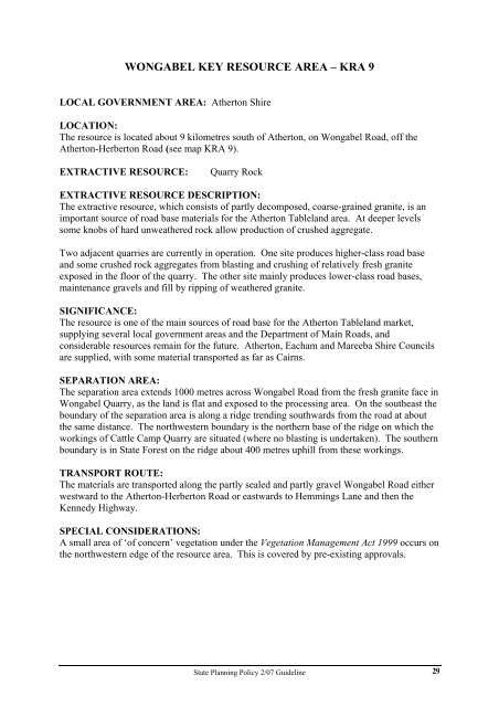
WONGABEL KEY RESOURCE AREA – KRA 9<br />
LOCAL GOVERNMENT AREA: Atherton Shire<br />
LOCATION:<br />
The resource is located about 9 kilometres south of Atherton, on Wongabel Road, off the<br />
Atherton-Herberton Road (see map KRA 9).<br />
EXTRACTIVE RESOURCE: Quarry Rock<br />
EXTRACTIVE RESOURCE DESCRIPTION:<br />
The extractive resource, which consists of partly decomposed, coarse-grained granite, is an<br />
important source of road base materials for the Atherton Tablel<strong>and</strong> area. At deeper levels<br />
some knobs of hard unweathered rock allow production of crushed aggregate.<br />
Two adjacent quarries are currently in operation. One site produces higher-class road base<br />
<strong>and</strong> some crushed rock aggregates from blasting <strong>and</strong> crushing of relatively fresh granite<br />
exposed in the floor of the quarry. The other site mainly produces lower-class road bases,<br />
maintenance gravels <strong>and</strong> fill by ripping of weathered granite.<br />
SIGNIFICANCE:<br />
The resource is one of the main sources of road base for the Atherton Tablel<strong>and</strong> market,<br />
supplying several local government areas <strong>and</strong> the Department of Main Roads, <strong>and</strong><br />
considerable resources remain for the future. Atherton, Eacham <strong>and</strong> Mareeba Shire Councils<br />
are supplied, with some material transported as far as Cairns.<br />
SEPARATION AREA:<br />
The separation area extends 1000 metres across Wongabel Road from the fresh granite face in<br />
Wongabel Quarry, as the l<strong>and</strong> is flat <strong>and</strong> exposed to the processing area. On the southeast the<br />
boundary of the separation area is along a ridge trending southwards from the road at about<br />
the same distance. The northwestern boundary is the northern base of the ridge on which the<br />
workings of Cattle Camp Quarry are situated (where no blasting is undertaken). The southern<br />
boundary is in <strong>State</strong> Forest on the ridge about 400 metres uphill from these workings.<br />
TRANSPORT ROUTE:<br />
The materials are transported along the partly sealed <strong>and</strong> partly gravel Wongabel Road either<br />
westward to the Atherton-Herberton Road or eastwards to Hemmings Lane <strong>and</strong> then the<br />
Kennedy Highway.<br />
SPECIAL CONSIDERATIONS:<br />
A small area of ‘of concern’ vegetation under the Vegetation Management Act 1999 occurs on<br />
the northwestern edge of the resource area. This is covered by pre-existing approvals.<br />
<strong>State</strong> <strong>Planning</strong> <strong>Policy</strong> 2/<strong>07</strong> <strong>Guideline</strong><br />
29


