State Planning Policy 2/07 Guideline - Queensland Mining and Safety
State Planning Policy 2/07 Guideline - Queensland Mining and Safety
State Planning Policy 2/07 Guideline - Queensland Mining and Safety
You also want an ePaper? Increase the reach of your titles
YUMPU automatically turns print PDFs into web optimized ePapers that Google loves.
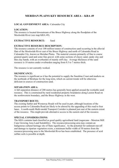
MERIDAN PLAINS KEY RESOURCE AREA – KRA 49<br />
LOCAL GOVERNMENT AREA: Caloundra City<br />
LOCATION:<br />
The resource is located downstream of the Bruce Highway along the floodplain of the<br />
Mooloolah River (see map KRA 49).<br />
EXTRACTIVE RESOURCE: S<strong>and</strong><br />
EXTRACTIVE RESOURCE DESCRIPTION:<br />
The resource consists of over 100 million tonnes of construction s<strong>and</strong> occurring in the alluvial<br />
flats of the Mooloolah River east of the Bruce Highway <strong>and</strong> north of Caloundra Road in<br />
Caloundra City, known as Meridan Plains. The material consists primarily of fine to coarse<br />
grained quartz s<strong>and</strong> <strong>and</strong> some fine gravel, with some sections of clayey s<strong>and</strong>, s<strong>and</strong>y clay <strong>and</strong><br />
thin clay b<strong>and</strong>s, with an overburden of mainly stiff clay. Average thickness of the s<strong>and</strong><br />
resource is 10 metres under overburden ranging from 0.5 to 7 metres thick.<br />
The resource is not currently worked.<br />
SIGNIFICANCE:<br />
The resource is significant as it has the potential to supply the Sunshine Coast <strong>and</strong> markets on<br />
the northside of Brisbane for the long term, which on current trends will be otherwise<br />
deficient in sources of construction s<strong>and</strong>.<br />
SEPARATION AREA:<br />
A full separation distance of 200 metres has generally been applied around the workable s<strong>and</strong><br />
resource. This is constrained by rural residential property boundaries along Laxton Road on<br />
the northwestern boundary, <strong>and</strong> the Bruce Highway in the west.<br />
TRANSPORT ROUTE:<br />
The existing Sattler <strong>and</strong> Westaway Roads will be used in part, although locations of the<br />
access points to Caloundra Road are likely to be altered by the upgrading of this road to four<br />
lanes. A north-south Multi-modal Transport Corridor is planned just east of the eastern extent<br />
of the resource. This might provide alternative access to the eastern end of the resource.<br />
SPECIAL CONSIDERATIONS:<br />
The KRA contains l<strong>and</strong> classified as good quality agricultural l<strong>and</strong> (sugarcane - Moreton Mill<br />
Cane Growing Area L<strong>and</strong> Suitability). The resource/processing area may contain an<br />
Indigenous cultural heritage site of <strong>State</strong> significance. As the potential for sediment run-off<br />
<strong>and</strong> damage to riparian vegetation exists, a minimum buffer width of 50 metres from the<br />
resource/processing area to the Mooloolah River has been established. The presence of acid<br />
sulfate soils is possible at depth.<br />
<strong>State</strong> <strong>Planning</strong> <strong>Policy</strong> 2/<strong>07</strong> <strong>Guideline</strong><br />
69


