Powering Europe - European Wind Energy Association
Powering Europe - European Wind Energy Association
Powering Europe - European Wind Energy Association

You also want an ePaper? Increase the reach of your titles
YUMPU automatically turns print PDFs into web optimized ePapers that Google loves.
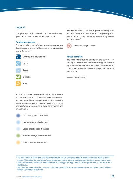
Legend<br />
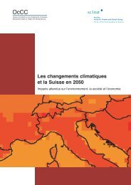
The grid maps depict the evolution of renewable energy<br />
in the <strong>Europe</strong>an power system up to 2050.<br />
productionsources<br />
The main on-land and offshore renewable energy producing<br />
areas are shown. Each source is represented<br />
by a different icon.<br />
Onshore and offshore wind<br />
Hydro<br />
Ocean<br />
Biomass<br />
Solar<br />
In order to indicate the general location of the generation<br />
sources, shaded bubbles have been incorporated<br />
into the map. These bubbles vary in size according<br />
to the relevance and penetration level of the corresponding<br />
generation source in the different areas and<br />
timeframes 17 .<br />
<strong>Wind</strong> energy production area<br />
Hydro energy production area<br />
Ocean energy production area<br />
Biomass energy production area<br />
Solar energy production area<br />
chApTEr 1 INtrODUctION:aeUrOpeaNVISION<br />
The five countries with the highest electricity consumption<br />
were identified and a corresponding icon<br />
was added according to their approximate higher consumption<br />
area 18 .<br />
Main consumption area<br />
powercorridors<br />
The main transmission corridors 19 are coloured according<br />
to the dominant renewable energy source flowing<br />
across them; this does not mean that there are no<br />
other power production sources using those transmission<br />
routes.<br />
Power corridor<br />
17 The main sources of information were EWEA, OffshoreGrid, and the Greenpeace-ErEc [r]evolution scenarios. Based on these<br />
sources, 3E identified the main types of power generation, their locations and possible penetration levels for the different years.<br />
18 Data from <strong>Europe</strong>an commission, Directorate-General for <strong>Energy</strong>, EU <strong>Energy</strong> Trends to 2030 – Update 2009, IccS-NTUA for Ec, 4<br />
August 2010.<br />
19 Transmission lines were based on the current UcTE map, the ENTSO-E ten year development plan, and EWEA’s 20 Year Offshore<br />
Network Development Master plan.<br />
29