PROJETO RADAMBRASIL
PROJETO RADAMBRASIL
PROJETO RADAMBRASIL
Create successful ePaper yourself
Turn your PDF publications into a flip-book with our unique Google optimized e-Paper software.
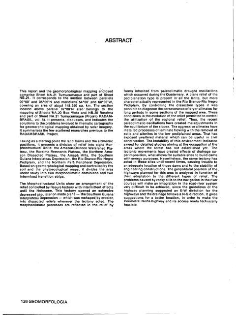
This report and the geomorphological mapping enclosed<br />
comprise Sheet NA.21. Tumucumaque and part of Sheet<br />
NB.21. It corresponds to the section between parallels<br />
00°00' and 05°00'N and meridians" 54°00' and 60°00'W,<br />
covering an area of about 148.550 sq. km. The section<br />
located above parallel'02°00'N also'belongs to the<br />
mapping of Sheets ! NA.20 Boa Vista and NB.20 Roraima<br />
and part of Sheet NA.21 Tumucumaque (Projeto RADAM-<br />
BRASIL, vol. 8). It presents, discusses, and indicates the<br />
solutions to the problems involved in thematic cartography<br />
for geomorphological mapping obtained by radar imagery.<br />
It summarizes the few scattered researches previous to the<br />
<strong>RADAMBRASIL</strong> Project.<br />
Taking as a starting point the land forms and the altimetric „<br />
positions, it presents a division .of relief into eight Morphostructural<br />
Units: the Amazon-Orinoco Watershed Plateau,<br />
the Roraima Remnants Plateau, the Northern Amazon<br />
Dissected Plateau, the Amapa Hills, the Southern<br />
Guiana Interplateau Depression, the Rio Branco-Rio Negro<br />
Pediplain, and the Northern Parä Peripheral Depression.<br />
Based on geomorphological mapping and controlled by the<br />
soil and the phytoecological' maps, it divides the area<br />
under study into two morphoclimatic dominions and two<br />
intermixed transition strips.<br />
The Morphostructural Units show an arrangement of the<br />
relief controlled by fissure tectony with intermittent effects<br />
until the Holocene. This tectony opened an extensive<br />
depressed gap, later on made plane — the Southern Guiana<br />
Interplateau Depression — which was reshaped.by erosion<br />
into dissected reliefs whenever the tectony acted. Thé<br />
morphoclimatic processes are reflected in the.relief by<br />
126GEOMORFOLOGIA<br />
ABSTRACT<br />
forms rnherited from paleoclimatic drought oscillations<br />
which occurred during the Quaternary. A plane relief of the<br />
pediplanation type is present in-all the Units, but more<br />
characteristically represented in the Rio Branco-Rio Negro<br />
Pediplain. By Controlling the dissection types it was<br />
possible to diagnose the perseverance of dryer climates for<br />
long periods in some sections of the mapped area. These<br />
conditions in the evolution of the relief permitted to control<br />
the utilization, of the regional relief. Thus, the recent<br />
paleoclimatic oscillations have created maladjustments in<br />
the equilibrium of the slopes. The aggressive climates have<br />
installed processes of laminate flowing with the removal of<br />
soils and alterites in the low pediplained areas. That has<br />
exposed unaltered material which can be useful in civil<br />
construction. The instability of this environment indicates<br />
a need for detailed studies aiming at the occupation of the<br />
areas where the forest has not established yet. The<br />
tectonic movements have created effects of drainage superimposition,<br />
what allows for suitable sites to build dams<br />
with energy purposes. Nevertheless, the same tectony has<br />
acted in these sites until recent times, causing trouble to<br />
an adequate location of those dams and to the stability of<br />
engineering constructions. The geopolitical position of the ,<br />
highways planned for this area is analyzed in function of<br />
their adaptation to the. different types of relief. The<br />
problems caused by rocky sills to the navigation in the river<br />
courses will make an integration in the road-river system<br />
very difficult to be achieved, since the guidelines of the<br />
highway planning suggested an E-W direction for the<br />
highways and the drainage follows a N-S direction. It gives<br />
suggestions for a better location, in order to make the<br />
Perimetral Norte highway and its access roads technically<br />
feasible.


