An Economic and Spatial Plan for Limerick Appendices
An Economic and Spatial Plan for Limerick Appendices
An Economic and Spatial Plan for Limerick Appendices

You also want an ePaper? Increase the reach of your titles
YUMPU automatically turns print PDFs into web optimized ePapers that Google loves.
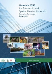
<strong>Limerick</strong> 2030 <strong>An</strong> <strong>Economic</strong> <strong>and</strong> <strong>Spatial</strong> <strong>Plan</strong> <strong>for</strong> <strong>Limerick</strong><br />
Henry Street – Poor use of space<br />
Oversupply of lanes means higher speeds <strong>and</strong> poor use of space overall. Need to rationalise.<br />
Maximum ‘through lanes’ available limited to three by Franciscan Church between Sarsfield<br />
Street <strong>and</strong> Bed<strong>for</strong>d Row (right photo below).<br />
Area outside Savoy with Echelon parking (<strong>and</strong> on Shannon Street) is poor organisation <strong>and</strong> use of<br />
frontage.<br />
North of Sarsfield Street this corridor (k/a Liddy Street) is more lightly trafficked.<br />
Henry St is likely to be able to cope with minimum of 2 lanes northbound <strong>and</strong> 1 lane southbound,<br />
with right turn boxes added at junctions.<br />
Henry Street <strong>and</strong> O’Connell Street Together<br />
Although it may be beneficial to create full pedestrian area on O’Connell Street it is unlikely that<br />
Henry Street could cope with all relocated traffic (<strong>and</strong> turning movements). Northern entry width<br />
to Catherine Street restricts significant use of that corridor south of William Street.<br />
June 2013 98