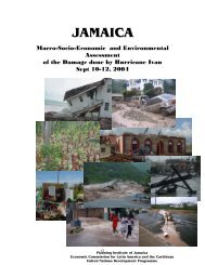
assessment of the socio-economic and environmental impact
assessment of the socio-economic and environmental impact
assessment of the socio-economic and environmental impact
You also want an ePaper? Increase the reach of your titles
YUMPU automatically turns print PDFs into web optimized ePapers that Google loves.
PROJECT TITLE: MAPPING OF COASTAL CHANGE HAZARDS<br />
The Problem<br />
Coastal damage resulting from storm surge that occur during hurricanes pose significant hazards<br />
to buildings <strong>and</strong> infrastructure that are close to vulnerable shorelines. The increased frequency<br />
<strong>and</strong> intensity <strong>of</strong> hurricanes has triggered significant storm surge activity Jamaica’s coasts have<br />
resulted in loss <strong>of</strong> lives <strong>and</strong> damage to coastal infrastructure. The cost to <strong>the</strong> country has been in<br />
billions <strong>of</strong> dollars <strong>and</strong> lives <strong>and</strong> livelihoods are constantly under threat. Mitigating <strong>the</strong> risk from<br />
storm surges is important because approximately 1.8 million <strong>of</strong> Jamaica’s 2.6 million inhabitants<br />
live in coastal areas. In addition, <strong>the</strong>se areas have important <strong>economic</strong> assets including port<br />
facilities, <strong>and</strong> tourism infrastructure.<br />
In order to manage coastal hazards adequate data are required for decision-making. National<br />
Hazard Maps <strong>and</strong> to some extent hazard management plans <strong>and</strong> policies exist at <strong>the</strong> national<br />
level. However, <strong>the</strong>re is a need for <strong>the</strong>se tools to be fur<strong>the</strong>r developed, established, <strong>and</strong> utilized<br />
at parish/municipal levels. This will enable disaster managers to predict where <strong>and</strong> how much<br />
coastal change will occur in order to locate new construction l<strong>and</strong>ward <strong>of</strong> coastal hazards.<br />
Developing this predictive capability requires quantifying how coasts respond to extreme storm<br />
events.<br />
Project Objective<br />
To determine possible storm surge inundation <strong>and</strong> run up levels which may occur in <strong>the</strong> passage<br />
<strong>of</strong> a hurricane in selected coastal towns. This information will serve to guide <strong>the</strong> decision making<br />
process as it relates to development planning, resource <strong>and</strong> l<strong>and</strong> management, mitigation,<br />
emergency preparedness <strong>and</strong> evacuation planning.<br />
Major Components<br />
1. Preparation <strong>of</strong> digitized <strong>and</strong> geo-reference existing bathymetric charts, topographic contours<br />
<strong>and</strong> satellite imagery.<br />
83


