2010-06-07_(2).pdf - 19318.8K - BridgeportCT.gov
2010-06-07_(2).pdf - 19318.8K - BridgeportCT.gov
2010-06-07_(2).pdf - 19318.8K - BridgeportCT.gov

Create successful ePaper yourself
Turn your PDF publications into a flip-book with our unique Google optimized e-Paper software.
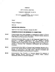
Report of Committee on Ordinances<br />
65 09<br />
10<br />
Water surface elevation means the height in relation to the North American<br />
Vertical Datum NAVD of 1988 the National Geodetic Vertic<br />
1 Datum NGVD of<br />
or other datum where specified<br />
of floods of various magnitudes and<br />
frequencies in the floodplains of coastal or riverine areas<br />
Ord dated 6 20 94 part Ord dated 11 6 89 part prior code 921 70 part<br />
15 44 050 Lands to which this chapter applies<br />
This chapter shall apply to all areas of special flood withiin the jurisdiction<br />
Bridgeport flood and erosion control board<br />
Ord dated 6 20 94 part Ord dated 11 6 89 part prior code 9 21 71<br />
of the<br />
15 44 <strong>06</strong>0 Basis for establishing the areas of special flood hazard<br />
The areas of special flood hazard identified bY the Federal Emeraency<br />
Manaaement Aaency FEMA in its Flood Insurance StudY FIS for Fairfield<br />
County Connecticut Dated June 18 <strong>2010</strong> and the accompanyina Flood<br />
Insurance Rate Maps FIRM dated June 18 <strong>2010</strong> and lother supportina data<br />
applicable to the City of Bridaeport and any subseauent revisions thereto are<br />
adopted bY reference and declared to be part of this chapter Since mappina is<br />
leaally adopted by reference into this chapter it must take precedence when more<br />
restrictive until such time as a map amendment or map revision is obtained from<br />
FEMA The area of special flood hazard includes any area shown on the FIRM as<br />
Zones A AE and VE includina areas desianated as a<br />
flooc lway on a FIRM Zone<br />
VE is also identified as a Coastal Hiah Hazard Area Areas of special flood hazard<br />
are determined utilizina the base flood elevations BFE prcvided on flood profiles<br />
in the Flood Insurance Study FIS for a community BFEs provided on a Flood<br />
Insurance Rate Map FIRM are only approximate rounded UP or down and<br />
should be verified with the BFEs published in the FIS for the specific location<br />
The FIS and FIRM are on file in the City Enaineer s office IRoom 216 City Hall 45<br />
Lyon Terrace Bridaeport Connecticut<br />
R<br />
he areas of special<br />
flood hazard identified by tho Fedoral Insuranoe<br />
r ration in a ooionooo ana onginooring roport ontillod Tllo Fiooa Insuronco Study<br />
ol8ridgoport aaloSopt bo 6 1989 and as Feiood with aGGompaFlYing<br />
t revision June 16 1992 and lC revised is adopted by<br />
d<br />
I rance Rate Maps late