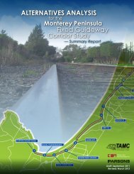
Commuter Rail Extension Alternatives Analysis - Transportation ...
Commuter Rail Extension Alternatives Analysis - Transportation ...
Commuter Rail Extension Alternatives Analysis - Transportation ...

Create successful ePaper yourself
Turn your PDF publications into a flip-book with our unique Google optimized e-Paper software.
CALTRAIN EXTENSION TO MONTEREY COUNTYALTERNATIVES ANALYSISPajaro to CastrovilleThe Lewis Road at-grade crossing (MP 100.5) is located at the south end of the Watsonville yard. It isimmediately south of the Pajaro <strong>Rail</strong> Station which is no longer used for passenger rail service. A newCaltrain/Amtrak station is proposed for this location. Adjacent to Lewis Road, on the west side ofSalinas Road, one restaurant/bar and several residences are located approximately 400 feet to thenorthwest of the at-grade crossing. Just north of the Lewis Road crossing, there is also one house onthe east side of the railroad located about 100 feet from the nearest track.South of Lewis Road, the rail line passes through agricultural lands running parallel to Salinas Road.At MP 101.67, Elkhorn Road passes overhead, and there are no sensitive receptors within 400 feet ofthe track.South of Elkhorn Road, the single track approaches the Elkhorn Slough, which extends roughly fromMP 103 to MP 107. As the track travels through the slough, a boat ramp at Kirby Road (MP 104.60)with no sensitive receptors is located within 400 feet.South of Elkhorn Slough, as the Coast Line runs south by southwest, there is an automobile salvageyard just north of Dolan Road that lies about 200 feet from the track. Dolan Road crosses over theCoast Line track at MP 107.95, but is not listed in the California Public Utilities Commission referencefile of main line crossings. One house is located more than 150 feet from the track on the south sideof Dolan Road.South of Dolan Road, the Coast Line runs through agricultural lands until it reaches the State Route(SR) 156 highway overcrossing in Castroville (MP 110.00). Just north of SR 156, a commuter railCaltrain station is proposed for construction. South of the SR 156 overcrossing, the Coast Line runsparallel to Del Monte Road through a mixed industrial/residential neighborhood. In this section oftrack, between SR 156 and Blackie Road, there are about 30 apartments and about 50 houses on thewest side of the track between approximately 200 feet to one-third mile away from the tracks. AtBlackie Road (MP 110.60), industrial land uses surround the at-grade crossing and there are nosensitive receptors within 400 feet of the crossing.Castroville to SalinasSouth of Castroville, the Coast Line runs through agricultural lands and is parallel to SR 183, which isaligned to the west of the Coast Line. At the Espinosa Road at-grade crossing (MP 111.60), threehouses north of Espinosa Road and one house south of Espinosa Road are on the east side of thetrack and within 400 feet of the crossing.South of Espinosa Road, San Jon Road (MP 115.00) crosses the Coast Line track at-grade from theeast, connecting to SR 183. There is one house located to the west of SR 183 within 400 feet of theSan Jon Road crossing.South of San Jon Road, McFadden Road intersects with SR 183 to the west of the rail line. GravesSchool is located adjacent to this intersection but is greater than 150 feet from the track. BetweenMcFadden Road and an old cemetery opposite Boronda Road, there are two houses on the west sideof SR 183, both of which are greater than 150 feet from the track.About one-half mile north of Davis Road (MP 117.23), Boronda Road dead ends about 100 feet fromthe track on the east side. There are no sensitive receptors within 150 feet.parsons CHAPTER 5: ENVIRONMENTAL ANALYSIS 120