Commuter Rail Extension Alternatives Analysis - Transportation ...
Commuter Rail Extension Alternatives Analysis - Transportation ...
Commuter Rail Extension Alternatives Analysis - Transportation ...

Create successful ePaper yourself
Turn your PDF publications into a flip-book with our unique Google optimized e-Paper software.
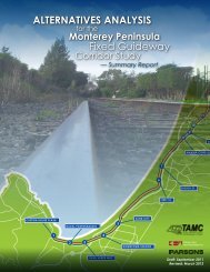
CALTRAIN EXTENSION TO MONTEREY COUNTYALTERNATIVES ANALYSISCOMMUTING TRENDSThe historical pattern of commuter growth from Monterey County and elsewhere to Silicon Valleyslowed following 2000 due to the downtown in the region’s technology-based economy. To gauge theimpact of this slowdown on regional traffic patterns, 24-hour and peak period traffic counts were compiledfor gateways leading to/from Santa Clara County and the San Francisco Bay Area. Figure 2-3illustrates the locations for which traffic count trend data was available and examined for this study.Figure 2-4 illustrates the year-by-year trend of AM peak period (3-hour, 6 AM to 9 AM) entering SantaClara County and/or the San Francisco Bay Area along gateway highways, i.e., U.S. 101 and I-580.By and large, the traffic volume trends are generally flat over time, indicating that the technologysector recession has not had a pronounced impact on the volume of commuters living in outlyingcounties who commute to the Bay Area. Additional evidence of these commuting trends is discussedin the Regional <strong>Rail</strong> section of Existing Conditions.SANTA CLARA COUNTY TRAFFIC CONDITIONSThe Caltrain <strong>Extension</strong> Alternative ridership forecasts documented in Chapter 4 indicate that 90 percentof the riders boarding trains in Monterey County will be destined to stations in Santa ClaraCounty. Of these, more than two-thirds will be destined to “north county” stations in Sunnyvale, MountainView and Palo Alto; and one-third will be destined to downtown San Jose and Santa Clara. Theremaining 10 percent are forecast to ride to stations located in San Mateo and San Franciscocounties.Monterey County and Santa Cruz County (Watsonville) commuters destined to job locations in SantaClara County (“Silicon Valley”) currently experience traffic congestion along U.S. 101 in Monterey andSan Benito counties (as described above), and along U.S. 101, I-280, SR 85, and a myriad of localstreets and expressways in Santa Clara County.Within Santa Clara County, the Santa Clara Valley <strong>Transportation</strong> Authority (VTA) monitors highwaysystem performance through its “Congestion Management Program.” The following data is taken fromVTA’s 2005 Monitoring and Conformance Report, dated April 2006.VTA monitors approximately 152 miles of freeway. Including two travel directions for each freeway,there are about 304 directional miles. About 155 directional miles of the freeway system containhigh-occupancy vehicle (HOV) lanes.VTA’s Traffic Level of Service <strong>Analysis</strong> Guidelines, dated June 2003, adopted density as theparameter for freeway LOS analysis in Santa Clara County. The density values for LOS A/B, B/Cand C/D thresholds are based on values from the Highway Capacity Manual (HCM) 2000. TheLOS D/E and E/F thresholds are based on Santa Clara County conditions.Table 2-4 compares the VTA and HCM 2000 LOS density value thresholds. By VTA’s standards, LOSD, E and F are worse than (more congested) HCM 2000 criteria.Based on VTA’s LOS thresholds, a total of 61 directional freeway miles operated at LOS F duringboth the AM and PM peak hours during 2005. The duration of congestion lasted from one to threehours.parsons CHAPTER 2: EXISTING AND FORECAST CONDITIONS 27