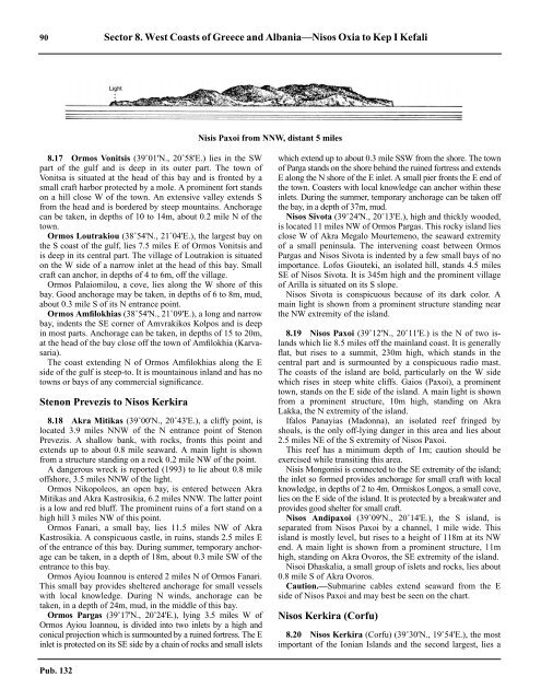
90 Sector 8. West Coasts of Greece and Albania—Nisos Oxia to Kep I KefaliNisis Paxoi from NNW, distant 5 miles8.17 Ormos Vonitsis (39˚01'N., 20˚58'E.) lies in the SWpart of the gulf and is deep in its outer part. The town ofVonitsa is situated at the head of this bay and is fronted by asmall craft harbor protected by a mole. A prominent fort standson a hill close W of the town. An extensive valley extends Sfrom the head and is bordered by steep mountains. Anchoragecan be taken, in depths of 10 to 14m, about 0.2 mile N of thetown.8.17 Ormos Loutrakiou (38˚54'N., 21˚04'E.), the largest bay onthe S coast of the gulf, lies 7.5 miles E of Ormos Vonitsis andis deep in its central part. The village of Loutrakion is situatedon the W side of a narrow inlet at the head of this bay. Smallcraft can anchor, in depths of 4 to 6m, off the village.8.17 Ormos Palaiomilou, a cove, lies along the W shore of thisbay. Good anchorage may be taken, in depths of 6 to 8m, mud,about 0.3 mile S of its N entrance point.8.17 Ormos Amfilokhias (38˚54'N., 21˚09'E.), a long and narrowbay, indents the SE corner of Amvrakikos Kolpos and is deepin most parts. Anchorage can be taken, in depths of 15 to 20m,at the head of the bay close off the town of Amfilokhia (Karvasaria).8.17 The coast extending N of Ormos Amfilokhias along the Eside of the gulf is steep-to. It is mountainous inland and has notowns or bays of any commercial significance.Stenon Prevezis to Nisos Kerkira8.18 Akra Mitikas (39˚00'N., 20˚43'E.), a cliffy point, islocated 3.9 miles NNW of the N entrance point of StenonPrevezis. A shallow bank, with rocks, fronts this point andextends up to about 0.8 mile seaward. A main light is shownfrom a structure standing on a rock 0.2 mile NW of the point.8.18 A dangerous wreck is reported (1993) to lie about 0.8 mileoffshore, 3.5 miles NNW of the light.8.18 Ormos Nikopoleos, an open bay, is entered between AkraMitikas and Akra Kastrosikia, 6.2 miles NNW. The latter pointis a low and red bluff. The prominent ruins of a fort stand on ahigh hill 3 miles NW of this point.8.18 Ormos Fanari, a small bay, lies 11.5 miles NW of AkraKastrosikia. A conspicuous castle, in ruins, stands 2.5 miles Eof the entrance of this bay. During summer, temporary anchoragecan be taken, in a depth of 18m, about 0.3 mile SW of theentrance to this bay.8.18 Ormos Ayiou Ioannou is entered 2 miles N of Ormos Fanari.This small bay provides sheltered anchorage for small vesselswith local knowledge. During N winds, anchorage can betaken, in a depth of 24m, mud, in the middle of this bay.8.18 Ormos Pargas (39˚17'N., 20˚24'E.), lying 3.5 miles W ofOrmos Ayiou Ioannou, is divided into two inlets by a high andconical projection which is surmounted by a ruined fortress. The Einlet is protected on its SE side by a chain of rocks and small isletswhich extend up to about 0.3 mile SSW from the shore. The townof Parga stands on the shore behind the ruined fortress and extendsE along the N shore of the E inlet. A small pier fronts the E end ofthe town. Coasters with local knowledge can anchor within theseinlets. During the summer, temporary anchorage can be taken offthe bay, in a depth of 37m, mud.8.18 Nisos Sivota (39˚24'N., 20˚13'E.), high and thickly wooded,is located 11 miles NW of Ormos Pargas. This rocky island liesclose W of Akra Megalo Mourtemeno, the seaward extremityof a small peninsula. The intervening coast between OrmosPargas and Nisos Sivota is indented by a few small bays of noimportance. Lofos Giouteki, an isolated hill, stands 4.5 milesSE of Nisos Sivota. It is 345m high and the prominent villageof Arilla is situated on its S slope.8.18 Nisos Sivota is conspicuous because of its dark color. Amain light is shown from a prominent structure standing nearthe NW extremity of the island.8.19 Nisos Paxoi (39˚12'N., 20˚11'E.) is the N of two islandswhich lie 8.5 miles off the mainland coast. It is generallyflat, but rises to a summit, 230m high, which stands in thecentral part and is surmounted by a conspicuous radio mast.The coasts of the island are bold, particularly on the W sidewhich rises in steep white cliffs. Gaios (Paxoi), a prominenttown, stands on the E side of the island. A main light is shownfrom a prominent structure, 10m high, standing on AkraLakka, the N extremity of the island.8.19 Ifalos Panayias (Madonna), an isolated reef fringed byshoals, is the only off-lying danger in this area and lies about2.5 miles NE of the S extremity of Nisos Paxoi.8.19 This reef has a minimum depth of 1m; caution should beexercised while transiting this area.8.19 Nisis Mongonisi is connected to the SE extremity of the island;the inlet so formed provides anchorage for small craft with localknowledge, in depths of 2 to 4m. Ormiskos Longos, a small cove,lies on the E side of the island. It is protected by a breakwater andprovides good shelter for small craft.8.19 Nisos Andipaxoi (39˚09'N., 20˚14'E.), the S island, isseparated from Nisos Paxoi by a channel, 1 mile wide. Thisisland is mostly level, but rises to a height of 118m at its NWend. A main light is shown from a prominent structure, 11mhigh, standing on Akra Ovoros, the SE extremity of the island.8.19 Nisoi Dhaskalia, a small group of islets and rocks, lies about0.8 mile S of Akra Ovoros.8.19 Caution.—Submarine cables extend seaward from the Eside of Nisos Paxoi and may best be seen on the chart.Nisos Kerkira (Corfu)8.20 Nisos Kerkira (Corfu) (39˚30'N., 19˚54'E.), the mostimportant of the Ionian Islands and the second largest, lies aPub. 132
Sector 8. West Coasts of Greece and Albania—Nisos Oxia to Kep I Kefali 91short distance off the mainland near the boundary of Greeceand Albania. This island is extremely mountainous throughoutmost of its area. Oros Pandokrator, 911m high, is the summit ofthe island and stands in the NE part.8.20 Akra Asprokavos (Cape Bianco) (39˚22'N., 20˚07'E.), theSE extremity of Nisos Kerkira, is composed of high whitecliffs. Shoals front this cape and extend up to about 2.3 miles Eand SE of it.8.20 The W coast of the island between Akra Asprokavos andAkra Arilla, 31 miles NW, is of little importance to commercialshipping. There are few landmarks and the only anchoragesavailable are for the use of small craft with local knowledge.The numerous rocks, islets, and shoals found along this sectionof the coast lie within 1.5 miles of the shore.8.20 Vrakhoi Lagoudhia, consisting of two small islets, lies about1 mile offshore, 10.3 miles NW of Akra Asprokavos. Theseislets are surrounded by shoals and are marked by a light.8.20 Ormos Liapadhes, a small bay, is entered 4 miles SE of AkraArilla. During N and E winds, vessels can anchor here, in adepth of 18m, fine sand. Ormos Ayiou Yeoryiou, another smallbay, is entered close S of Akra Arilla and provides anchorage,in depths of 10 to 14m, sand, in its N part.8.20 Akra Arilla (39˚43'N., 19˚39'E.), 91m high, is the boldtermination of a peninsula and is marked by a light.8.20 Between Akra Arilla and Akra Dhrastis, 5.2 miles NNE, theNW coast of Nisos Kerkira is fronted by numerous small islets,rocks, and shoal patches which extend between it and theisland of Nisos Mathraki, 5.5 miles W.8.21 Nisos Mathraki (Nisos Samothraki) (39˚46'N.,19˚31'E.), 155m high, is a fairly large island. It is fringed byfoul ground which extends up to 1.5 miles offshore in places. Adetached patch, with a depth of 3.2m, lies about 1.7 miles NWof the N extremity of the island. Vessels, without localknowledge, should not attempt to pass between the island andthe NW coast of Nisos Kerkira. Nisis Trakhia, 28m high, lieson a bank 1 mile SW of Akra Sakki, the N extremity of theisland.8.21 Nisos Othonoi (39˚51'N., 19˚24'E.), pine covered, lies 7miles NW of Nisos Mathraki. This island is precipitous on itsW side and rises to heights of 315m in its NW part and 393min its SW part. A main light is shown from a prominentstructure, 10m high, standing near Akra Kastri, the NE extremityof the island. Another light is shown from the S extremityof the island.8.21 Nisos Erikousa (39˚53'N., 19˚35'E.), 121m high, is N of theIonian Islands and lies 7.5 miles NNE of Nisos Mathraki. Its Nand W sides are formed by high cliffs. A main light is shownfrom a structure standing near its E extremity.8.21 Both Nisos Othonoi and Nisos Erikousa are fringed withdangers which extend up to about 1 mile seaward in places. Ashoal, with a depth of 11m, lies about 2.5 miles NNE of AkraKastri.8.21 Akra Ayia Aikaterini (39˚49'N., 19˚51'E.), 61m high, islocated 8 miles ENE of Akra Dhrastis. This point is marked bya light and is surmounted by a conspicuous church. The coastbetween is generally low, sandy, and is fronted by foul ground.8.21 Caution.—Submarine cables extend between the NW coastof Nisos Kerkira and the off-lying islands and may best be seenon the chart.8.22 Akra Levkimmis (39˚28'N., 20˚04'E.), marked by alight, is located 6.3 miles NNW of Akra Asprokavos. Thispoint is the N extremity of a low and sandy peninsula which isdifficult to distinguish.8.22 Ormos Levkimmis, a small open bay, lies between AkraLevkimmis and Akra Voukari, 3.5 miles W. It provides excellentanchorage, in depths of 28 to 31m.8.22 Between Ormos Levkimmis and Akra Anemomilos, 10miles NE, the shore recedes to the W and N. Several villages,with anchorages for small craft, are situated along this sectionof the coast.8.22 Ormos Garitsa, a shallow bay, is entered close N of AkraAnemomilos. It is frequented by fishing craft and Garitsa, asuburb of the town of Kerkira, stands at the head.8.22 Akra Sidhero (39˚38'N., 19˚56'E.), the N entrance point ofOrmos Garitsa, is the E extremity of a rocky promontory onwhich stands the citadel of Kerkira. A light is shown from atower standing on the citadel. A disused signal station is situatednear the light.8.22 Akra Ayios Nikolaos, the E entrance point of KerkiraHarbor, lies 0.4 mile WNW of Akra Sidhero.8.22 Nisis Vidhon (39˚39'N., 19˚55'E.), a wooded island, lies 0.7mile N of Akra Ayios Nikolaos. This island is 38m high and isfringed by foul ground and several above-water rocks. A lightis shown from its S extremity. Nisis Kaloyiros, 2m high, lies ona shoal bank 0.4 mile WNW of the SW extremity of the island.8.22 Nisis Lazaretton (Nisos Gouvinon) lies 2 miles WNW ofNisis Vidhon. This small island is 20m high and fringed by areef.8.23 Kerkira (Corfu) (39˚37'N., 19˚56'E.) (World PortIndex No. 41720), the largest town on Nisos Kerkira and thecapital of the island, extends along the shore to the W of AkraAyios Nikolaos. A small harbor, with several piers, fronts thetown. Large vessels secure to mooring buoys or anchor in theroadstead to work cargo.8.23 Depths—Limitations.—Depths in the approach, E and SEof Nisis Vidhon, are in excess of 35m. They decrease graduallyto 18 to 30m in the roadstead N of the harbor area. The maincommercial facilities include 2,050m of quayage, with depthsof 5.8 to 6.5m alongside. There are facilities for general cargo,ro-ro, bulk, and ferry vessels. Vessels up to 7.5m draft can beaccommodated alongside.8.23 Aspect.—Two prominent radio masts stand close W of anairfield 1.8 miles SW of Akra Sidhero. A conspicuous whitetower, with a large red dome, stands 300m W of Akra AyiosNikolaos. A conspicuous chimney stands 1.2 mile W of AkraSidhero.8.23 Pilotage.—Pilotage is compulsory. Pilots can be contactedon VHF channel 12 and board in the channel between Kerkiraand Nisis Vidhon. Vessels should advise of pilotage requirements48 hours and 24 hours in advance and confirm their ETA24 hours prior to arrival.8.23 Regulations.—A vessel traffic service (VTS) has beenestablished for Kerkira call “Kerkira Traffic.” Vessels mustcontact Kerkira Traffic on VHF channel 13, 2 hours prior toarrival.8.23 Anchorage.—Anchorage can be taken, in depths of 18 to29m, stiff mud and clay, in the roadstead N of the town. Duringthe winter, this anchorage is sheltered from NE winds by NisisPub. 132
- Page 1 and 2:
PUB.132SAILING DIRECTIONS(ENROUTE)
- Page 3 and 4:
Preface0.0 Pub. 132, Sailing Direct
- Page 5 and 6:
ContentsHow to Keep this Book Corre
- Page 7 and 8:
0.0SECTOR LIMITS—PUB. 132Pub. 132
- Page 9:
AbbreviationsThe following abbrevia
- Page 13 and 14:
3SECTOR 1COAST OF LIBYA1.0 Plan.—
- Page 15 and 16:
Sector1.CoastofLibya 51.5 Pilotage.
- Page 17 and 18:
Sector1.CoastofLibya 71.12 Caution.
- Page 19 and 20:
Sector1.CoastofLibya 91.17 Jabal La
- Page 21 and 22:
Sector1.CoastofLibya 111.21 Tukrah
- Page 23:
Sector1.CoastofLibya 131.28 Aspect.
- Page 27 and 28:
17SECTOR 2COAST OF EGYPT2.0 Plan.
- Page 29 and 30:
Sector2.CoastofEgypt 19a depth of 2
- Page 31 and 32:
Sector2.CoastofEgypt 212.10 Several
- Page 33 and 34:
Sector2.CoastofEgypt 232.17 Local v
- Page 35:
Sector2.CoastofEgypt 25high, stands
- Page 39 and 40:
29SECTOR 3COASTS OF ISRAEL, LEBANON
- Page 41 and 42:
Sector 3. Coasts of Israel, Lebanon
- Page 43 and 44:
Sector 3. Coasts of Israel, Lebanon
- Page 45 and 46:
Sector 3. Coasts of Israel, Lebanon
- Page 47 and 48:
Sector 3. Coasts of Israel, Lebanon
- Page 49: 4.CyprusPub. 1324.0Additional chart
- Page 52 and 53: 42 Sector4.Cyprusthe village. Ancho
- Page 54 and 55: 44 Sector4.Cyprus4.10 A conspicuous
- Page 56 and 57: 46 Sector4.Cyprus4.18 Kakoskaliou I
- Page 59 and 60: 49SECTOR 5SOUTH COAST OF TURKEY—K
- Page 61 and 62: Sector 5. South Coast of Turkey—K
- Page 63 and 64: Sector 5. South Coast of Turkey—K
- Page 65 and 66: Sector 5. South Coast of Turkey—K
- Page 67: Sector 5. South Coast of Turkey—K
- Page 71 and 72: 61SECTOR 6RODHOS (RHODES), NISOS KA
- Page 73 and 74: Sector 6. Rodhos (Rhodes), Nisos Ka
- Page 75 and 76: Sector 6. Rodhos (Rhodes), Nisos Ka
- Page 77 and 78: Sector 6. Rodhos (Rhodes), Nisos Ka
- Page 79 and 80: Sector 6. Rodhos (Rhodes), Nisos Ka
- Page 81 and 82: Sector 6. Rodhos (Rhodes), Nisos Ka
- Page 83: 7.West Coast of Greece and Dhiorix
- Page 86 and 87: 76 Sector 7. West Coast of Greece a
- Page 88 and 89: 78 Sector 7. West Coast of Greece a
- Page 90 and 91: 80 Sector 7. West Coast of Greece a
- Page 93: 8.West Coasts of Greece and Albania
- Page 96 and 97: 86 Sector 8. West Coasts of Greece
- Page 98 and 99: 88 Sector 8. West Coasts of Greece
- Page 102 and 103: 92 Sector 8. West Coasts of Greece
- Page 105: 9.Coasts of Albania, Montenegro, an
- Page 108 and 109: 98 Sector 9. Coasts of Albania, Mon
- Page 110 and 111: 100 Sector 9. Coasts of Albania, Mo
- Page 112 and 113: 102 Sector 9. Coasts of Albania, Mo
- Page 114 and 115: 104 Sector 9. Coasts of Albania, Mo
- Page 117: 10.Coasts of Croatia and Bosnia-Her
- Page 120 and 121: 110 Sector 10. Coasts of Croatia an
- Page 122 and 123: 112 Sector 10. Coasts of Croatia an
- Page 124 and 125: 114 Sector 10. Coasts of Croatia an
- Page 126 and 127: 116 Sector 10. Coasts of Croatia an
- Page 128 and 129: 118 Sector 10. Coasts of Croatia an
- Page 131 and 132: 121SECTOR 11COAST OF CROATIA—RT M
- Page 133 and 134: Sector 11. Coast of Croatia—Rt Mo
- Page 135 and 136: Sector 11. Coast of Croatia—Rt Mo
- Page 137 and 138: Sector 11. Coast of Croatia—Rt Mo
- Page 139 and 140: Sector 11. Coast of Croatia—Rt Mo
- Page 141 and 142: Sector 11. Coast of Croatia—Rt Mo
- Page 143: Sector 11. Coast of Croatia—Rt Mo
- Page 147 and 148: 137SECTOR 12COAST OF GREECE—AKRA
- Page 149 and 150: Sector 12. Coast of Greece—Akra T
- Page 151 and 152:
Sector 12. Coast of Greece—Akra T
- Page 153 and 154:
Sector 12. Coast of Greece—Akra T
- Page 155:
13.Coast of Greece—Saronikos Kolp
- Page 158 and 159:
148 Sector 13. Coast of Greece—Sa
- Page 160 and 161:
150 Sector 13. Coast of Greece—Sa
- Page 162 and 163:
152 Sector 13. Coast of Greece—Sa
- Page 164 and 165:
154 Sector 13. Coast of Greece—Sa
- Page 167:
14.Greece—Kikladhes Nisoi15714.0A
- Page 170 and 171:
160 Sector14.Greece—KikladhesNiso
- Page 172 and 173:
162 Sector14.Greece—KikladhesNiso
- Page 174 and 175:
164 Sector14.Greece—KikladhesNiso
- Page 176 and 177:
166 Sector14.Greece—KikladhesNiso
- Page 178 and 179:
168 Sector14.Greece—KikladhesNiso
- Page 181:
15.Greece—Channels West of Nisos
- Page 184 and 185:
174 Sector 15. Greece—Channels We
- Page 186 and 187:
176 Sector 15. Greece—Channels We
- Page 188 and 189:
178 Sector 15. Greece—Channels We
- Page 191:
16.Greece—Nisoi Vorioi Sporadhes
- Page 194 and 195:
184 Sector 16. Greece—Nisoi Vorio
- Page 196 and 197:
186 Sector 16. Greece—Nisoi Vorio
- Page 199:
17.Coast of Greece—Thermaikos Kol
- Page 202 and 203:
192 Sector 17. Coast of Greece—Th
- Page 204 and 205:
194 Sector 17. Coast of Greece—Th
- Page 206 and 207:
196 Sector 17. Coast of Greece—Th
- Page 209:
18.Greece—Dhodhekanisos and South
- Page 212 and 213:
202 Sector 18. Greece—Dhodhekanis
- Page 214 and 215:
204 Sector 18. Greece—Dhodhekanis
- Page 216 and 217:
206 Sector 18. Greece—Dhodhekanis
- Page 219:
19.West Coast of Turkey—Samos Str
- Page 222 and 223:
212 Sector 19. West Coast of Turkey
- Page 224 and 225:
214 Sector 19. West Coast of Turkey
- Page 226 and 227:
216 Sector 19. West Coast of Turkey
- Page 229:
20.The Dardanelles Approach and Adj
- Page 232 and 233:
222 Sector 20. The Dardanelles Appr
- Page 234 and 235:
224 Sector 20. The Dardanelles Appr
- Page 236 and 237:
226 Sector 20. The Dardanelles Appr
- Page 238 and 239:
228 Sector 20. The Dardanelles Appr
- Page 240 and 241:
230 GlossariesArabicARABICEnglishAR
- Page 242 and 243:
232 GlossariesARABICEnglishARABICEn
- Page 244 and 245:
234 GlossariesHebrewHEBREWEnglishHE
- Page 246 and 247:
236 GlossariesTURKISHEnglishTURKISH
- Page 249 and 250:
How to use the Index—Gazetteer239
- Page 251 and 252:
Index—Gazetteer 241PositionSec.˚
- Page 253 and 254:
Index—Gazetteer 243PositionSec.˚
- Page 255 and 256:
Index—Gazetteer 245PositionSec.˚
- Page 257 and 258:
Index—Gazetteer 247PositionSec.˚