92 Sector 8. West Coasts of Greece and Albania—Nisos Oxia to Kep I KefaliVidhon. During SE winds, the recommended anchorage liesabout 0.4 mile SW of the SE extremity of Nisis Vidhon.8.23 Caution.—Foul ground areas (sunken booms), which maybest be seen on the chart, lie between the SE extremity of NisisVidhon and Akra Ayios Nikolaos and in the vicinity of the SWextremity of Nisis Vidhon.8.23 A submarine cable, which may best be seen on the chart, liesbetween Nisis Vidhon and Akra Ayios Nikolaos.8.23 Ferry traffic in the harbor is considerable.8.24 Ormos Gouvion (39˚39'N., 19˚51'E.), a shallow andsheltered bay, is only used by small craft and small coasters.Banks extend from both of the entrance points and form only anarrow entrance channel. A marina is situated within this bay.8.24 Ormos Ipsou (39˚42'N., 19˚51'E.) lies between AkraKefaloipsos, located 2 miles N of Ormos Gouvion, and a point1.5 miles NNE. The shores of this bay are fringed by a bank,with depths of less than 9m, which extends up to 0.4 mileseaward in places. A conspicuous red house stands 0.3 mileNW of Akra Kefaloipsos. Vessels occasionally anchor, indepths of 12 to 18m, sand, in the S part of the bay, but the holdingground is poor.8.24 Akra Ayios Stefanos (39˚46'N., 19˚57'E.) is located 6.7miles NE of Ormos Ipsou. The coast between is bold andsteep-to. Several small bays lie along this section of the shore,but are of no commercial importance. A detached patch, with adepth of 16m, lies about 1.2 miles S of Akra Ayios Stefanos. Aprominent tower stands 0.4 mile NW of the point.8.24 Ifalos Serpa (39˚46'N., 19˚58'E.), a reef with an abovewaterrock, lies about 0.3 mile NE of Akra Ayios Stefanos andis marked by a lighted buoy and a beacon. In calm weather, thisdanger can be distinguished by the reddish colored water in itsvicinity. Vessels should pass to the E of the lighted buoy.8.24 Akra Psaromita (39˚47'N., 19˚57'E.), located 1.2 milesNNW of Akra Ayios Stefanos, is marked by a light. OrmosBolana (Ormos Volanas), a small and open bay, lies 0.6 mile Wof this point and provides shelter from S winds. Akra Kassiopis,the W entrance point of the bay, is located 1.4 miles WNWof Akra Psaromita. It is fringed by a reef and surmounted bythe ruins of a fort.8.24 Between Akra Kassiopi and Akra Ayia Aikaterini, 3.8 milesNW, the coast is fronted by a bank, with depths of less than9m, which extends up to 0.5 mile seaward.8.24 Caution.—A prohibited area, which may best be seen on thechart, extends along the NE coast of Nisos Kerkira, between theNE part of Ormos Ipsou and Akra Ayia Aikaterini, the Nextremity of the island. Navigation, without prior permission ofthe appropriate naval authorities, is prohibited within this area.Nisos Sivota to Kep I Kefali8.25 Notion Stenon Kerkiras (39˚21'N., 20˚12'E.), astrait, leads into Corfu Channel and is entered between AkraAsprokavos, the SE extremity of Nisos Kerkira and NisosSivota. The W side of the approach is obstructed by the foulground which extends up to 2 miles seaward of Akra Asprokavos.The E side of the approach is clear and deep, havinggeneral depths of 55 to 73m.8.25 The E side of Notion Stenon Kerkiras, between Nisos Sivotaand Kep i Stilo, 20 miles NNW, is very irregular and is indentedby numerous bays and coves. Potamos Thiamis, thelargest of many rivers and streams along this part of the coast,discharges through two mouths. Its S mouth lies 8 miles N ofNisos Sivota and its N mouth lies 10 miles SE of Stilo.8.25 Ormos Igoumenitsis (39˚30'N., 20˚14'E.), the mostsheltered of the many bays along this part of the coast, lies 6miles N of Nisos Sivota. The entrance of this bay is obstructedby a bar through which an access channel leads. This channelis marked by buoys and has a least depth of 7.9m (1993). Ashoal, with a least depth of 5.5m, lies about 0.3 mile W of theentrance to the channel. Simultaneous passage of vessels inopposite <strong>directions</strong> is prohibited within the channel. Generaldepths of 16 to 26m exist in the greater part of bay within thebar.8.25 The town of Igoumenitsa, a tourist center, is situated at the Eside of the bay and a prominent ruined fort stands at its S end.8.25 A pier, extending SW from the shore, fronts the town and isused by ferries. A berth on its W side is 125m long and has adepth of 7m alongside. A berth on its E side is 100m long andhas a depth of 5.8m alongside.8.25 A jetty extends 120m W from the shore close S of the pierand has depths of 8.5 to 10m alongside its N side and head. Inaddition, there is also 480m of quayage with depths of 3 to 6malongside.8.25 An oil installation is situated in the SE corner of the bay andis fronted by a small pier. A cement factory is situated closeNW of the oil installation and is fronted by a small T-head pierwith depths of 8 to 9m alongside.8.25 Caution.—Due to the existence of submarine cables, anchoringand fishing are prohibited in an area, which may bestbe seen on the chart, extending between Nisos Kerkira and apoint on the shore close NW of the entrance to Ormos Igoumenitsis.8.26 Nisis Prasoudhi (39˚30'N., 20˚09'E.), a small island,lies about 0.8 mile offshore, 6.7 miles NW of Nisos Sivota. It is40m high, covered in vegetation, and marked by a light. Adetached shallow reef lies about 0.4 mile ENE of this island.8.26 Ormos Sayiadhas (39˚37'N., 20˚10'E.), which indents thecoast for 2 miles, lies centered 6.5 miles N of Nisis Prasoudhi.A shallow bank fronts the coast on the SE side of the bay. Thesmall town of Sayiadha is situated at the head of the bay and isfronted by a shallow pier. Vessels can anchor, in depths of 7 to22m, mud, W of the town.8.26 Akra Strovili, the N entrance point of Ormos Sayiadhas,rises to a conspicuous conical hill, 115m high.8.26 Khersonisos Pagania, an irregular shaped peninsula, islocated 1.7 mile WNW of Akra Strovili. This peninsula is 77mhigh and has coves on its SE and NW sides.8.26 Kep i Stilo (Kep i Stilit) (39˚41'N., 19˚59'E.), a low andsalient headland, is located 5.5 miles WNW of KhersonisosPagania. Stilos, a prominent hill, stands 2 miles NE of the pointand is 272m high. Nisis Stilos, 82m high, lies close offshore0.4 mile SE of the point.8.26 Ormos Ftelias lies 1 mile E of Kep i Stilo and the coastalborder between Greece and Albania lies in its vicinity.8.26 Caution.—A prohibited area, which may best be seen on thechart, extends along the coast between Nisis Prasoudhi andOrmos Ftelias. Navigation, without prior permission of theappropriate naval authorities, is prohibited within this area.Pub. 132
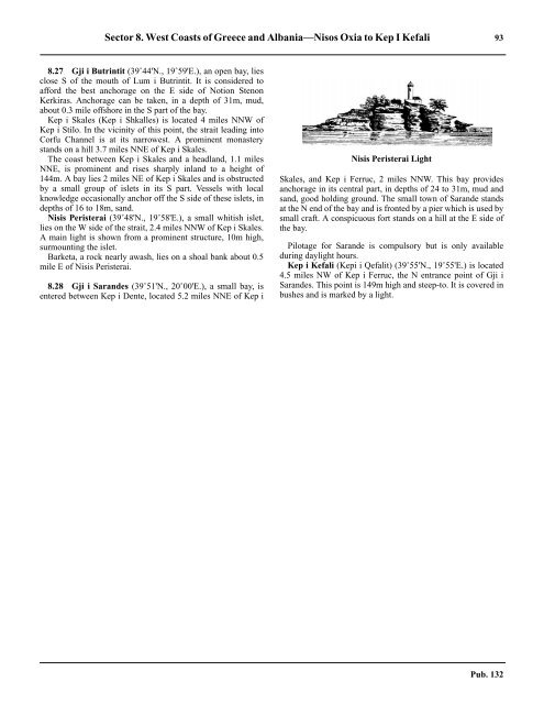
Sector 8. West Coasts of Greece and Albania—Nisos Oxia to Kep I Kefali 938.27 Gji i Butrintit (39˚44'N., 19˚59'E.), an open bay, liesclose S of the mouth of Lum i Butrintit. It is considered toafford the best anchorage on the E side of Notion StenonKerkiras. Anchorage can be taken, in a depth of 31m, mud,about 0.3 mile offshore in the S part of the bay.8.27 Kep i Skales (Kep i Shkalles) is located 4 miles NNW ofKep i Stilo. In the vicinity of this point, the strait leading intoCorfu Channel is at its narrowest. A prominent monasterystands on a hill 3.7 miles NNE of Kep i Skales.8.27 The coast between Kep i Skales and a headland, 1.1 milesNNE, is prominent and rises sharply inland to a height of144m. A bay lies 2 miles NE of Kep i Skales and is obstructedby a small group of islets in its S part. Vessels with localknowledge occasionally anchor off the S side of these islets, indepths of 16 to 18m, sand.8.27 Nisis Peristerai (39˚48'N., 19˚58'E.), a small whitish islet,lies on the W side of the strait, 2.4 miles NNW of Kep i Skales.A main light is shown from a prominent structure, 10m high,surmounting the islet.8.27 Barketa, a rock nearly awash, lies on a shoal bank about 0.5mile E of Nisis Peristerai.8.28 Gji i Sarandes (39˚51'N., 20˚00'E.), a small bay, isentered between Kep i Dente, located 5.2 miles NNE of Kep iNisis Peristerai LightSkales, and Kep i Ferruc, 2 miles NNW. This bay providesanchorage in its central part, in depths of 24 to 31m, mud andsand, good holding ground. The small town of Sarande standsat the N end of the bay and is fronted by a pier which is used bysmall craft. A conspicuous fort stands on a hill at the E side ofthe bay.8.28 Pilotage for Sarande is compulsory but is only availableduring daylight hours.8.28 Kep i Kefali (Kepi i Qefalit) (39˚55'N., 19˚55'E.) is located4.5 miles NW of Kep i Ferruc, the N entrance point of Gji iSarandes. This point is 149m high and steep-to. It is covered inbushes and is marked by a light.Pub. 132
- Page 1 and 2:
PUB.132SAILING DIRECTIONS(ENROUTE)
- Page 3 and 4:
Preface0.0 Pub. 132, Sailing Direct
- Page 5 and 6:
ContentsHow to Keep this Book Corre
- Page 7 and 8:
0.0SECTOR LIMITS—PUB. 132Pub. 132
- Page 9:
AbbreviationsThe following abbrevia
- Page 13 and 14:
3SECTOR 1COAST OF LIBYA1.0 Plan.—
- Page 15 and 16:
Sector1.CoastofLibya 51.5 Pilotage.
- Page 17 and 18:
Sector1.CoastofLibya 71.12 Caution.
- Page 19 and 20:
Sector1.CoastofLibya 91.17 Jabal La
- Page 21 and 22:
Sector1.CoastofLibya 111.21 Tukrah
- Page 23:
Sector1.CoastofLibya 131.28 Aspect.
- Page 27 and 28:
17SECTOR 2COAST OF EGYPT2.0 Plan.
- Page 29 and 30:
Sector2.CoastofEgypt 19a depth of 2
- Page 31 and 32:
Sector2.CoastofEgypt 212.10 Several
- Page 33 and 34:
Sector2.CoastofEgypt 232.17 Local v
- Page 35:
Sector2.CoastofEgypt 25high, stands
- Page 39 and 40:
29SECTOR 3COASTS OF ISRAEL, LEBANON
- Page 41 and 42:
Sector 3. Coasts of Israel, Lebanon
- Page 43 and 44:
Sector 3. Coasts of Israel, Lebanon
- Page 45 and 46:
Sector 3. Coasts of Israel, Lebanon
- Page 47 and 48:
Sector 3. Coasts of Israel, Lebanon
- Page 49:
4.CyprusPub. 1324.0Additional chart
- Page 52 and 53: 42 Sector4.Cyprusthe village. Ancho
- Page 54 and 55: 44 Sector4.Cyprus4.10 A conspicuous
- Page 56 and 57: 46 Sector4.Cyprus4.18 Kakoskaliou I
- Page 59 and 60: 49SECTOR 5SOUTH COAST OF TURKEY—K
- Page 61 and 62: Sector 5. South Coast of Turkey—K
- Page 63 and 64: Sector 5. South Coast of Turkey—K
- Page 65 and 66: Sector 5. South Coast of Turkey—K
- Page 67: Sector 5. South Coast of Turkey—K
- Page 71 and 72: 61SECTOR 6RODHOS (RHODES), NISOS KA
- Page 73 and 74: Sector 6. Rodhos (Rhodes), Nisos Ka
- Page 75 and 76: Sector 6. Rodhos (Rhodes), Nisos Ka
- Page 77 and 78: Sector 6. Rodhos (Rhodes), Nisos Ka
- Page 79 and 80: Sector 6. Rodhos (Rhodes), Nisos Ka
- Page 81 and 82: Sector 6. Rodhos (Rhodes), Nisos Ka
- Page 83: 7.West Coast of Greece and Dhiorix
- Page 86 and 87: 76 Sector 7. West Coast of Greece a
- Page 88 and 89: 78 Sector 7. West Coast of Greece a
- Page 90 and 91: 80 Sector 7. West Coast of Greece a
- Page 93: 8.West Coasts of Greece and Albania
- Page 96 and 97: 86 Sector 8. West Coasts of Greece
- Page 98 and 99: 88 Sector 8. West Coasts of Greece
- Page 100 and 101: 90 Sector 8. West Coasts of Greece
- Page 105: 9.Coasts of Albania, Montenegro, an
- Page 108 and 109: 98 Sector 9. Coasts of Albania, Mon
- Page 110 and 111: 100 Sector 9. Coasts of Albania, Mo
- Page 112 and 113: 102 Sector 9. Coasts of Albania, Mo
- Page 114 and 115: 104 Sector 9. Coasts of Albania, Mo
- Page 117: 10.Coasts of Croatia and Bosnia-Her
- Page 120 and 121: 110 Sector 10. Coasts of Croatia an
- Page 122 and 123: 112 Sector 10. Coasts of Croatia an
- Page 124 and 125: 114 Sector 10. Coasts of Croatia an
- Page 126 and 127: 116 Sector 10. Coasts of Croatia an
- Page 128 and 129: 118 Sector 10. Coasts of Croatia an
- Page 131 and 132: 121SECTOR 11COAST OF CROATIA—RT M
- Page 133 and 134: Sector 11. Coast of Croatia—Rt Mo
- Page 135 and 136: Sector 11. Coast of Croatia—Rt Mo
- Page 137 and 138: Sector 11. Coast of Croatia—Rt Mo
- Page 139 and 140: Sector 11. Coast of Croatia—Rt Mo
- Page 141 and 142: Sector 11. Coast of Croatia—Rt Mo
- Page 143: Sector 11. Coast of Croatia—Rt Mo
- Page 147 and 148: 137SECTOR 12COAST OF GREECE—AKRA
- Page 149 and 150: Sector 12. Coast of Greece—Akra T
- Page 151 and 152: Sector 12. Coast of Greece—Akra T
- Page 153 and 154:
Sector 12. Coast of Greece—Akra T
- Page 155:
13.Coast of Greece—Saronikos Kolp
- Page 158 and 159:
148 Sector 13. Coast of Greece—Sa
- Page 160 and 161:
150 Sector 13. Coast of Greece—Sa
- Page 162 and 163:
152 Sector 13. Coast of Greece—Sa
- Page 164 and 165:
154 Sector 13. Coast of Greece—Sa
- Page 167:
14.Greece—Kikladhes Nisoi15714.0A
- Page 170 and 171:
160 Sector14.Greece—KikladhesNiso
- Page 172 and 173:
162 Sector14.Greece—KikladhesNiso
- Page 174 and 175:
164 Sector14.Greece—KikladhesNiso
- Page 176 and 177:
166 Sector14.Greece—KikladhesNiso
- Page 178 and 179:
168 Sector14.Greece—KikladhesNiso
- Page 181:
15.Greece—Channels West of Nisos
- Page 184 and 185:
174 Sector 15. Greece—Channels We
- Page 186 and 187:
176 Sector 15. Greece—Channels We
- Page 188 and 189:
178 Sector 15. Greece—Channels We
- Page 191:
16.Greece—Nisoi Vorioi Sporadhes
- Page 194 and 195:
184 Sector 16. Greece—Nisoi Vorio
- Page 196 and 197:
186 Sector 16. Greece—Nisoi Vorio
- Page 199:
17.Coast of Greece—Thermaikos Kol
- Page 202 and 203:
192 Sector 17. Coast of Greece—Th
- Page 204 and 205:
194 Sector 17. Coast of Greece—Th
- Page 206 and 207:
196 Sector 17. Coast of Greece—Th
- Page 209:
18.Greece—Dhodhekanisos and South
- Page 212 and 213:
202 Sector 18. Greece—Dhodhekanis
- Page 214 and 215:
204 Sector 18. Greece—Dhodhekanis
- Page 216 and 217:
206 Sector 18. Greece—Dhodhekanis
- Page 219:
19.West Coast of Turkey—Samos Str
- Page 222 and 223:
212 Sector 19. West Coast of Turkey
- Page 224 and 225:
214 Sector 19. West Coast of Turkey
- Page 226 and 227:
216 Sector 19. West Coast of Turkey
- Page 229:
20.The Dardanelles Approach and Adj
- Page 232 and 233:
222 Sector 20. The Dardanelles Appr
- Page 234 and 235:
224 Sector 20. The Dardanelles Appr
- Page 236 and 237:
226 Sector 20. The Dardanelles Appr
- Page 238 and 239:
228 Sector 20. The Dardanelles Appr
- Page 240 and 241:
230 GlossariesArabicARABICEnglishAR
- Page 242 and 243:
232 GlossariesARABICEnglishARABICEn
- Page 244 and 245:
234 GlossariesHebrewHEBREWEnglishHE
- Page 246 and 247:
236 GlossariesTURKISHEnglishTURKISH
- Page 249 and 250:
How to use the Index—Gazetteer239
- Page 251 and 252:
Index—Gazetteer 241PositionSec.˚
- Page 253 and 254:
Index—Gazetteer 243PositionSec.˚
- Page 255 and 256:
Index—Gazetteer 245PositionSec.˚
- Page 257 and 258:
Index—Gazetteer 247PositionSec.˚