78 Sector 7. West Coast of Greece and Dhiorix Korinthou (Corinth Canal)7.11 Limin Killinis, a small craft harbor, lies on the E side ofAkra Killinis and is protected by a breakwater. Small vesselscan anchor, in depths of 9 to 11m, about 0.8 mile E of thebreakwater.7.11 Akra Pappas (Akra Araxos) (38˚13'N., 21˚22'E.) is located20 miles NE of Akra Killinis. The coast between is low, sandy,and backed by wooded and cultivated land.This point is marked by a light and shoals, with depths ofless than 11m, extend up to 1 mile seaward of it. A dangerouswreck and a wreck, with a depth of 16m, lie about 1.2 milesand 3 miles WSW, respectively, of Akra Pappas.7.11 The prominent ruins of a fortress stand on Akra Kounoupeli,which is located 7 miles S of Akra Pappas; an aeronauticallight is occasionally shown from a structure standing 5 milesNE of it.7.11 Caution.—A submarine cable, which may best be seen onthe chart, extends seaward from a point on the shore 0.5 mile Nof Akra Tripiti. Anchorage is prohibited within the vicinity ofthe cable.7.11 A prohibited area, which may best be seen on the chart,fronts the coast in the vicinity of Akra Pappas and extends upto 1.5 miles from the shore.Patraikos Kolpos7.12 Patraikos Kolpos (38˚15'N., 21˚30'E.), a gulf, separatesPeloponnisos from the mainland to the N and is enteredbetween Akra Pappas and Nisos Oxia, 13 miles WNW. Thereare no detached dangers in the middle of the fairway of thischannel. Though the shores bordering this gulf are generallylow, they are backed by high land.7.12 Winds—Weather.—In the gulf, the prevailing NE windblows for 9 months of the year, but during the summer, a freshNW wind or sea breeze blows occasionally.7.12 Tides—Currents.—A countercurrent sets in the oppositedirection to that of the wind on the S coast of the gulf. Thiscurrent either sets toward or away from Patrai, depending onthe direction of the wind.7.12 Southwest of Akra Pappas, the current parallels the coast in ageneral NW direction on the order of 0.2 to 0.4 knot, but it isinvariably stronger in the passages between the islands. In thevicinity of Akra Pappas, the current is caused almost entirelyby the wind. With fresh NE winds the current sets W at avelocity of 1.5 knots or greater, and sets E with NW winds7.12 Caution.—Numerous fishing vessels may be encounteredwithin Patraikos Kolpos. These vessels often work in pairs,about 0.5 mile apart, with a net extended between them.7.13 Patraikos Kolpos—South shore.—Akra Vardhia(38˚13'N., 21˚23'E.), located close E of Akra Pappas, is surmountedby the prominent ruins of a tower. The lagoon enteredbetween these points is the site of Papas, a small craft harbor,which is protected by a breakwater and is used as a militarybase.7.13 From Akra Vardhia, the S coast of the gulf extends 15 milesE to Patrai and is low and sandy. Several villages stand alongthe shore.7.13 Akra Ayia, a low point, is located 1.7 miles NNE of Patraiand is marked by a light. A tower stands close N of the light.7.13 Akra Rion (38˚19'N., 21˚47'E.) is located at the SE end ofthe gulf, 2.4 miles NNE of Akra Ayia. The coast between islow and sandy. A castle is situated on the point and is markedby a light. An oil terminal, with several tanks, is situated closeE of the point and is fronted by a short jetty. A berth, consistingof several mooring buoys, lies close off the jetty and is reported(1994) to accommodate tankers up to 160m in length and 9.1mdraft.Patrai (38˚15'N., 21˚44'E.)World Port Index No. 418507.14 The city of Patrai (Patron) is situated along the Sshore of the gulf and is fronted by a large harbor which consistsof several basins protected by an extensive detached breakwater.7.14 Wind—Weather.—During the winter, winds from betweenthe NE and SE prevail and occasionally attain gale force.7.14 Tides—Currents.—The tidal rise is small, being only 0.5mat springs.7.14 During strong NE winds, a current may occasionally setstrongly to windward off the port. The tidal current, whichdoes not exceed 0.5 knot, usually sets SW on the ebb and NEon the flood.7.14 Depths—Limitations.—Vessels normally enter and leavethe port by the N entrance.7.14 The main commercial facilities include Psilis Quay, 180mlong, with a depth of 7m alongside; Gounari Jetty, which has530m of total berthing space, with a depth of 8.5m alongside;Agiou Nikolaou Jetty, which has 824m of total berthing space,with depths of 6.5 to 8.5m alongside; Astinges Jetty, 380mlong, with depths of 8.5 to 11.5m alongside; Glyfadas Quay,244m long, with a depth of 10.5m alongside; and North Jetty,300m long, with a depth of 12m alongside.7.14 There are facilities for general cargo, ro-ro, passenger, andcontainer vessels. Ro-ro vessels up to 200m in length can behandled. Other vessels up to 11.3m draft, with no length limitations,can be accommodated.7.14 An extensive marina, protected by a breakwater, lies close Nof the main harbor.7.14 Aspect.—The city is conspicuous from seaward. OrosPanakhaikon, 1,929m high, stands 9 miles ESE of the harborand is prominent.7.14 Prominent landmarks include Ayios Pandokrator Church,with three domes, standing about 0.8 mile SSE of the elbow ofthe breakwater; Venetia Castle (Frourion Patron), situated on ahill 0.4 mile NE of Ayios Pandanassa Church; and a highchimney situated in the N part of the city.7.14 Pilotage.—Pilotage is compulsory for all foreign vessels andGreek vessels of more than 500 tons. Pilots can be contactedon VHF channel 12 and board about 0.5 mile seaward of thebreakwater. Advance notice of ETA is required.7.14 Anchorage.—Large vessels usually anchor to the W of thebreakwater, in depths of 22 to 29m, mud and sand.7.15 Patraikos Kolpos—North shore.—Akra Oxia(38˚17'N., 21˚06'E.), the S extremity of Nisos Oxia, is steep-toPub. 132
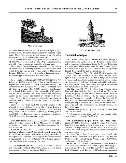
Sector 7. West Coast of Greece and Dhiorix Korinthou (Corinth Canal) 79Akra Oxia Lightand forms the NW entrance point of Patraikos Kolpos. A lightis shown from a prominent structure, 8m high, standing on thispoint. Nisis Oxia appears as two islands from the offingbecause of the low neck lying at its central part.7.15 Akra Evinou, a low and shingle point, is located 18 miles Eof Akra Oxia. Shoals, which are subject to continuous silting,extend S of this point and are marked by a lighted buoy.7.15 The N shore of the gulf between Akra Oxia and the vicinityof Akra Evinou is formed by a chain of low and sandy islandswhich form the seaward side of the extensive MesolongionLagoon. This lagoon is accessible only to boats and vesselsshould not approach the coastal bank in this area.7.16 Limin Mesolongion (38˚22'N., 21˚25'E.) (World PortIndex No. 41800), a small harbor, lies within MesolongionLagoon and is accessible via a narrow entrance channel. Thischannel is marked by lighted beacons and has a dredged depthof 5.5m over a width of 40m (1993). Vessels up to 5.4m draftcan be handled. The harbor can be contacted by VHF; vesselsare advised to ascertain the latest information concerningdepths, as the channel and harbor are subject to frequentsilting. Pilotage is not compulsory, but unlicensed pilots areavailable and are recommended for vessels without localknowledge.7.16 Lighted buoys, which mark the seaward entrance of thechannel, are moored about 0.5 mile SW of Nisos Tourlis, asmall islet, which is connected to the harbor by a causewaylying close E of the channel. A passenger landing pier issituated at Nisos Tourlis and vessels can anchor, in depths of10 to 13m, close S of the entrance channel.7.16 Nisis Ayios Sostis (38˚19'N., 21˚22'E.), low and sandy, lies 2miles W of the entrance to Limin Mesolongion. A light isshown from a prominent structure, 11m high, standing on the Eend of this islet.7.16 Krioneri (38˚21'N., 21˚36'E.), a small town, is situated atthe head of a bight, 6 miles NE of Akra Evinou. It stands at thefoot of Ormos Varasovon, which rises to a height of 914m. Asmall pier, with a depth of 3.7m alongside, fronts the town andis approached via a buoyed channel with a dredged depth of4m. Local knowledge is necessary for entry.7.16 Akra Andirrion (38˚20'N., 21˚46'E.) is located at the NEend of the gulf, 8 miles E of Krioneri. A light is shown from aconspicuous old fortress standing on this low point.Korinthiakos KolposAkra Andirrion Light7.17 Korinthiakos Kolpos is entered from the W through anarrow strait, which is known as The Narrows (Stenon Rion)and is connected to Saronikos Kolpos by Dhiorix Korinthou(Corinth Canal). This canal shortens the route from the E partof Greece to the W part by about 150 miles. The main passagethrough the center of this gulf is clear of dangers.7.17 Winds—Weather.—The NW wind blowing during thesummer raise a considerable sea in the E part of the gulf, but atnight it is usually calm. In the W part of the gulf a NE windprevails, which usually increases in force as the entrance to thegulf is approached. In Krissalos Kolpos and Andikiron Kolpos,it is usually calm during the summer, although a fresh breezemay be blowing in the middle of the gulf.7.17 The Narrows (38˚19'N., 21˚46'E.), lying between AkraRion and Akra Andirrion, has a least depth of 27m in thefairway. At springs, the tidal currents attain a rate of 2 knots inthis strait, but they are influenced by the force and direction ofthe wind. The currents generally set E with the flood and Wwith the ebb. During strong winds, the ebb current flowing outof the gulf may attain rates of 3.5 knots in the center and 5knots at the sides of The Narrows. This current diminishes tothe E of the strait.7.17 Caution.—Ferries frequently cross between the Akra Rionand Akra Andirrion.7.17 A prohibited anchorage area, which may best be seen on thechart, lies in the vicinity of The Narrows.7.18 Korinthiakos Kolpos—South side.—Akra Dhrepanon(38˚20'N., 21˚52'E.), located 3.5 miles NE of AkraRion, is low and sandy. A light is shown from a prominentstructure, 7m high, standing on this point. A shallow spitextends NW from this point; its seaward extremity is markedby a lighted buoy.7.18 A cement factory, fronted by a quay, is situated 0.3 mileSSW of Akra Dhrepanon. This quay is 300m long and hasdepths of 9.8 to 11.6m alongside. Vessels of up to 30,000 tonscan be accommodated alongside.7.18 Aiyion (38˚15'N., 22˚05'E.) (World Port Index No. 41840), asmall town, stands at the head of Ormos Aiyiou, a small bay. Apier and a quay front the town. The pier is 90m long and has adepth of 5m at its head. The quay is 213m long and has depthsPub. 132
- Page 1 and 2:
PUB.132SAILING DIRECTIONS(ENROUTE)
- Page 3 and 4:
Preface0.0 Pub. 132, Sailing Direct
- Page 5 and 6:
ContentsHow to Keep this Book Corre
- Page 7 and 8:
0.0SECTOR LIMITS—PUB. 132Pub. 132
- Page 9:
AbbreviationsThe following abbrevia
- Page 13 and 14:
3SECTOR 1COAST OF LIBYA1.0 Plan.—
- Page 15 and 16:
Sector1.CoastofLibya 51.5 Pilotage.
- Page 17 and 18:
Sector1.CoastofLibya 71.12 Caution.
- Page 19 and 20:
Sector1.CoastofLibya 91.17 Jabal La
- Page 21 and 22:
Sector1.CoastofLibya 111.21 Tukrah
- Page 23:
Sector1.CoastofLibya 131.28 Aspect.
- Page 27 and 28:
17SECTOR 2COAST OF EGYPT2.0 Plan.
- Page 29 and 30:
Sector2.CoastofEgypt 19a depth of 2
- Page 31 and 32:
Sector2.CoastofEgypt 212.10 Several
- Page 33 and 34:
Sector2.CoastofEgypt 232.17 Local v
- Page 35:
Sector2.CoastofEgypt 25high, stands
- Page 39 and 40: 29SECTOR 3COASTS OF ISRAEL, LEBANON
- Page 41 and 42: Sector 3. Coasts of Israel, Lebanon
- Page 43 and 44: Sector 3. Coasts of Israel, Lebanon
- Page 45 and 46: Sector 3. Coasts of Israel, Lebanon
- Page 47 and 48: Sector 3. Coasts of Israel, Lebanon
- Page 49: 4.CyprusPub. 1324.0Additional chart
- Page 52 and 53: 42 Sector4.Cyprusthe village. Ancho
- Page 54 and 55: 44 Sector4.Cyprus4.10 A conspicuous
- Page 56 and 57: 46 Sector4.Cyprus4.18 Kakoskaliou I
- Page 59 and 60: 49SECTOR 5SOUTH COAST OF TURKEY—K
- Page 61 and 62: Sector 5. South Coast of Turkey—K
- Page 63 and 64: Sector 5. South Coast of Turkey—K
- Page 65 and 66: Sector 5. South Coast of Turkey—K
- Page 67: Sector 5. South Coast of Turkey—K
- Page 71 and 72: 61SECTOR 6RODHOS (RHODES), NISOS KA
- Page 73 and 74: Sector 6. Rodhos (Rhodes), Nisos Ka
- Page 75 and 76: Sector 6. Rodhos (Rhodes), Nisos Ka
- Page 77 and 78: Sector 6. Rodhos (Rhodes), Nisos Ka
- Page 79 and 80: Sector 6. Rodhos (Rhodes), Nisos Ka
- Page 81 and 82: Sector 6. Rodhos (Rhodes), Nisos Ka
- Page 83: 7.West Coast of Greece and Dhiorix
- Page 86 and 87: 76 Sector 7. West Coast of Greece a
- Page 90 and 91: 80 Sector 7. West Coast of Greece a
- Page 93: 8.West Coasts of Greece and Albania
- Page 96 and 97: 86 Sector 8. West Coasts of Greece
- Page 98 and 99: 88 Sector 8. West Coasts of Greece
- Page 100 and 101: 90 Sector 8. West Coasts of Greece
- Page 102 and 103: 92 Sector 8. West Coasts of Greece
- Page 105: 9.Coasts of Albania, Montenegro, an
- Page 108 and 109: 98 Sector 9. Coasts of Albania, Mon
- Page 110 and 111: 100 Sector 9. Coasts of Albania, Mo
- Page 112 and 113: 102 Sector 9. Coasts of Albania, Mo
- Page 114 and 115: 104 Sector 9. Coasts of Albania, Mo
- Page 117: 10.Coasts of Croatia and Bosnia-Her
- Page 120 and 121: 110 Sector 10. Coasts of Croatia an
- Page 122 and 123: 112 Sector 10. Coasts of Croatia an
- Page 124 and 125: 114 Sector 10. Coasts of Croatia an
- Page 126 and 127: 116 Sector 10. Coasts of Croatia an
- Page 128 and 129: 118 Sector 10. Coasts of Croatia an
- Page 131 and 132: 121SECTOR 11COAST OF CROATIA—RT M
- Page 133 and 134: Sector 11. Coast of Croatia—Rt Mo
- Page 135 and 136: Sector 11. Coast of Croatia—Rt Mo
- Page 137 and 138: Sector 11. Coast of Croatia—Rt Mo
- Page 139 and 140:
Sector 11. Coast of Croatia—Rt Mo
- Page 141 and 142:
Sector 11. Coast of Croatia—Rt Mo
- Page 143:
Sector 11. Coast of Croatia—Rt Mo
- Page 147 and 148:
137SECTOR 12COAST OF GREECE—AKRA
- Page 149 and 150:
Sector 12. Coast of Greece—Akra T
- Page 151 and 152:
Sector 12. Coast of Greece—Akra T
- Page 153 and 154:
Sector 12. Coast of Greece—Akra T
- Page 155:
13.Coast of Greece—Saronikos Kolp
- Page 158 and 159:
148 Sector 13. Coast of Greece—Sa
- Page 160 and 161:
150 Sector 13. Coast of Greece—Sa
- Page 162 and 163:
152 Sector 13. Coast of Greece—Sa
- Page 164 and 165:
154 Sector 13. Coast of Greece—Sa
- Page 167:
14.Greece—Kikladhes Nisoi15714.0A
- Page 170 and 171:
160 Sector14.Greece—KikladhesNiso
- Page 172 and 173:
162 Sector14.Greece—KikladhesNiso
- Page 174 and 175:
164 Sector14.Greece—KikladhesNiso
- Page 176 and 177:
166 Sector14.Greece—KikladhesNiso
- Page 178 and 179:
168 Sector14.Greece—KikladhesNiso
- Page 181:
15.Greece—Channels West of Nisos
- Page 184 and 185:
174 Sector 15. Greece—Channels We
- Page 186 and 187:
176 Sector 15. Greece—Channels We
- Page 188 and 189:
178 Sector 15. Greece—Channels We
- Page 191:
16.Greece—Nisoi Vorioi Sporadhes
- Page 194 and 195:
184 Sector 16. Greece—Nisoi Vorio
- Page 196 and 197:
186 Sector 16. Greece—Nisoi Vorio
- Page 199:
17.Coast of Greece—Thermaikos Kol
- Page 202 and 203:
192 Sector 17. Coast of Greece—Th
- Page 204 and 205:
194 Sector 17. Coast of Greece—Th
- Page 206 and 207:
196 Sector 17. Coast of Greece—Th
- Page 209:
18.Greece—Dhodhekanisos and South
- Page 212 and 213:
202 Sector 18. Greece—Dhodhekanis
- Page 214 and 215:
204 Sector 18. Greece—Dhodhekanis
- Page 216 and 217:
206 Sector 18. Greece—Dhodhekanis
- Page 219:
19.West Coast of Turkey—Samos Str
- Page 222 and 223:
212 Sector 19. West Coast of Turkey
- Page 224 and 225:
214 Sector 19. West Coast of Turkey
- Page 226 and 227:
216 Sector 19. West Coast of Turkey
- Page 229:
20.The Dardanelles Approach and Adj
- Page 232 and 233:
222 Sector 20. The Dardanelles Appr
- Page 234 and 235:
224 Sector 20. The Dardanelles Appr
- Page 236 and 237:
226 Sector 20. The Dardanelles Appr
- Page 238 and 239:
228 Sector 20. The Dardanelles Appr
- Page 240 and 241:
230 GlossariesArabicARABICEnglishAR
- Page 242 and 243:
232 GlossariesARABICEnglishARABICEn
- Page 244 and 245:
234 GlossariesHebrewHEBREWEnglishHE
- Page 246 and 247:
236 GlossariesTURKISHEnglishTURKISH
- Page 249 and 250:
How to use the Index—Gazetteer239
- Page 251 and 252:
Index—Gazetteer 241PositionSec.˚
- Page 253 and 254:
Index—Gazetteer 243PositionSec.˚
- Page 255 and 256:
Index—Gazetteer 245PositionSec.˚
- Page 257 and 258:
Index—Gazetteer 247PositionSec.˚