130 Sector 11. Coast of Croatia—Rt Movar to Rt Marlera11.33 The Adriatic Highway follows the mainland coast, closeinland, along the E side of the channel and is conspicuous inplaces.11.33 Rt Silo (45˚09'N., 14˚40'E.), marked by a light, is located onthe W side of the channel and is fringed by shoals. This point isthe termination of a narrow and low tongue of land whichprojects from the E side of Otok Krk. Plic Konjska, with adepth of 4.4m, lies about 0.5 mile SE of the point.11.33 Zaliv Soline, a nearly land-locked small bay, lies 1.5 milesWNW of Rt Silo and is entered through a narrow channel.Although there are depths of 10 to 12m over a width of 100min the entrance, the bay has depths of only 2 to 4m and is usedmostly by small craft.Tihi Kanal (45˚13'N., 14˚37'E.), 3 miles long, connects theNW end of Vinodolski Kanal to Rijecki Zaliv. The channel isdeep and tortuous and leads between the mainland and the NEend of Otok Krk. Otocic Sveti Marko, barren and light-colored,lies close off the N extremity of Otok Krk and divides the Npart of the fairway into two passages. The main passage leadsNE of the island and is 0.2 mile wide. During strong gales, thecurrent in this channel may attain a rate of 3 knots. The passageleading SW of the island is suitable only for small craft. A lightis shown from the NE side of Otocic Sveti Marko.11.33 A road bridge spans the two passages of Tihi Kanal at the Send of Otocic Sveti Marko. The W passage has a verticalclearance of 50m and the E passage, under the center span, hasa vertical clearance of 60m.11.33 Southbound vessels using Tihi Kanal are generally given theright of way. Approval to transit Tihi Kanal must be obtainedfrom the Rijeka port authority.Kvarner and Approaches11.34 Otok Susak (44˚31'N., 14˚18'E.), the S and outerisland in the approaches to Kvarner, is bold and mostly flat. Itsextremities are fronted by shallow banks. A main light isshown from a prominent structure, 12m high, surmounting thesummit which rises near the center of the island. The village ofSusak, with a prominent belfry, is situated in a cove at the NEside of the island.11.34 Otok Unije (44˚38'N., 14˚15'E.), a long and irregular shapedisland, lies with Rt Vnetak, its SW extremity, located 7 milesNNW of Otok Susak. The island consists of a chain of partlywooded hills and the summit, 132m high, stands in the SE part.The shores are rocky in places and indented, especially alongthe E side. A reef, marked by a beacon, extends up to 0.3 mileS from Rt Arbit, the S extremity of the island. Rt Lokunji, theN extremity of the island, is marked by a light. The village ofUnjie, with a prominent church, stands at the head of a smallbay near the center of the W side of the island. It is fronted by asmall craft harbor used by local ferries. Vessels can anchor inthe bay, in depths of 20 to 25m, mud, about 0.6 mile offshore.Local knowledge is advised.11.34 Otococi Srakane, consisting of two narrow islets, extends upto 3.7 miles SE of the SE extremity of Otok Unije. These isletsare partly wooded and steep-to. Hrid Silo lies close SE of theSE islet. A light is shown from a prominent structure, 10mhigh, standing on this rock.11.34 Unijski Kanal (44˚37'N., 14˚20'E.) leads between OtokUnije and Otococi Srakane, at the W side, and Otok Losinj, atthe E side. This passage is partially landlocked and affordsgood shelter for a large number of vessels. It is reported to be arefuge for fishing vessels. Anchorage can be taken nearlyanywhere, according to draft and shelter required, but thebottom close to the shore of Otok Losinj is reported to berocky. The currents in the channel are tidal and are affected bythe winds. The flood current is reported to sometimes attain arate up to 2.5 knots.11.34 Hrid Galiola (44˚44'N., 14˚11'E.), a low and rocky islet, lieson a reef 5 miles WNW of the N extremity of Otok Unijski. Amain light is shown from a conspicuous structure, 19m high,standing on this islet at the E side of the entrance to Kvarner.Hrid Galiola Light11.35 Otocic Zeca (44˚46'N., 14˚19'E.), a light-coloredislet, lies at the E side of the channel 1.5 miles off the W coastof Otok Cres. The summit of the islet, 65m high, rises near itsS end and is surmounted by a pyramid topped with a globe anda staff. A light is shown from a tower, 8m high, standing at theSW side of the island.11.35 Rt Pernat (44˚57'N., 14˚19'E.), a conspicuous and steep-topoint, is located on the W coast of Otok Cres 10 miles N ofOtocic Zeca. Brdo Helm, 482m high, rises 5.5 miles SSE of thepoint and is prominent.11.35 Hrid Zaglav, marked by a light, is located at the E side of thechannel. This rock lies on a shoal about 0.6 mile offshore 2miles SSW of Rt Pernat.11.36 Rt Crna Punta (44˚57'N., 14˚09'E.) is located on theW side of Kvarner 7.2 miles W of Rt Pernat. This point is darkcolored,steep-to, and thickly wooded. It rises to Vrh Brdowhich stands 1.5 miles NNW and is surmounted by a stonepyramid. A light is shown from a prominent structure, 7mhigh, standing on the point and a stone monument is situated0.3 mile NW of the light.11.36 The coast to the S of Rt Crna Punta is described beginning inparagraph 11.43.11.36 Vrh Ucka (45˚17'N., 14˚12'E.), double-peaked, rises 3 milesinland 20 miles N of Rt Crna Punta. This mountain is 1,401mhigh and is surmounted by a television mast. It is veryconspicuous from all parts of Kvarner.11.36 Rt Sveti Andrija (45˚04'N., 14˚10'E.), marked by a light, islocated 7 miles N of Rt Crna Punta and several prominenthotels are situated to the NE of it. Luka Rabac, a shelteredinlet, is entered SW of this point and the small resort town ofPub. 132
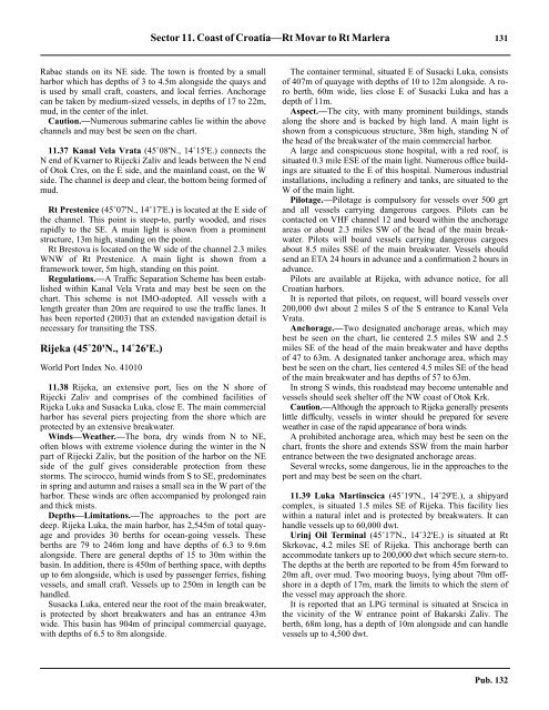
Sector 11. Coast of Croatia—Rt Movar to Rt Marlera 131Rabac stands on its NE side. The town is fronted by a smallharbor which has depths of 3 to 4.5m alongside the quays andis used by small craft, coasters, and local ferries. Anchoragecan be taken by medium-sized vessels, in depths of 17 to 22m,mud, in the center of the inlet.11.36 Caution.—Numerous submarine cables lie within the abovechannels and may best be seen on the chart.11.37 Kanal Vela Vrata (45˚08'N., 14˚15'E.) connects theN end of Kvarner to Rijecki Zaliv and leads between the N endof Otok Cres, on the E side, and the mainland coast, on the Wside. The channel is deep and clear, the bottom being formed ofmud.11.37 Rt Prestenice (45˚07'N., 14˚17'E.) is located at the E side ofthe channel. This point is steep-to, partly wooded, and risesrapidly to the SE. A main light is shown from a prominentstructure, 13m high, standing on the point.11.37 Rt Brestova is located on the W side of the channel 2.3 milesWNW of Rt Prestenice. A main light is shown from aframework tower, 5m high, standing on this point.11.37 Regulations.—A Traffic Separation Scheme has been establishedwithin Kanal Vela Vrata and may best be seen on thechart. This scheme is not IMO-adopted. All vessels with alength greater than 20m are required to use the traffic lanes. Ithas been reported (2003) that an extended navigation detail isnecessary for transiting the TSS.Rijeka (45˚20'N., 14˚26'E.)World Port Index No. 4101011.38 Rijeka, an extensive port, lies on the N shore ofRijecki Zaliv and comprises of the combined facilities ofRijeka Luka and Susacka Luka, close E. The main commercialharbor has several piers projecting from the shore which areprotected by an extensive breakwater.11.38 Winds—Weather.—The bora, dry winds from N to NE,often blows with extreme violence during the winter in the Npart of Rijecki Zaliv, but the position of the harbor on the NEside of the gulf gives considerable protection from thesestorms. The scirocco, humid winds from S to SE, predominatesin spring and autumn and raises a small sea in the W part of theharbor. These winds are often accompanied by prolonged rainand thick mists.11.38 Depths—Limitations.—The approaches to the port aredeep. Rijeka Luka, the main harbor, has 2,545m of total quayageand provides 30 berths for ocean-going vessels. Theseberths are 79 to 246m long and have depths of 6.3 to 9.6malongside. There are general depths of 15 to 30m within thebasin. In addition, there is 450m of berthing space, with depthsup to 6m alongside, which is used by passenger ferries, fishingvessels, and small craft. Vessels up to 250m in length can behandled.11.38 Susacka Luka, entered near the root of the main breakwater,is protected by short breakwaters and has an entrance 43mwide. This basin has 904m of principal commercial quayage,with depths of 6.5 to 8m alongside.11.38 The container terminal, situated E of Susacki Luka, consistsof 407m of quayage with depths of 10 to 12m alongside. A roroberth, 60m wide, lies close E of Susacki Luka and has adepth of 11m.11.38 Aspect.—The city, with many prominent buildings, standsalong the shore and is backed by high land. A main light isshown from a conspicuous structure, 38m high, standing N ofthe head of the breakwater of the main commercial harbor.11.38 A large and conspicuous stone hospital, with a red roof, issituated 0.3 mile ESE of the main light. Numerous office buildingsare situated to the E of this hospital. Numerous industrialinstallations, including a refinery and tanks, are situated to theW of the main light.11.38 Pilotage.—Pilotage is compulsory for vessels over 500 grtand all vessels carrying dangerous cargoes. Pilots can becontacted on VHF channel 12 and board within the anchorageareas or about 2.3 miles SW of the head of the main breakwater.Pilots will board vessels carrying dangerous cargoesabout 8.5 miles SSE of the main breakwater. Vessels shouldsend an ETA 24 hours in advance and a confirmation 2 hours inadvance.11.38 Pilots are available at Rijeka, with advance notice, for allCroatian harbors.11.38 It is reported that pilots, on request, will board vessels over200,000 dwt about 2 miles S of the S entrance to Kanal VelaVrata.11.38 Anchorage.—Two designated anchorage areas, which maybest be seen on the chart, lie centered 2.5 miles SW and 2.5miles SE of the head of the main breakwater and have depthsof 47 to 63m. A designated tanker anchorage area, which maybest be seen on the chart, lies centered 4.5 miles SE of the headof the main breakwater and has depths of 57 to 63m.11.38 In strong S winds, this roadstead may become untenable andvessels should seek shelter off the NW coast of Otok Krk.11.38 Caution.—Although the approach to Rijeka generally presentslittle difficulty, vessels in winter should be prepared for severeweather in case of the rapid appearance of bora winds.11.38 A prohibited anchorage area, which may best be seen on thechart, fronts the shore and extends SSW from the main harborentrance between the two designated anchorage areas.11.38 Several wrecks, some dangerous, lie in the approaches to theport and may best be seen on the chart.11.3811.39 Luka Martinscica (45˚19'N., 14˚29'E.), a shipyardcomplex, is situated 1.5 miles SE of Rijeka. This facility lieswithin a natural inlet and is protected by breakwaters. It canhandle vessels up to 60,000 dwt.11.39 Urinj Oil Terminal (45˚17'N., 14˚32'E.) is situated at RtSkrkovac, 4.2 miles SE of Rijeka. This anchorage berth canaccommodate tankers up to 200,000 dwt which secure stern-to.The depths at the berth are reported to be from 45m forward to20m aft, over mud. Two mooring buoys, lying about 70m offshorein a depth of 17m, mark the limits to which the stern ofthe vessel may approach the shore.11.39 It is reported that an LPG terminal is situated at Srscica inthe vicinity of the W entrance point of Bakarski Zaliv. Theberth, 68m long, has a depth of 10m alongside and can handlevessels up to 4,500 dwt.Pub. 132
- Page 1 and 2:
PUB.132SAILING DIRECTIONS(ENROUTE)
- Page 3 and 4:
Preface0.0 Pub. 132, Sailing Direct
- Page 5 and 6:
ContentsHow to Keep this Book Corre
- Page 7 and 8:
0.0SECTOR LIMITS—PUB. 132Pub. 132
- Page 9:
AbbreviationsThe following abbrevia
- Page 13 and 14:
3SECTOR 1COAST OF LIBYA1.0 Plan.—
- Page 15 and 16:
Sector1.CoastofLibya 51.5 Pilotage.
- Page 17 and 18:
Sector1.CoastofLibya 71.12 Caution.
- Page 19 and 20:
Sector1.CoastofLibya 91.17 Jabal La
- Page 21 and 22:
Sector1.CoastofLibya 111.21 Tukrah
- Page 23:
Sector1.CoastofLibya 131.28 Aspect.
- Page 27 and 28:
17SECTOR 2COAST OF EGYPT2.0 Plan.
- Page 29 and 30:
Sector2.CoastofEgypt 19a depth of 2
- Page 31 and 32:
Sector2.CoastofEgypt 212.10 Several
- Page 33 and 34:
Sector2.CoastofEgypt 232.17 Local v
- Page 35:
Sector2.CoastofEgypt 25high, stands
- Page 39 and 40:
29SECTOR 3COASTS OF ISRAEL, LEBANON
- Page 41 and 42:
Sector 3. Coasts of Israel, Lebanon
- Page 43 and 44:
Sector 3. Coasts of Israel, Lebanon
- Page 45 and 46:
Sector 3. Coasts of Israel, Lebanon
- Page 47 and 48:
Sector 3. Coasts of Israel, Lebanon
- Page 49:
4.CyprusPub. 1324.0Additional chart
- Page 52 and 53:
42 Sector4.Cyprusthe village. Ancho
- Page 54 and 55:
44 Sector4.Cyprus4.10 A conspicuous
- Page 56 and 57:
46 Sector4.Cyprus4.18 Kakoskaliou I
- Page 59 and 60:
49SECTOR 5SOUTH COAST OF TURKEY—K
- Page 61 and 62:
Sector 5. South Coast of Turkey—K
- Page 63 and 64:
Sector 5. South Coast of Turkey—K
- Page 65 and 66:
Sector 5. South Coast of Turkey—K
- Page 67:
Sector 5. South Coast of Turkey—K
- Page 71 and 72:
61SECTOR 6RODHOS (RHODES), NISOS KA
- Page 73 and 74:
Sector 6. Rodhos (Rhodes), Nisos Ka
- Page 75 and 76:
Sector 6. Rodhos (Rhodes), Nisos Ka
- Page 77 and 78:
Sector 6. Rodhos (Rhodes), Nisos Ka
- Page 79 and 80:
Sector 6. Rodhos (Rhodes), Nisos Ka
- Page 81 and 82:
Sector 6. Rodhos (Rhodes), Nisos Ka
- Page 83:
7.West Coast of Greece and Dhiorix
- Page 86 and 87:
76 Sector 7. West Coast of Greece a
- Page 88 and 89:
78 Sector 7. West Coast of Greece a
- Page 90 and 91: 80 Sector 7. West Coast of Greece a
- Page 93: 8.West Coasts of Greece and Albania
- Page 96 and 97: 86 Sector 8. West Coasts of Greece
- Page 98 and 99: 88 Sector 8. West Coasts of Greece
- Page 100 and 101: 90 Sector 8. West Coasts of Greece
- Page 102 and 103: 92 Sector 8. West Coasts of Greece
- Page 105: 9.Coasts of Albania, Montenegro, an
- Page 108 and 109: 98 Sector 9. Coasts of Albania, Mon
- Page 110 and 111: 100 Sector 9. Coasts of Albania, Mo
- Page 112 and 113: 102 Sector 9. Coasts of Albania, Mo
- Page 114 and 115: 104 Sector 9. Coasts of Albania, Mo
- Page 117: 10.Coasts of Croatia and Bosnia-Her
- Page 120 and 121: 110 Sector 10. Coasts of Croatia an
- Page 122 and 123: 112 Sector 10. Coasts of Croatia an
- Page 124 and 125: 114 Sector 10. Coasts of Croatia an
- Page 126 and 127: 116 Sector 10. Coasts of Croatia an
- Page 128 and 129: 118 Sector 10. Coasts of Croatia an
- Page 131 and 132: 121SECTOR 11COAST OF CROATIA—RT M
- Page 133 and 134: Sector 11. Coast of Croatia—Rt Mo
- Page 135 and 136: Sector 11. Coast of Croatia—Rt Mo
- Page 137 and 138: Sector 11. Coast of Croatia—Rt Mo
- Page 139: Sector 11. Coast of Croatia—Rt Mo
- Page 143: Sector 11. Coast of Croatia—Rt Mo
- Page 147 and 148: 137SECTOR 12COAST OF GREECE—AKRA
- Page 149 and 150: Sector 12. Coast of Greece—Akra T
- Page 151 and 152: Sector 12. Coast of Greece—Akra T
- Page 153 and 154: Sector 12. Coast of Greece—Akra T
- Page 155: 13.Coast of Greece—Saronikos Kolp
- Page 158 and 159: 148 Sector 13. Coast of Greece—Sa
- Page 160 and 161: 150 Sector 13. Coast of Greece—Sa
- Page 162 and 163: 152 Sector 13. Coast of Greece—Sa
- Page 164 and 165: 154 Sector 13. Coast of Greece—Sa
- Page 167: 14.Greece—Kikladhes Nisoi15714.0A
- Page 170 and 171: 160 Sector14.Greece—KikladhesNiso
- Page 172 and 173: 162 Sector14.Greece—KikladhesNiso
- Page 174 and 175: 164 Sector14.Greece—KikladhesNiso
- Page 176 and 177: 166 Sector14.Greece—KikladhesNiso
- Page 178 and 179: 168 Sector14.Greece—KikladhesNiso
- Page 181: 15.Greece—Channels West of Nisos
- Page 184 and 185: 174 Sector 15. Greece—Channels We
- Page 186 and 187: 176 Sector 15. Greece—Channels We
- Page 188 and 189: 178 Sector 15. Greece—Channels We
- Page 191:
16.Greece—Nisoi Vorioi Sporadhes
- Page 194 and 195:
184 Sector 16. Greece—Nisoi Vorio
- Page 196 and 197:
186 Sector 16. Greece—Nisoi Vorio
- Page 199:
17.Coast of Greece—Thermaikos Kol
- Page 202 and 203:
192 Sector 17. Coast of Greece—Th
- Page 204 and 205:
194 Sector 17. Coast of Greece—Th
- Page 206 and 207:
196 Sector 17. Coast of Greece—Th
- Page 209:
18.Greece—Dhodhekanisos and South
- Page 212 and 213:
202 Sector 18. Greece—Dhodhekanis
- Page 214 and 215:
204 Sector 18. Greece—Dhodhekanis
- Page 216 and 217:
206 Sector 18. Greece—Dhodhekanis
- Page 219:
19.West Coast of Turkey—Samos Str
- Page 222 and 223:
212 Sector 19. West Coast of Turkey
- Page 224 and 225:
214 Sector 19. West Coast of Turkey
- Page 226 and 227:
216 Sector 19. West Coast of Turkey
- Page 229:
20.The Dardanelles Approach and Adj
- Page 232 and 233:
222 Sector 20. The Dardanelles Appr
- Page 234 and 235:
224 Sector 20. The Dardanelles Appr
- Page 236 and 237:
226 Sector 20. The Dardanelles Appr
- Page 238 and 239:
228 Sector 20. The Dardanelles Appr
- Page 240 and 241:
230 GlossariesArabicARABICEnglishAR
- Page 242 and 243:
232 GlossariesARABICEnglishARABICEn
- Page 244 and 245:
234 GlossariesHebrewHEBREWEnglishHE
- Page 246 and 247:
236 GlossariesTURKISHEnglishTURKISH
- Page 249 and 250:
How to use the Index—Gazetteer239
- Page 251 and 252:
Index—Gazetteer 241PositionSec.˚
- Page 253 and 254:
Index—Gazetteer 243PositionSec.˚
- Page 255 and 256:
Index—Gazetteer 245PositionSec.˚
- Page 257 and 258:
Index—Gazetteer 247PositionSec.˚