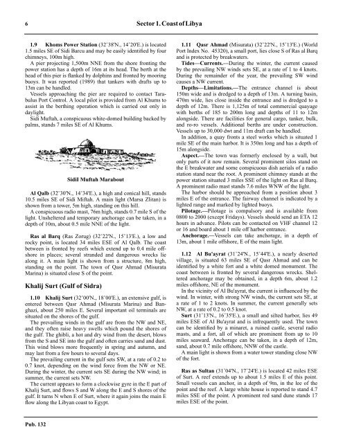
6 Sector 1.CoastofLibya1.9 Khoms Power Station (32˚38'N., 14˚20'E.) is located1.5 miles SE of Sidi Barcu and may be easily identified by fourchimneys, 100m high.1.9 A pier projecting 1,500m NNE from the shore fronting thepower station has a depth of 16m at its head. The berth at thehead of this pier is flanked by dolphins and fronted by mooringbuoys. It was reported (1989) that tankers with drafts up to13m can be handled.1.9 Vessels approaching the pier are required to contact TarabulusPort Control. A local pilot is provided from Al Khums toassist in the berthing operation which is carried out only indaylight.1.9 Sidi Muftah, a conspicuous white-domed building backed bypalms, stands 7 miles SE of Al Khums.SidiI Muftah Marabout1.9 Al Qalb (32˚30'N., 14˚34'E.), a high and conical hill, stands10.5 miles SE of Sidi Miftah. A main light (Marsa Zlitan) isshown from a tower, 5m high, standing on this hill.1.9 A conspicuous radio mast, 76m high, stands 0.7 mile S of thelight. Unsheltered and temporary anchorage can be taken, in adepth of 10m, about 0.5 mile NNE of the light.1.9 Ras al Barq (Ras Zorug) (32˚22'N., 15˚13'E.), a low androcky point, is located 34 miles ESE of Al Qalb. The coastbetween is fronted by reefs which extend up to 0.4 mile offshorein places; several stranded and dangerous wrecks liealong it. A main light is shown from a structure, 8m high,standing on the point. The town of Qasr Ahmad (MisurataMarina) is situated close S of the point.Khalij Surt (Gulf of Sidra)1.10 Khalij Surt (32˚00'N., 18˚00'E.), an extensive gulf, isentered between Qasr Ahmad (Misurata Marina) and Banghazi,about 250 miles E. Several important oil terminals aresituated on the shores of the gulf.1.10 The prevailing winds in the gulf are from the NW and NE,and they often raise heavy swells which pound the shores ofthe gulf. The ghibli, a hot and dry wind from the desert, blowsfrom the S and SE into the gulf and often carries sand and dust.This wind blows more frequently in spring and autumn, andmay last from a few hours to several days.1.10 The prevailing current in the gulf sets SW, at a rate of 0.2 to0.7 knot, depending on the wind force from the NW or NE.During the winter, the current sets SE during the NW wind; insummer, the current sets NW.1.10 The current appears to form a clockwise gyre in the E part ofKhalij Surt, and flows S and W along the E and S shores of thegulf. It turns N when E of Surt, where it again joins the main Eflow along the Libyan coast to Egypt.1.11 Qasr Ahmad (Misurata) (32˚22'N., 15˚13'E.) (WorldPort Index No. 45320), a small port, lies close S of Ras al Barqand is protected by breakwaters.1.11 Tides—Currents.—During the winter, the current causedby the prevailing NW winds sets SE, at a rate of 1 to 4 knots.During the remainder of the year, the prevailing SW windcauses a NW current.1.11 Depths—Limitations.—The entrance channel is about150m wide and is dredged to a depth of 13m. A turning basin,470m wide, lies close inside the entrance and is dredged to adepth of 12m. There is 1,125m of total commercial quayagewith berths of 185 to 200m long and depths of 11 to 12malongside. There are facilities for general cargo, tanker, bulk,and ro-ro vessels. Additional berths are under construction.Vessels up to 30,000 dwt and 11m draft can be handled.1.11 In addition, a quay fronts a steel works which is situated 1mile SE of the main harbor. It is 350m long and has a depth of15m alongside.1.11 Aspect.—The town was formerly enclosed by a wall, butonly parts of it now remain. Several prominent silos stand onthe E breakwater and some conspicuous dish aerials of a radiostation stand near the root. A prominent chimney stands at thepower station situated 3 miles SSE of the light on Ras al Barq.A prominent radio mast stands 7.6 miles WNW of the light.1.11 The harbor should be approached from a position about 3miles E of the entrance. The fairway channel is indicated by alighted range and marked by lighted buoys.1.11 Pilotage.—Pilotage is compulsory and is available from0800 to 2000 (except Fridays). Vessels should send an ETA 12hours in advance. Pilots can be contacted on VHF channel 12or 16 and board about 1 mile off harbor entrance.1.11 Anchorage.—Vessels can take anchorage, in a depth of13m, about 1 mile offshore, E of the main light.1.12 Al Bu'ayrat (31˚24'N., 15˚44'E.), a nearly desertedvillage, is situated 63 miles SE of Qasr Ahmad and can beidentified by a white fort and a white domed monument. Thecoast between is fronted by several dangerous wrecks. Shelteredanchorage may be obtained, in a depth 6m, about 1.2miles offshore, NE of the monument.1.12 In the vicinity of Al Bu'ayrat, the current is influenced by thewind. In winter, with strong NW winds, the current sets SE, ata rate of 1 to 2 knots. In summer, the current generally setsNW, at a rate of 0.2 to 0.5 knot.1.12 Surt (31˚13'N., 16˚35'E.), a small and silted harbor, lies 49miles ESE of Al Bu'ayrat and is infrequently used. The towncan be identified by a minaret, a ruined castle, several radiomasts, and a fort, all of which are prominent from up to 10miles seaward. Anchorage can be taken, in a depth of 12m,sand, about 0.7 mile offshore, NNW of the castle.1.12 A main light is shown from a water tower standing close NWof the fort.1.12 Ras as Sultan (31˚04'N., 17˚24'E.) is located 42 miles ESEof Surt. A reef extends up to about 1.5 miles E of this point.Small vessels can anchor, in a depth of 9m, in the lee of thepoint and the reef. A large white house is reported to stand 4.7miles SSE of the point. A prominent red sand dune stands 17miles ESE of the point.Pub. 132
Sector1.CoastofLibya 71.12 Caution.—Numerous oil rigs, platforms, and associated servicevessels may be encountered within about 23 miles of thecoast between Ras es Sultan and As Sidr (Es Sider), 57 milesESE.1.121.12 Jabal al Mudawwar (30˚50'N., 17˚43'E.), 121m high, is aflat-topped mountain which is conspicuous from seaward.1.12 Ras al 'Uwayja (30˚55'N., 17˚52'E.) is a high, rocky, andprominent cape. A reef, with a least depth of 2.7m, extends 3.2miles ESE from this cape. Anchorage can be taken, in depthsof 9 to 14m, within the bight entered close SE of the cape.Local knowledge is required.As Sidr (30˚38'N., 18˚22'E.)World Port Index No. 452971.13 As Sidr is an open roadstead with an offshore marineoil terminal. Several buildings and a pumping station are situatednear the shore and are fronted by a boat harbor which isused by terminal officials.1.13 Tides—Currents.—Tides are negligible, being only 0.3m atsprings.1.13 The currents are wind induced and are predominantly fromthe SE with occasional maximum rates of up to 2 knots.1.13 Depths—Limitations.—There are four offshore loadingterminals which are connected to the pumping station by submarinepipelines. No. 1 Berth and No. 3 Berth consist ofseveral mooring buoys. No. 4 Berth and No. 5 Berth consist ofan SBM.1.13 No. 1 Berth lies 1.8 miles NE of the pumping station and canhandle vessels up to 281m in length and 15.54m draft.1.13 No. 3 Berth lies 1.8 miles NNE of the pumping station andcan handle vessels up to 290m in length and 15.54m draft.1.13 No. 4 Berth lies 2.5 miles NNE of the pumping station andcan handle vessels up to 351m in length and 19.05m draft.1.13 No. 5 Berth lies 4 miles NE of the pumping station and canhandle vessels up to 355m in length and 22.25m draft.1.13 Aspect.—A conspicuous water tower, 20m high, and a conspicuousradio tower stand in the vicinity of the pumpingstation.1.13 An aeronautical radiobeacon is situated 0.4 mile SSE of thewater tower; a conspicuous group of oil tanks stands 3.6 milesWSW of the water tank; and a prominent radio mast, 50m high,stands 0.3 mile NW of the oil tanks.1.13 The offshore berths are marked by lighted buoys; theapproach is indicated by a lighted range, which may best beseen on the chart.1.13 Pilotage.—Pilotage is compulsory. Pilots can be contactedon VHF channel 8 or 16 and board about 4 miles NNE of theterminal. Vessels should send an ETA 72 hours, 24 hours, 12hours, and 4 hours in advance.1.13 It is reported that Mooring Masters board vessels in thevicinity of the anchorage area and remain on board until thevessels depart the loading berths. They advise vessels regardingcommunications, mooring, unmooring, connecting hoses,disconnecting hoses, and all other relevant operations.1.13 Anchorage.—The recommended anchorage area, whichmay best be seen on the chart, lies centered 4.5 miles NNE ofthe conspicuous water tower and has depths of 27 to 33m,sand. A continuous listening watch is required on VHF channels8 and 16 while at anchor.1.13 Caution.—Vessels approaching the anchorage area from theN or NW should disregard the terminal ranges and mooringbuoy marker lights which are shown intermittently and are onlyfor the use of the mooring masters.1.13 VLCCs are not berthed at night.1.13 An anchorage prohibited area lies in the vicinity of theterminals and may best be seen on the chart.1.13 The approaches to the terminal offshore berths are clear ofknown dangers; however, rigs, platforms, and vessels involvedin oil and gas drilling operations may be encountered up toseveral miles offshore between this terminal and Marsa alBurayqah (Marsa el Brega), 64 miles ESE.Ras Lanuf (30˚31'N., 18˚34'E.)World Port Index No. 452961.14 Ras Lanuf, a low and sandy point, is located 13 milesSE of As Sidr and is fronted by an offshore oil terminal. Inaddition, a harbor, which is protected by breakwaters, lieswithin the point and provides alongside gas and oil loadingfacilities.1.14 Tides—Currents.—Tides are negligible, being only 0.3m atsprings.1.14 The currents are wind induced and are predominantly fromthe SE with occasional maximum rates of up to 2 knots.1.14 Depths—Limitations.—The harbor approach channel isdredged to a depth of 15.5m. Three finger jetties are situated inthe harbor and provide six oil berths with depths of 11.5 to14m alongside. Vessels up to 50,000 dwt, 250m in length, and12.5m draft can be accommodated. In addition, there is a cargoquay, 177m long, which has a depth of 11m alongside. Vesselsup 20,000 dwt, 177m in length, and 9.5m draft can be accommodated.1.14 The offshore terminal consists of four berths, each connected tothe shore by a submarine pipeline. No. 1 Berth and No. 2 Berthconsist of several mooring buoys. No. 3 Berth and No. 4 Berthconsist of an SBM.1.14 No. 1 Berth and No. 2 Berth have depths of 21 to 27m andcan handle vessels up to 130,000 dwt.1.14 No. 3 Berth lies in a depth of 30m and can handle vessels upto 300,000 dwt.1.14 No. 4 Berth lies in a depth of 30m and can handle vessels upto 255,000 dwt and 29m draft.1.14 Aspect.—A conspicuous water tower, from which a light isshown, stands 1.5 miles W of Ras Lanuf. Several oil tanks aresituated 4 miles SW of the water tower and are prominent fromseaward. Marble Arch, a prominent monument, spans thecoastal highway, 3.5 miles S of Ras Lanuf.1.14 An outer lighted buoy, moored about 1.7 miles E of the headof the N breakwater, marks the seaward entrance of the harborapproach channel. A lighted range, which may best be seen onthe chart, indicates the fairway leading through the harbor entrance.An outer lighted buoy, moored 3 miles N of Ras Lanuf,marks the approach to the offshore terminal.1.14 Pilotage.—Pilotage is compulsory. Vessels should send anETA 72 hours, 24 hours, and 12 hours in advance with a confirmationmessage 4 hours before arrival. Vessels should alsoPub. 132
- Page 1 and 2: PUB.132SAILING DIRECTIONS(ENROUTE)
- Page 3 and 4: Preface0.0 Pub. 132, Sailing Direct
- Page 5 and 6: ContentsHow to Keep this Book Corre
- Page 7 and 8: 0.0SECTOR LIMITS—PUB. 132Pub. 132
- Page 9: AbbreviationsThe following abbrevia
- Page 13 and 14: 3SECTOR 1COAST OF LIBYA1.0 Plan.—
- Page 15: Sector1.CoastofLibya 51.5 Pilotage.
- Page 19 and 20: Sector1.CoastofLibya 91.17 Jabal La
- Page 21 and 22: Sector1.CoastofLibya 111.21 Tukrah
- Page 23: Sector1.CoastofLibya 131.28 Aspect.
- Page 27 and 28: 17SECTOR 2COAST OF EGYPT2.0 Plan.
- Page 29 and 30: Sector2.CoastofEgypt 19a depth of 2
- Page 31 and 32: Sector2.CoastofEgypt 212.10 Several
- Page 33 and 34: Sector2.CoastofEgypt 232.17 Local v
- Page 35: Sector2.CoastofEgypt 25high, stands
- Page 39 and 40: 29SECTOR 3COASTS OF ISRAEL, LEBANON
- Page 41 and 42: Sector 3. Coasts of Israel, Lebanon
- Page 43 and 44: Sector 3. Coasts of Israel, Lebanon
- Page 45 and 46: Sector 3. Coasts of Israel, Lebanon
- Page 47 and 48: Sector 3. Coasts of Israel, Lebanon
- Page 49: 4.CyprusPub. 1324.0Additional chart
- Page 52 and 53: 42 Sector4.Cyprusthe village. Ancho
- Page 54 and 55: 44 Sector4.Cyprus4.10 A conspicuous
- Page 56 and 57: 46 Sector4.Cyprus4.18 Kakoskaliou I
- Page 59 and 60: 49SECTOR 5SOUTH COAST OF TURKEY—K
- Page 61 and 62: Sector 5. South Coast of Turkey—K
- Page 63 and 64: Sector 5. South Coast of Turkey—K
- Page 65 and 66: Sector 5. South Coast of Turkey—K
- Page 67:
Sector 5. South Coast of Turkey—K
- Page 71 and 72:
61SECTOR 6RODHOS (RHODES), NISOS KA
- Page 73 and 74:
Sector 6. Rodhos (Rhodes), Nisos Ka
- Page 75 and 76:
Sector 6. Rodhos (Rhodes), Nisos Ka
- Page 77 and 78:
Sector 6. Rodhos (Rhodes), Nisos Ka
- Page 79 and 80:
Sector 6. Rodhos (Rhodes), Nisos Ka
- Page 81 and 82:
Sector 6. Rodhos (Rhodes), Nisos Ka
- Page 83:
7.West Coast of Greece and Dhiorix
- Page 86 and 87:
76 Sector 7. West Coast of Greece a
- Page 88 and 89:
78 Sector 7. West Coast of Greece a
- Page 90 and 91:
80 Sector 7. West Coast of Greece a
- Page 93:
8.West Coasts of Greece and Albania
- Page 96 and 97:
86 Sector 8. West Coasts of Greece
- Page 98 and 99:
88 Sector 8. West Coasts of Greece
- Page 100 and 101:
90 Sector 8. West Coasts of Greece
- Page 102 and 103:
92 Sector 8. West Coasts of Greece
- Page 105:
9.Coasts of Albania, Montenegro, an
- Page 108 and 109:
98 Sector 9. Coasts of Albania, Mon
- Page 110 and 111:
100 Sector 9. Coasts of Albania, Mo
- Page 112 and 113:
102 Sector 9. Coasts of Albania, Mo
- Page 114 and 115:
104 Sector 9. Coasts of Albania, Mo
- Page 117:
10.Coasts of Croatia and Bosnia-Her
- Page 120 and 121:
110 Sector 10. Coasts of Croatia an
- Page 122 and 123:
112 Sector 10. Coasts of Croatia an
- Page 124 and 125:
114 Sector 10. Coasts of Croatia an
- Page 126 and 127:
116 Sector 10. Coasts of Croatia an
- Page 128 and 129:
118 Sector 10. Coasts of Croatia an
- Page 131 and 132:
121SECTOR 11COAST OF CROATIA—RT M
- Page 133 and 134:
Sector 11. Coast of Croatia—Rt Mo
- Page 135 and 136:
Sector 11. Coast of Croatia—Rt Mo
- Page 137 and 138:
Sector 11. Coast of Croatia—Rt Mo
- Page 139 and 140:
Sector 11. Coast of Croatia—Rt Mo
- Page 141 and 142:
Sector 11. Coast of Croatia—Rt Mo
- Page 143:
Sector 11. Coast of Croatia—Rt Mo
- Page 147 and 148:
137SECTOR 12COAST OF GREECE—AKRA
- Page 149 and 150:
Sector 12. Coast of Greece—Akra T
- Page 151 and 152:
Sector 12. Coast of Greece—Akra T
- Page 153 and 154:
Sector 12. Coast of Greece—Akra T
- Page 155:
13.Coast of Greece—Saronikos Kolp
- Page 158 and 159:
148 Sector 13. Coast of Greece—Sa
- Page 160 and 161:
150 Sector 13. Coast of Greece—Sa
- Page 162 and 163:
152 Sector 13. Coast of Greece—Sa
- Page 164 and 165:
154 Sector 13. Coast of Greece—Sa
- Page 167:
14.Greece—Kikladhes Nisoi15714.0A
- Page 170 and 171:
160 Sector14.Greece—KikladhesNiso
- Page 172 and 173:
162 Sector14.Greece—KikladhesNiso
- Page 174 and 175:
164 Sector14.Greece—KikladhesNiso
- Page 176 and 177:
166 Sector14.Greece—KikladhesNiso
- Page 178 and 179:
168 Sector14.Greece—KikladhesNiso
- Page 181:
15.Greece—Channels West of Nisos
- Page 184 and 185:
174 Sector 15. Greece—Channels We
- Page 186 and 187:
176 Sector 15. Greece—Channels We
- Page 188 and 189:
178 Sector 15. Greece—Channels We
- Page 191:
16.Greece—Nisoi Vorioi Sporadhes
- Page 194 and 195:
184 Sector 16. Greece—Nisoi Vorio
- Page 196 and 197:
186 Sector 16. Greece—Nisoi Vorio
- Page 199:
17.Coast of Greece—Thermaikos Kol
- Page 202 and 203:
192 Sector 17. Coast of Greece—Th
- Page 204 and 205:
194 Sector 17. Coast of Greece—Th
- Page 206 and 207:
196 Sector 17. Coast of Greece—Th
- Page 209:
18.Greece—Dhodhekanisos and South
- Page 212 and 213:
202 Sector 18. Greece—Dhodhekanis
- Page 214 and 215:
204 Sector 18. Greece—Dhodhekanis
- Page 216 and 217:
206 Sector 18. Greece—Dhodhekanis
- Page 219:
19.West Coast of Turkey—Samos Str
- Page 222 and 223:
212 Sector 19. West Coast of Turkey
- Page 224 and 225:
214 Sector 19. West Coast of Turkey
- Page 226 and 227:
216 Sector 19. West Coast of Turkey
- Page 229:
20.The Dardanelles Approach and Adj
- Page 232 and 233:
222 Sector 20. The Dardanelles Appr
- Page 234 and 235:
224 Sector 20. The Dardanelles Appr
- Page 236 and 237:
226 Sector 20. The Dardanelles Appr
- Page 238 and 239:
228 Sector 20. The Dardanelles Appr
- Page 240 and 241:
230 GlossariesArabicARABICEnglishAR
- Page 242 and 243:
232 GlossariesARABICEnglishARABICEn
- Page 244 and 245:
234 GlossariesHebrewHEBREWEnglishHE
- Page 246 and 247:
236 GlossariesTURKISHEnglishTURKISH
- Page 249 and 250:
How to use the Index—Gazetteer239
- Page 251 and 252:
Index—Gazetteer 241PositionSec.˚
- Page 253 and 254:
Index—Gazetteer 243PositionSec.˚
- Page 255 and 256:
Index—Gazetteer 245PositionSec.˚
- Page 257 and 258:
Index—Gazetteer 247PositionSec.˚