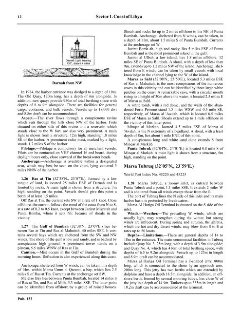
12 Sector 1.CoastofLibyaDarnah from NW1.25 In 1984, the harbor entrance was dredged to a depth of 10m.The Old Quay, 120m long, has a depth of 6m alongside. Inaddition, new quays provide 950m of total berthing space withdepths of 8 to 9m alongside. There are facilities for generalcargo, container, and bulk vessels. Vessels up to 18,000 dwtand 8.8m draft can be accommodated.1.25 Aspect.—The river flows through a conspicuous ravinewhich cuts through the hills close NW of the harbor. Fortssituated on either side of this ravine and a reservoir, whichstands close to the W fort, are also very prominent. A mainlight is shown from a structure, 12m high, standing 1.8 milesSE of the harbor. A prominent radio mast, marked by a light,stands 1.7 miles S of the harbor.1.25 Pilotage.—Pilotage is compulsory for all merchant vessels.Pilots can be contacted on VHF channel 16 and board, duringdaylight hours only, close seaward of the breakwater heads.1.25 Anchorage.—Anchorage is available within a designatedarea, which may best be seen on the chart, lying centered 3miles NNW of the harbor.1.26 Ras at Tin (32˚38'N., 23˚07'E.), formed by a lowtongue of land, is located 25 miles ESE of Darnah and isfronted by rocks. A main light is shown from a structure, 7mhigh, standing on the point. Vessels should give this point aberth of at least 1.5 miles.1.26 Off Ras at Tin, the current sets SW at a rate of 1 knot. Closeoffshore, the current follows the trend of the coast from N to S,at a rate of 0.2 to 0.5 knot, except between Jazirat Misratah andPunta Bomba, where it sets NE because of shoals in thevicinity.1.27 The Gulf of Bumbah (32˚38'N., 23˚07'E.) lies betweenRas at Tin and Ras al Mahattah, 40 miles SSE. It containsseveral bays which are sheltered from the SW and NWwinds. The shore of the gulf is low and sandy, and is backed byconspicuous high ground. A prominent tower stands on aplateau, 5.5 miles WNW of Ras at Tin.1.27 Caution.—Mist occurs in the Gulf of Bumbah during themorning hours. Refraction is also experienced along this coast.1.27 Anchorage, sheltered from W winds, can be taken, in a depthof 14m, within Marsa Umm al Qarami, a bay, which lies 2.5miles S of Ras at Tin. Currents at the anchorage set SW.1.27 Melelao Bay lies between Punta Bumbah, located 14 miles Sof Ras at Tin, and Ras al Milh, 5.3 miles SSE. The latter pointcan be identified from offshore by a group of ruined houses.Shoals and rocks lie up to 2 miles offshore to the NE of PuntaBumbah. Anchorage, sheltered from N winds, can be taken, ina depth of 11m, about 1.5 miles S of Punta Bumbah. Currentsat the anchorage set W.1.27 Jazirat Barda ah, high and rocky, lies 5 miles ESE of PuntaBumbah and is the most prominent island in the gulf.1.27 Jazirat al Ulbah, a low island, lies 1.8 miles offshore, 12miles SE of Punta Bumbah. A shoal, with a depth of less than9m, extends up to 1.2 miles NW of the island. Anchorage, shelteredfrom E winds, can be taken by small vessels with localknowledge in the channel lying to the W of the island.1.27 Marsa as Sahl (32˚08'N., 23˚50'E.), located 5.3 miles ESEof Ras al Mahattah, is the most conspicuous of the numerouscoves in this vicinity and can be identified by three large whitepatches on the coast. A remarkable cave, with a circular mouthrising to a height of 30m above the water, is located 2.5 miles Eof Marsa as Sahl.1.27 A white tomb, with a red dome, and the walls of the abandonedForte Perrone stand 1.5 miles WSW and 0.5 mile SE,respectively, of Marsa al 'Awdah, which is located 6.5 milesESE of Marsa as Sahl. Shoals extend up to 1 mile offshore inthe vicinity of this latter point.1.27 Minqar al Markab, located 4.5 miles ESE of Marsa al'Awdah, is the N extremity of a headland. A shoal, with a leastdepth of 8m, lies about 1 mile ENE of this point.1.27 A conspicuous long and white sand dune extends S fromMinqar al Markab.1.27 Punta Tobruk (32˚04'N., 24˚01'E.) is located 0.8 mile S ofMinqar al Markab. A main light is shown from a structure, 5mhigh, standing on the point.Marsa Tubruq (32˚05'N., 23˚59'E.)World Port Index No. 45220 and 452251.28 Marsa Tubruq, a roomy inlet, is entered betweenPunta Tobruk and a point, 1.1 miles SSE. It extends 2 miles Wand is sheltered from all winds except those from the E.1.28 The port of Tubruq lines the N side of this inlet and its mainharbor basin is protected by breakwaters.1.28 Marsa Al Hariga Oil Terminal is situated on the S side of theinlet.1.28 Winds.—Weather.—The prevailing W winds, which areusually light, may strengthen during the winter, but strongwinds are infrequent. During spring and autumn, the ghiblis,which are hot and dry desert winds, may blow from S to E atrates up to 50 knots.1.28 Depths—Limitations.—There are general depths of 14 to18m in the entrance. The main commercial facilities in Tubruqinclude Quay No. 3, 25m long, with a depth of 3.5m alongside;and Quay No. 4, which has 416m of total berthing space, withdepths of 6.5 to 9.2m alongside. Vessels up to 123m in lengthand 8.9m draft can be accommodated.1.28 Marsa al Hariga Oil Terminal has a T-shaped jetty, 800mlong, which is connected to the shore by an approach arm,200m long. This jetty has two berths which are extended bydolphins and have a depth 18.3m alongside. In addition, an offshoreberth, formed by several mooring buoys, lies close W ofthe jetty in a depth of 14.9m. Tankers up to 335m in length and18.2m draft can be accommodated at the terminal.Pub. 132
Sector1.CoastofLibya 131.28 Aspect.—The German War Memorial, a conspicuous yellowbuilding with towers, is situated on the S side of the inlet, 2miles SW of Punta Tubruq. A prominent group of oil tanksstands 0.5 miles SE of the memorial.1.28 A main light is shown from a prominent structure standing1.3 miles NW of Punta Tubruq.1.28 Lighted buoys are moored about 0.5 mile SSE and 1 mile SEof Punta Tubruq. A lighted range and an unlighted beaconrange, which may best be seen on the chart, are situated on theS side of the inlet and aid in the marking of the approach to theharbor and the oil terminal.1.28 Pilotage.—Pilotage is compulsory. Pilots and oil terminalmooring masters can be contacted on VHF channel 9, 12, 16,or 19 and board in the vicinity of the outer lighted buoy, about1 mile SE of Punta Tubruq. Vessels should send an ETA 72hours in advance.1.28 Anchorage.—Anchorage is available within a designatedarea, which may best be seen on the chart, lying centered 1.5miles E of Punta Tubruq.1.28 Caution.—Several foul areas lie within the inlet and maybest be seen on the chart.1.28 Deep-draft vessels should pass to the S of the lighted buoywhich is moored 0.5 mile SSE of Punta Tubruq.1.28 A restricted area surrounds the oil terminal and may best beseen on the chart. Vessels are prohibited from entering this areawithout prior permission from the oil terminal.Marsa Tubruq to the Egyptian Border1.29 Marsa Umm ash Shawush (32˚03'N., 24˚01'E.), asmall inlet, is entered close E of the S entrance point of MarsaTubruq and is used by small craft.1.29 An isolated shoal, with a depth of 9.8m, lies about 4 milesESE of Punta Tubruq.1.29 Secca Ahal (Ahal Shoal), a shoal with a depth of 5.2m, liesabout 2.5 miles offshore, 5.5 miles ESE of Punta Tubruq.1.29 Secca esc Sceich (Shiek Rocks), with a depth of 0.6m, lieabout 1 mile offshore, 9 miles ESE of Tubruq Point. Foulground lies between these rocks and the coast where there is aprominent cleft.1.29 Ras Azzaz (31˚58'N., 24˚59'E.) is located 50 miles E ofPunta Tubruq. A main light is shown from a structure, 11mhigh, standing on this point.1.29 From Sheik Rocks to Ras Azzaz, the rocks and shoalsfringing the coast lie within 1.5 miles of the shore.1.29 Ras al Muraysah (31˚55'N., 25˚02'E.), located 4.5 miles SEof Ras Azzaz, is the W entrance point of Khalij as Sallum(Gulf of Sollum). Vessels, with local knowledge, can seekshelter from W winds and anchor in the roadstead of Marsa alMuraysah (Marsa el Mreisa), close S of the point.1.29 Caution.—Vessels are advised to give the coast between RasAzzaz and Ras al Muraysah a wide berth as depths of less than9m extend up to 0.8 mile offshore and the current here tends toset towards the shore.1.30 Mina Bardiyah (31˚46'N., 25˚06'E.) (World PortIndex No. 45210), a small and natural harbor, is entered closeNW of Minqar Rai Ruhah, a point which rises to a height of95m and is marked by a light. A prominent tower stands on thecliffs at the N side of the entrance. The village is mostly inruins. This natural harbor provides sheltered anchorage forsmall craft. Anchorage outside the harbor entrance is obtainable,in a depth of 42m, sand, about 0.5 mile ENE of the tower.1.30 The coastal boundary between Libya and Egypt lies about6.5 miles S of Mina Bardiyah.1.30 Caution.—Unusual refraction and mirages occur in thisvicinity, usually during periods when the ghibli, a hot drywind, is blowing off the desert.Pub. 132
- Page 1 and 2: PUB.132SAILING DIRECTIONS(ENROUTE)
- Page 3 and 4: Preface0.0 Pub. 132, Sailing Direct
- Page 5 and 6: ContentsHow to Keep this Book Corre
- Page 7 and 8: 0.0SECTOR LIMITS—PUB. 132Pub. 132
- Page 9: AbbreviationsThe following abbrevia
- Page 13 and 14: 3SECTOR 1COAST OF LIBYA1.0 Plan.—
- Page 15 and 16: Sector1.CoastofLibya 51.5 Pilotage.
- Page 17 and 18: Sector1.CoastofLibya 71.12 Caution.
- Page 19 and 20: Sector1.CoastofLibya 91.17 Jabal La
- Page 21: Sector1.CoastofLibya 111.21 Tukrah
- Page 27 and 28: 17SECTOR 2COAST OF EGYPT2.0 Plan.
- Page 29 and 30: Sector2.CoastofEgypt 19a depth of 2
- Page 31 and 32: Sector2.CoastofEgypt 212.10 Several
- Page 33 and 34: Sector2.CoastofEgypt 232.17 Local v
- Page 35: Sector2.CoastofEgypt 25high, stands
- Page 39 and 40: 29SECTOR 3COASTS OF ISRAEL, LEBANON
- Page 41 and 42: Sector 3. Coasts of Israel, Lebanon
- Page 43 and 44: Sector 3. Coasts of Israel, Lebanon
- Page 45 and 46: Sector 3. Coasts of Israel, Lebanon
- Page 47 and 48: Sector 3. Coasts of Israel, Lebanon
- Page 49: 4.CyprusPub. 1324.0Additional chart
- Page 52 and 53: 42 Sector4.Cyprusthe village. Ancho
- Page 54 and 55: 44 Sector4.Cyprus4.10 A conspicuous
- Page 56 and 57: 46 Sector4.Cyprus4.18 Kakoskaliou I
- Page 59 and 60: 49SECTOR 5SOUTH COAST OF TURKEY—K
- Page 61 and 62: Sector 5. South Coast of Turkey—K
- Page 63 and 64: Sector 5. South Coast of Turkey—K
- Page 65 and 66: Sector 5. South Coast of Turkey—K
- Page 67: Sector 5. South Coast of Turkey—K
- Page 71 and 72: 61SECTOR 6RODHOS (RHODES), NISOS KA
- Page 73 and 74:
Sector 6. Rodhos (Rhodes), Nisos Ka
- Page 75 and 76:
Sector 6. Rodhos (Rhodes), Nisos Ka
- Page 77 and 78:
Sector 6. Rodhos (Rhodes), Nisos Ka
- Page 79 and 80:
Sector 6. Rodhos (Rhodes), Nisos Ka
- Page 81 and 82:
Sector 6. Rodhos (Rhodes), Nisos Ka
- Page 83:
7.West Coast of Greece and Dhiorix
- Page 86 and 87:
76 Sector 7. West Coast of Greece a
- Page 88 and 89:
78 Sector 7. West Coast of Greece a
- Page 90 and 91:
80 Sector 7. West Coast of Greece a
- Page 93:
8.West Coasts of Greece and Albania
- Page 96 and 97:
86 Sector 8. West Coasts of Greece
- Page 98 and 99:
88 Sector 8. West Coasts of Greece
- Page 100 and 101:
90 Sector 8. West Coasts of Greece
- Page 102 and 103:
92 Sector 8. West Coasts of Greece
- Page 105:
9.Coasts of Albania, Montenegro, an
- Page 108 and 109:
98 Sector 9. Coasts of Albania, Mon
- Page 110 and 111:
100 Sector 9. Coasts of Albania, Mo
- Page 112 and 113:
102 Sector 9. Coasts of Albania, Mo
- Page 114 and 115:
104 Sector 9. Coasts of Albania, Mo
- Page 117:
10.Coasts of Croatia and Bosnia-Her
- Page 120 and 121:
110 Sector 10. Coasts of Croatia an
- Page 122 and 123:
112 Sector 10. Coasts of Croatia an
- Page 124 and 125:
114 Sector 10. Coasts of Croatia an
- Page 126 and 127:
116 Sector 10. Coasts of Croatia an
- Page 128 and 129:
118 Sector 10. Coasts of Croatia an
- Page 131 and 132:
121SECTOR 11COAST OF CROATIA—RT M
- Page 133 and 134:
Sector 11. Coast of Croatia—Rt Mo
- Page 135 and 136:
Sector 11. Coast of Croatia—Rt Mo
- Page 137 and 138:
Sector 11. Coast of Croatia—Rt Mo
- Page 139 and 140:
Sector 11. Coast of Croatia—Rt Mo
- Page 141 and 142:
Sector 11. Coast of Croatia—Rt Mo
- Page 143:
Sector 11. Coast of Croatia—Rt Mo
- Page 147 and 148:
137SECTOR 12COAST OF GREECE—AKRA
- Page 149 and 150:
Sector 12. Coast of Greece—Akra T
- Page 151 and 152:
Sector 12. Coast of Greece—Akra T
- Page 153 and 154:
Sector 12. Coast of Greece—Akra T
- Page 155:
13.Coast of Greece—Saronikos Kolp
- Page 158 and 159:
148 Sector 13. Coast of Greece—Sa
- Page 160 and 161:
150 Sector 13. Coast of Greece—Sa
- Page 162 and 163:
152 Sector 13. Coast of Greece—Sa
- Page 164 and 165:
154 Sector 13. Coast of Greece—Sa
- Page 167:
14.Greece—Kikladhes Nisoi15714.0A
- Page 170 and 171:
160 Sector14.Greece—KikladhesNiso
- Page 172 and 173:
162 Sector14.Greece—KikladhesNiso
- Page 174 and 175:
164 Sector14.Greece—KikladhesNiso
- Page 176 and 177:
166 Sector14.Greece—KikladhesNiso
- Page 178 and 179:
168 Sector14.Greece—KikladhesNiso
- Page 181:
15.Greece—Channels West of Nisos
- Page 184 and 185:
174 Sector 15. Greece—Channels We
- Page 186 and 187:
176 Sector 15. Greece—Channels We
- Page 188 and 189:
178 Sector 15. Greece—Channels We
- Page 191:
16.Greece—Nisoi Vorioi Sporadhes
- Page 194 and 195:
184 Sector 16. Greece—Nisoi Vorio
- Page 196 and 197:
186 Sector 16. Greece—Nisoi Vorio
- Page 199:
17.Coast of Greece—Thermaikos Kol
- Page 202 and 203:
192 Sector 17. Coast of Greece—Th
- Page 204 and 205:
194 Sector 17. Coast of Greece—Th
- Page 206 and 207:
196 Sector 17. Coast of Greece—Th
- Page 209:
18.Greece—Dhodhekanisos and South
- Page 212 and 213:
202 Sector 18. Greece—Dhodhekanis
- Page 214 and 215:
204 Sector 18. Greece—Dhodhekanis
- Page 216 and 217:
206 Sector 18. Greece—Dhodhekanis
- Page 219:
19.West Coast of Turkey—Samos Str
- Page 222 and 223:
212 Sector 19. West Coast of Turkey
- Page 224 and 225:
214 Sector 19. West Coast of Turkey
- Page 226 and 227:
216 Sector 19. West Coast of Turkey
- Page 229:
20.The Dardanelles Approach and Adj
- Page 232 and 233:
222 Sector 20. The Dardanelles Appr
- Page 234 and 235:
224 Sector 20. The Dardanelles Appr
- Page 236 and 237:
226 Sector 20. The Dardanelles Appr
- Page 238 and 239:
228 Sector 20. The Dardanelles Appr
- Page 240 and 241:
230 GlossariesArabicARABICEnglishAR
- Page 242 and 243:
232 GlossariesARABICEnglishARABICEn
- Page 244 and 245:
234 GlossariesHebrewHEBREWEnglishHE
- Page 246 and 247:
236 GlossariesTURKISHEnglishTURKISH
- Page 249 and 250:
How to use the Index—Gazetteer239
- Page 251 and 252:
Index—Gazetteer 241PositionSec.˚
- Page 253 and 254:
Index—Gazetteer 243PositionSec.˚
- Page 255 and 256:
Index—Gazetteer 245PositionSec.˚
- Page 257 and 258:
Index—Gazetteer 247PositionSec.˚