140 Sector 12. Coast of Greece—Akra Tainaron to Akra SkillaionDhiekplous Kithiron12.11 Dhiekplous Kithiron (36˚05'N., 23˚05'E.), themiddle channel of the three leading from the W into theGrecian archipelago, leads between Nisos Kithira and NisosAndikithira. Several islets and dangers lie off both of theseislands at the sides of the passage.12.11 Nisis Avgo (36˚06'N., 23˚00'E.) lies 3.1 miles SW of AkraKapello, the SE extremity of Nisos Kithira. This islet is 194mhigh and has a rounded surface which appears, as its nameimplies, like a large egg.12.11 Nisidhes Kofinidhia (36˚06'N., 23˚09'E.), located 5 milesENE of Nisis Avgo, consists of two small and rocky islets lying0.6 mile apart. In cases of necessity, vessels can pass betweenthese islets, but caution is necessary as the currents are strongand irregular in this vicinity. The N and larger islet is 10m highand flat. A rock, with a depth of 2.7m, lies close off its S side.Rocky patches, with depths of about 25m, lie 1.7 miles SE and1.2 miles S of the S islet.12.11 Nisis Pori (35˚58'N., 23˚15'E.), a rocky islet, lies on the Sside of the channel and is 126m high and precipitous. A shoal,with a depth of 7m, lies about 0.8 mile N of this islet.12.11 Vrakhos Poreti, a small and cliffy islet, lies 2 miles SW ofNisis Pori and is 40m high and also precipitous. VrakhosNavtilos, 3m high, lies 1.2 miles SSE of Vrakhos Poreti and issurrounded by submerged rocks. From a distance, this abovewaterrock has the appearance of several scattered rocks, beingvery pointed and rugged. A shoal, with a depth of 6m, liesabout 0.5 mile N of the rock.12.12 Nisos Andikithira (35˚52'N., 23˚18'E.), a rocky andhilly island, has a barren aspect and rises to a summit, 378mhigh. Its coasts consist of steep and inaccessible cliffs. AkraKefali, the N extremity of the island, is formed by red cliffs,220m high. Akra Apolitares, the S extremity of the island, isformed by a level point, 24m high. A main light is shown froma prominent structure standing on this point.12.12 Ormos Potamou, an inlet, indents the N coast and offers theonly shelter of the island. A light is shown from Akra Kastro,its E entrance point, and Potamos, a small village, is situated atthe head. The sides of the inlet are high and rocky and a fortsurmounts a hill which rises at the SE side. Small craft cananchor near the head of this inlet, in depths of 11 to 18m, but aheavy and dangerous swell rolls in during strong N winds.12.12 Singular and conspicuous horizontal marks, which attract theeye, may be observed, at precisely the same level, all aroundNisos Andikithira, Nisis Pori, and Vrakhos Poreti. Locatedabout 2m above the water, these uniformly straight andhorizontal marks are formed by the rock being worn away to adepth of 5 cm and resemble the high water mark of places subjectto regular tides. In winter, it is reported that the water levelis much higher than usual, but never reaches the mark.Stenon Andikithiron12.13 Stenon Andikithiron (35˚45'N., 23˚25'E.), the Schannel of the three leading from W into the Grecianarchipelago, lies between the S end of Nisos Andikithira andthe NW end of Kriti (Crete). Levka Ori, the high peaks of Kriti,may be seen from the approaches to the channel and are nearlyalways capped with snow. When using this passage, vessels areadvised to keep to the N side. During N or NE winds, a strongcurrent has been observed to set to the W.Peloponnisos—East Coast12.14 Akra Maleas (36˚26'N., 23˚12'E.), the SE extremityof Peloponnisos, is formed by a bold headland, 553m high. Amain light is shown from a prominent structure, 15m high,standing 1 mile N of the point.12.14 Violent squalls occur frequently near this headland, spillingover from the high mountains above it. The coast extending Nfrom the point to the head of Argolikos Kolpos is mountainous,extremely rugged, and inhospitable in its general appearance.12.14 The current in the vicinity of Akra Maleas generally sets Wat a velocity of 1 knot, but its strength and direction can varybecause of the wind.12.14 Akra Kamili, a small and low promontory, is located 6.5miles NW of Akra Maleas. A hummock, which closelyresembles the hump of a camel, is located on this point. Severalsmall islets and numerous rocks front the coast between thispoint and Monemvasia.12.14 Monemvasia (36˚41'N., 23˚03'E.) is connected to themainland at its W end by a bridge, under which only boats canpass, and a causeway. This small and narrow island is 199mhigh and a conspicuous castle surmounts its summit. A town,enclosed by walls, is situated on the S side and a light is shownfrom its E extremity.12.14 Kolpos Monemvasias, a bay, is entered between the E end ofMonemvasia and Akra Kremmidhi, 3 miles NE, and providesprotection from N, NW, and NE winds. Good anchorage can betaken within this bay, in depths of 9 to 18m ,sand. The smallvillage of Gephyra stands on the mainland W of Monemvasia andis fronted by a small craft harbor used by local fishing boats.12.14 A small harbor, protected by a mole, fronts the NW end ofthe island in the SW corner of the bay. It has depths of 4 to 5mand is used by small craft. During the summer, temporaryanchorage can be taken, in depths of 27 to 33m, sand andweeds, about 0.4 mile N of the bridge and causeway. Localknowledge is advised.12.14 Akra Palaio Monemvasia is located on the N side of the bay2 miles WNW of Akra Kremmidhi. This point is marked by alight and divides the N side of the bay into two parts. Vesselscan take anchorage, in depth of 9 to 18m, sand, within OrmosPalaias Monemvasias, the NW part of the bay. Vessels can alsotake anchorage, in depth of 11 to 35m, within Ormos Kremmidhi,the NE part of the bay, but should avoid the foul groundcaused by a sunken boom lying across the entrance.12.15 Ormos Ierakos (36˚47'N., 23˚06'E.), a small inlet,lies 3.2 miles N of Akra Kremmidhi. It is entered betweenAkra Kari and Akra Koufanda, 0.3 mile NW. The entrance isbacked by high land and is reported to be difficult to distinguishfrom seaward. However, vessels approaching from theN may sight a church which stands on the summit of a hill 2.5miles NW of the entrance. The inlet is sheltered from all exceptNE winds and is used by local small craft.12.15 Akra Nisaki (36˚58'N., 23˚00'E.), marked by a light on its NWside, forms the S entrance point of Ormos Kiparissiou, a smallbay, and is fronted by rocks on the E side. Akra Kortia, located 0.8Pub. 132
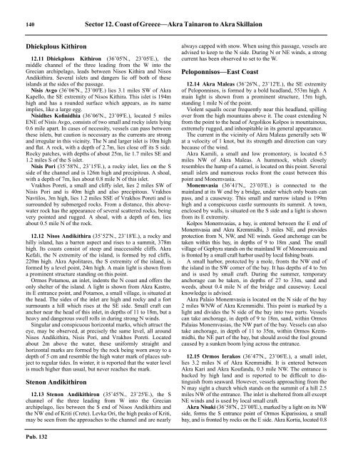
Sector 12. Coast of Greece—Akra Tainaron to Akra Skillaion 141Ormos Ierakos bearing 204˚mile N of Akra Nisaki, forms the N entrance point of the bay andis also marked by a light. A village is situated near the SW cornerof the bay. Small vessels with local knowledge can takeanchorage, in depths of 11 to 25m, within the bay.12.15 Akra Sambateki (37˚11'N., 22˚55'E.), the SW entrancepoint of Argolikos Kolpos, is located 14 miles NNW of AkraNisaki. This point is fronted by rocks and is marked by a light.12.15 Plaka (Skala Leonidhion) (37˚10'N., 22˚52'E.) (World PortIndex No. 42030), a small harbor, lies on the NW side ofOrmos Poulithra 3 miles SSW of Akra Sambateki. It is protectedby a mole and has depths of up to 6m alongside thequays. Small vessels of up to 4.5m draft can be handled. Aconspicuous white sandy beach extends 1.3 miles N from thevillage in which a prominent white church stands. Vessels cananchor, in depths of 9 to 27m, within Ormos Poulithra.12.15 Caution.—A submarine exercise area, which may best beseen on the chart, lies centered 16 miles SE of Akra Sambateki.Off-lying Islands and Islets12.16 Nisis Falkonera (36˚50'N., 23˚53'E.), the outermostisland lying off this part of the coast, is 183m high and markedby a light on its SE peak. A small above-water rock lies closeoff its NW extremity.12.16 Nisidhes Karavi (36˚46'N., 23˚36'E.), consisting of a groupof three sheer and barren islets, lies 14 miles WSW of NisisFalkonera. The largest islet is 33m high; they resemble a shipunder sail from a distance.12.16 Nisis Velopoula (Nisis Parapola) (36˚55'N., 23˚28'E.), 227mhigh, is almost inaccessible. A main light is shown from aprominent structure, 10m high, standing in the NW part of theisland.Argolikos Kolpos12.17 Argolikos Kolpos (37˚15'N., 23˚00'E.), an extensivegulf, is entered between Akra Sambatikis and Nisos Spetsai, 10miles ENE, and is bounded on both sides by mountains. Theslightly irregular W shore is low in places while the E shore isindented by several bays and is fronted by several islands.Navplio, a port, lies at the head of the gulf.12.17 In Argolikos Kolpos during the summer the land and seabreezes are very irregular. The sea breeze, which normallyreaches a force of from 4 to 5 at about 1600, sets in from theSSE about 1100 and blows until between 2000 and 2200. It isthen succeeded by the land breeze from the NNE, whichcontinues until about 0600, when it falls calm until the seabreeze sets in again.12.17 Akra Tirou (37˚15'N., 22˚53'E.), located 3.8 miles NW ofAkra Sambateki, is the S entrance point of Ormos Tirou, asmall bay, which offers shelter to small craft. This point isfronted by a reef and surmounted by three conspicuous windmills.Akra Trikeri, located 1.6 miles NNW of Akra Tirou, isbold and rises to a height of 293m. Ormos Zaritsi, anothersmall bay, lies 2.7 miles NW of Akra Tirou and offers shelter tosmall vessels. A small prominent church stands near the shoreof this bay.12.18 Paralion Astros (37˚25'N., 22˚46'E.) (World PortIndex No. 42040), a small harbor, lies on the N shore of OrmosAstros 10 miles NW of Akra Trikeri. The coast between isindented by several small bays which provide shelter to smallvessels with local knowledge. The harbor fronts the S side of asmall promontory and is protected by two moles. It has depthsof 2 to 4m and is used by small craft. A light is shown from theSE extremity of the promontory. Anchorage can be taken, indepths of 12 to 18m, mud and sand, about 250m S or SE of theharbor.12.18 Ormos Navplion (37˚33'N., 22˚46'E.) is entered betweenAkra Kiveri and Akra Khondros, 4 miles E, and forms the Nportion of Argolikos Kolpos. Anchorage can be taken anywherein the bay where depths permit. However, severalobstructions and foul areas, which may best be seen on thechart, lie within the bay.12.18 The sides of this bay are backed by high mountains while thehead is low and marshy and is backed by a cultivated plain.Kiveri, a village, is situated 0.5 mile NW of Akra Kiveri andnear the conspicuous ruins of a medieval castle. Temporaryanchorage can be taken off this village, in depths of 11 to 15m,sand. Anchorage can also be taken, in a depth of 13m, goodholding ground, about 1 mile E of the village of Miloi whichstands 1.8 miles NNW of Kiveri.12.18 The conspicuous acropolis of Larissa, with a beacon, issituated on a hill, 285m high, standing close W of the town ofArgos, 5.2 miles N of Miloi. A prominent chimney stands 2.7miles NE of Miloi, close E of the village of Nea Kios.12.19 Navplio (37˚34'N., 22˚48'E.) (World Port Index No.42050), a small port, lies on the E side of the bay and fronts theN side of Khersonisos Akronavplias, a small flat-topped peninsula.The harbor is protected from the SW by a mole and fromthe N by a stone breakwater, 0.5 mile long.Pub. 132
- Page 1 and 2:
PUB.132SAILING DIRECTIONS(ENROUTE)
- Page 3 and 4:
Preface0.0 Pub. 132, Sailing Direct
- Page 5 and 6:
ContentsHow to Keep this Book Corre
- Page 7 and 8:
0.0SECTOR LIMITS—PUB. 132Pub. 132
- Page 9:
AbbreviationsThe following abbrevia
- Page 13 and 14:
3SECTOR 1COAST OF LIBYA1.0 Plan.—
- Page 15 and 16:
Sector1.CoastofLibya 51.5 Pilotage.
- Page 17 and 18:
Sector1.CoastofLibya 71.12 Caution.
- Page 19 and 20:
Sector1.CoastofLibya 91.17 Jabal La
- Page 21 and 22:
Sector1.CoastofLibya 111.21 Tukrah
- Page 23:
Sector1.CoastofLibya 131.28 Aspect.
- Page 27 and 28:
17SECTOR 2COAST OF EGYPT2.0 Plan.
- Page 29 and 30:
Sector2.CoastofEgypt 19a depth of 2
- Page 31 and 32:
Sector2.CoastofEgypt 212.10 Several
- Page 33 and 34:
Sector2.CoastofEgypt 232.17 Local v
- Page 35:
Sector2.CoastofEgypt 25high, stands
- Page 39 and 40:
29SECTOR 3COASTS OF ISRAEL, LEBANON
- Page 41 and 42:
Sector 3. Coasts of Israel, Lebanon
- Page 43 and 44:
Sector 3. Coasts of Israel, Lebanon
- Page 45 and 46:
Sector 3. Coasts of Israel, Lebanon
- Page 47 and 48:
Sector 3. Coasts of Israel, Lebanon
- Page 49:
4.CyprusPub. 1324.0Additional chart
- Page 52 and 53:
42 Sector4.Cyprusthe village. Ancho
- Page 54 and 55:
44 Sector4.Cyprus4.10 A conspicuous
- Page 56 and 57:
46 Sector4.Cyprus4.18 Kakoskaliou I
- Page 59 and 60:
49SECTOR 5SOUTH COAST OF TURKEY—K
- Page 61 and 62:
Sector 5. South Coast of Turkey—K
- Page 63 and 64:
Sector 5. South Coast of Turkey—K
- Page 65 and 66:
Sector 5. South Coast of Turkey—K
- Page 67:
Sector 5. South Coast of Turkey—K
- Page 71 and 72:
61SECTOR 6RODHOS (RHODES), NISOS KA
- Page 73 and 74:
Sector 6. Rodhos (Rhodes), Nisos Ka
- Page 75 and 76:
Sector 6. Rodhos (Rhodes), Nisos Ka
- Page 77 and 78:
Sector 6. Rodhos (Rhodes), Nisos Ka
- Page 79 and 80:
Sector 6. Rodhos (Rhodes), Nisos Ka
- Page 81 and 82:
Sector 6. Rodhos (Rhodes), Nisos Ka
- Page 83:
7.West Coast of Greece and Dhiorix
- Page 86 and 87:
76 Sector 7. West Coast of Greece a
- Page 88 and 89:
78 Sector 7. West Coast of Greece a
- Page 90 and 91:
80 Sector 7. West Coast of Greece a
- Page 93:
8.West Coasts of Greece and Albania
- Page 96 and 97:
86 Sector 8. West Coasts of Greece
- Page 98 and 99:
88 Sector 8. West Coasts of Greece
- Page 100 and 101: 90 Sector 8. West Coasts of Greece
- Page 102 and 103: 92 Sector 8. West Coasts of Greece
- Page 105: 9.Coasts of Albania, Montenegro, an
- Page 108 and 109: 98 Sector 9. Coasts of Albania, Mon
- Page 110 and 111: 100 Sector 9. Coasts of Albania, Mo
- Page 112 and 113: 102 Sector 9. Coasts of Albania, Mo
- Page 114 and 115: 104 Sector 9. Coasts of Albania, Mo
- Page 117: 10.Coasts of Croatia and Bosnia-Her
- Page 120 and 121: 110 Sector 10. Coasts of Croatia an
- Page 122 and 123: 112 Sector 10. Coasts of Croatia an
- Page 124 and 125: 114 Sector 10. Coasts of Croatia an
- Page 126 and 127: 116 Sector 10. Coasts of Croatia an
- Page 128 and 129: 118 Sector 10. Coasts of Croatia an
- Page 131 and 132: 121SECTOR 11COAST OF CROATIA—RT M
- Page 133 and 134: Sector 11. Coast of Croatia—Rt Mo
- Page 135 and 136: Sector 11. Coast of Croatia—Rt Mo
- Page 137 and 138: Sector 11. Coast of Croatia—Rt Mo
- Page 139 and 140: Sector 11. Coast of Croatia—Rt Mo
- Page 141 and 142: Sector 11. Coast of Croatia—Rt Mo
- Page 143: Sector 11. Coast of Croatia—Rt Mo
- Page 147 and 148: 137SECTOR 12COAST OF GREECE—AKRA
- Page 149: Sector 12. Coast of Greece—Akra T
- Page 153 and 154: Sector 12. Coast of Greece—Akra T
- Page 155: 13.Coast of Greece—Saronikos Kolp
- Page 158 and 159: 148 Sector 13. Coast of Greece—Sa
- Page 160 and 161: 150 Sector 13. Coast of Greece—Sa
- Page 162 and 163: 152 Sector 13. Coast of Greece—Sa
- Page 164 and 165: 154 Sector 13. Coast of Greece—Sa
- Page 167: 14.Greece—Kikladhes Nisoi15714.0A
- Page 170 and 171: 160 Sector14.Greece—KikladhesNiso
- Page 172 and 173: 162 Sector14.Greece—KikladhesNiso
- Page 174 and 175: 164 Sector14.Greece—KikladhesNiso
- Page 176 and 177: 166 Sector14.Greece—KikladhesNiso
- Page 178 and 179: 168 Sector14.Greece—KikladhesNiso
- Page 181: 15.Greece—Channels West of Nisos
- Page 184 and 185: 174 Sector 15. Greece—Channels We
- Page 186 and 187: 176 Sector 15. Greece—Channels We
- Page 188 and 189: 178 Sector 15. Greece—Channels We
- Page 191: 16.Greece—Nisoi Vorioi Sporadhes
- Page 194 and 195: 184 Sector 16. Greece—Nisoi Vorio
- Page 196 and 197: 186 Sector 16. Greece—Nisoi Vorio
- Page 199: 17.Coast of Greece—Thermaikos Kol
- Page 202 and 203:
192 Sector 17. Coast of Greece—Th
- Page 204 and 205:
194 Sector 17. Coast of Greece—Th
- Page 206 and 207:
196 Sector 17. Coast of Greece—Th
- Page 209:
18.Greece—Dhodhekanisos and South
- Page 212 and 213:
202 Sector 18. Greece—Dhodhekanis
- Page 214 and 215:
204 Sector 18. Greece—Dhodhekanis
- Page 216 and 217:
206 Sector 18. Greece—Dhodhekanis
- Page 219:
19.West Coast of Turkey—Samos Str
- Page 222 and 223:
212 Sector 19. West Coast of Turkey
- Page 224 and 225:
214 Sector 19. West Coast of Turkey
- Page 226 and 227:
216 Sector 19. West Coast of Turkey
- Page 229:
20.The Dardanelles Approach and Adj
- Page 232 and 233:
222 Sector 20. The Dardanelles Appr
- Page 234 and 235:
224 Sector 20. The Dardanelles Appr
- Page 236 and 237:
226 Sector 20. The Dardanelles Appr
- Page 238 and 239:
228 Sector 20. The Dardanelles Appr
- Page 240 and 241:
230 GlossariesArabicARABICEnglishAR
- Page 242 and 243:
232 GlossariesARABICEnglishARABICEn
- Page 244 and 245:
234 GlossariesHebrewHEBREWEnglishHE
- Page 246 and 247:
236 GlossariesTURKISHEnglishTURKISH
- Page 249 and 250:
How to use the Index—Gazetteer239
- Page 251 and 252:
Index—Gazetteer 241PositionSec.˚
- Page 253 and 254:
Index—Gazetteer 243PositionSec.˚
- Page 255 and 256:
Index—Gazetteer 245PositionSec.˚
- Page 257 and 258:
Index—Gazetteer 247PositionSec.˚