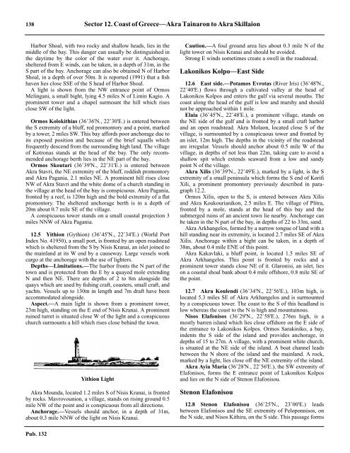
138 Sector 12. Coast of Greece—Akra Tainaron to Akra Skillaion12.4 Harbor Shoal, with two rocky and shallow heads, lies in themiddle of the bay. This danger can usually be distinguished inthe daytime by the color of the water over it. Anchorage,sheltered from E winds, can be taken, in a depth of 31m, in theS part of the bay. Anchorage can also be obtained N of HarborShoal, in a depth of over 50m. It is reported (1991) that a fishhaven lies close SSE of the S head of Harbor Shoal.12.4 A light is shown from the NW entrance point of OrmosMelingani, a small bight, lying 4.5 miles N of Limin Kagio. Aprominent tower and a chapel surmount the hill which risesclose SW of the light.12.4 Ormos Kolokithias (36˚36'N., 22˚30'E.) is entered betweenthe S extremity of a bluff, red promontory and a point, markedby a tower, 2 miles SW. This bay affords poor anchorage due toits exposed position and because of the brief squalls whichfrequently descend from the surrounding high land. The villageof Kotronas stands at the head of the bay. The only recommendedanchorage berth lies in the NE part of the bay.12.4 Ormos Skoutari (36˚39'N., 22˚31'E.) is entered betweenAkra Stavri, the NE extremity of the bluff, reddish promontoryand Akra Pagania, 2.1 miles NE. A prominent hill rises closeNW of Akra Stavri and the white dome of a church standing inthe village at the head of the bay is conspicuous. Akra Pagania,fronted by a reef, is 120m high and the bold extremity of a flatpromontory. The sheltered anchorage berth is in a depth of20m about 0.7 mile SE of the village.12.4 A conspicuous tower stands on a small coastal projection 3miles NNW of Akra Pagania.12.5 Yithion (Gythion) (36˚45'N., 22˚34'E.) (World PortIndex No. 41950), a small port, is fronted by an open roadsteadwhich is sheltered from the S by Nisis Kranai, an islet joined tothe mainland at its W end by a causeway. Large vessels workcargo at the anchorage with the use of lighters.12.5 Depths—Limitations.—The harbor fronts the N part of thetown and is protected from the E by a quayed mole extendingN and then NE. There are depths of 2 to 8m alongside thequays which are used by fishing craft, coasters, small craft, andyachts. Vessels up to 130m in length and 7m draft have beenaccommodated alongside.12.5 Aspect.—A main light is shown from a prominent tower,23m high, standing on the E end of Nisis Kranai. A prominentruined turret is situated close W of the light and a conspicuouschurch surmounts a hill which rises close behind the town.Yithion Light12.5 Akra Mounda, located 1.2 miles S of Nisis Kranai, is frontedby rocks. Mavrovounion, a village, stands on rising ground 0.5mile NW of the point and is conspicuous from all <strong>directions</strong>.12.5 Anchorage.—Vessels should anchor, in a depth of 31m,about 0.3 mile NNW of the light on Nisis Kranai.12.5 Caution.—A foul ground area lies about 0.3 mile N of thelight tower on Nisis Kranai and should be avoided.12.5 Strong E winds sometimes create a swell in the roadstead.Lakonikos Kolpo—East Side12.6 East side.—Potamos Evrotas (River Iris) (36˚48'N.,22˚40'E.) flows through a cultivated valley at the head ofLakonikos Kolpos and enters the gulf via several mouths. Thecoast along the head of the gulf is low and marshy and shouldnot be approached within 1 mile.12.6 Elaia (36˚45'N., 22˚48'E.), a prominent village, stands onthe NE side of the gulf and is fronted by a small craft harborand an open roadstead. Akra Molaon, located close S of thevillage, is surmounted by a conspicuous tower and fronted byan islet, 12m high. The depths in the vicinity of the roadsteadare irregular. Vessels should anchor about 0.5 mile W of thevillage, in depths of not less than 22m, taking care to avoid ashallow spit which extends seaward from a low and sandypoint N of the village.12.6 Akra Xilis (36˚39'N., 22˚49'E.), marked by a light, is the Sextremity of a small peninsula which forms the S end of KorifiXili, a prominent promontory previously described in paragraph12.2.12.6 Ormos Xilis, open to the S, is entered between Akra Xilisand Akra Koukourianikon, 2.5 miles E. The village of Plitra,fronted by a mole, stands at the head of this bay and thesubmerged ruins of an ancient town lie nearby. Anchorage canbe taken in the N part of the bay, in depths of 22 to 33m, sand.12.6 Akra Arkhangelos, formed by a narrow tongue of land with ahill standing near its extremity, is located 2.7 miles SE of AkraXilis. Anchorage within a bight can be taken, in a depth of38m, about 0.4 mile ENE of this point.12.6 Akra Kakavlaki, a bluff point, is located 1.5 miles SE ofAkra Arkhangelos. This point is fronted by rocks and aprominent tower stands close NE of it. Glaronisi, an islet, lieson a coastal shoal bank about 0.4 mile offshore, 0.8 mile SE ofthe point.12.7 Akra Koulendi (36˚34'N., 22˚56'E.), 103m high, islocated 5.3 miles SE of Akra Arkhangelos and is surmountedby a conspicuous tower. The coast to the S of this headland islow whereas the coast to the N is high and mountainous.12.7 Nisos Elafonisos (36˚29'N., 22˚58'E.), 276m high, is amostly barren island which lies close offshore on the E side ofthe entrance to Lakonikos Kolpos. Ormos Sarakiniko, a bay,indents the S side of the island and provides anchorage, indepths of 15 to 27m. A village, with a prominent white church,is situated at the NE side of the island. A boat channel leadsbetween the N shore of the island and the mainland. A rock,marked by a light, lies close off the NE extremity of the island.12.7 Akra Ayia Maria (36˚28'N., 22˚56'E.), the SW extremity ofElafonisos, forms the E entrance point of Lakonikos Kolposand lies on the N side of Stenon Elafonisou.Stenon Elafonisou12.8 Stenon Elafonisou (36˚25'N., 23˚00'E.) leadsbetween Elafonisos and the SE extremity of Peloponnisos, onthe N side, and Nisos Kithira, on the S side. This passage formsPub. 132
Sector 12. Coast of Greece—Akra Tainaron to Akra Skillaion 139the most direct route for vessels proceeding to the Grecianarchipelago from the W, although it is the narrowest of thethree channels which lie between the mainland of Greece andthe island of Kriti (Crete). Heavy traffic is reported in both<strong>directions</strong> through this channel.12.8 Strong winds and sudden changes of weather are frequent inStenon Elafonisou. Winds from the NW may blow to the W ofAkra Maleas when winds from the N or NE are blowing to theE of this cape.12.8 Ormos Viatika (Neapoleos) (36˚30'N., 23˚02'E.), a largebay, lies on the N side of Stenon Elafonisou and is frequentedby vessels encountering strong adverse winds. A prominentchurch stands in the village of Neapolis which is situated onthe NE side of the bay. The village is fronted by a small craftpier which was reported to be damaged. Vessels anchor asconvenient off Neapolis, in a depth of 27m, or about 0.5 milefrom the head of the bay, in depths of 18 to 22m. The bottomon the E side of the bay is uncertain, being rocky in places, andwinds from the S cause a heavy swell within the bay.12.9 Nisos Kithira (36˚15'N., 23˚00'E.), a mountainousvolcanic island, lies with Akra Spathi, its N extremity, located5 miles S of Akra Ayia Maria. Oros Mirmingari, the summit ofthe island, is 506m high and rises near the center of the W side.12.9 Akra Spathi is formed by steep cliffs up to 100m high and isfronted by a reef. Vessels should pass at least 0.5 mile off thispoint. A main light is shown from a prominent structure, 25mhigh, standing close S of the extremity of the point.12.9 Akra Armenopetra, the NW extremity of the island, islocated 5 miles SW of Akra Spathi. A rock, 10m high, liesclose off this point and appears as a well-defined cone whenseen from the N or S.Akra Spathi Light12.9 Ormos Fana Kopia, which affords the only anchorage in thisvicinity, is entered between Akra Koufoyialos, located 3 milesSSE of Akra Armenopetra, and Akra Limniona, 2.3 milesSSW. Two rocky islets lie on a shoal bank which extends 0.8mile NNE of Akra Limniona. The bay is protected from the Eand W, but the backwash caused by the swell striking the cliffsin the N part creates a confused sea and swell. Vessels shouldanchor, in a depth of 29m, off the SE side of the bay.12.9 Akra Trakhilos (36˚08'N., 23˚00'E.), located at the S end ofNisos Kithira, is the S extremity of a narrow tongue of landwhich extends S from the shore.12.9 Nisidhes Lindho (36˚12'N., 22˚54'E.), consisting of two isletsfringed by rocks, lies about 0.5 mile offshore, 5.7 milesNW of Akra Trakhilos. The S and largest islet is 28m high.12.9 Nisidhes Strongila, consisting of two islets, lies about 0.8 mileoffshore, 1.4 miles SSE of Nisidhes Lindho. The N islet is 30mhigh and the S islet is 33m high. Being comparatively small andlow, all of these islets are difficult to identify against the high land,especially at night, and they should be given a wide berth.12.9 Ormos Kapsaliou (36˚08'N., 23˚00'E.), a small bay exposedto the S, is entered close E of Akra Trakhilos and forms anatural harbor. During strong winds from between SE and SW,this bay is unsafe. Oros Kapsali, 477m high, stands 1.7 milesNW of the bay. This prominent peak is flat topped and a conspicuousmonastery is situated on its NW shoulder. Anotherprominent hill, 322m high, stands immediately N of the bayand is surmounted by a white house. A conspicuous white millstands on Akra Grosso, the E entrance point of the bay. Thetown of Kithira, fronted by a large fortress, stands on the NWside of the bay and is very conspicuous. The town is fronted bya small craft harbor. The best anchorage berth is in a depth of29m, mud and sand, about 0.3 mile SSW of the harbor.12.9 Akra Kapello (36˚08'N., 23˚03'E.), the SE extremity ofNisos Kithira, is located 2.3 miles E of Ormos Kapsaliou and isfronted by rocks. During N and NE winds, a heavy swell isexperienced off this point and it should be given a wide berth.12.9 Ormos Ayiou Nikolaou, a bay, is entered 5.5 miles N of AkraKapello and is subject to a heavy swell during S and SE winds.Limin Avlemonos, a cove, lies at the head of the bay andprovides shelter to small craft. Vessels can anchor in the bay, ina depth of 31m, sand and mud, about 0.4 mile SW of the castlewhich stands on the NW entrance point of Limin Avlemonos.12.10 Vrakhonisidhes Dhragoneres (36˚13'N., 23˚06'E.),consisting of two islets, lies close off the E extremity of theisland. Nisis Dhragonera, the S and larger islet, is 39m high.Nisis Andidhragonera, the N islet, is 20m high and is markedby a light. Both of these islets are covered with scanty grassand low scrub and both appear similar, having a dip in themiddle between two hummocks. During NE winds, the seabreaks heavily over the rocks which front the E side of NisisDhragonera. Small vessels can obtain temporary anchorage, indepths of 20 to 37m, between the island and the two islets.Local knowledge is required as patches of foul ground lie inthe approach.12.10 Makronisi (36˚16'N., 23˚05'E.) lies close off the coast 2.5miles NW of Nisis Andidhragonera. This islet is 29m high andis marked by a light at the N end, but is low at its S end. It isconnected at the S extremity to the mainland by a rocky ledge,with a depth of 0.6m, which acts as a breakwater during Swinds. Fidhonisi, a small rock, lies 0.5 mile SE of the islet andis 13m high.12.10 Limin Dhiakofti, also known as Angirovolion Makris, is asmall natural harbor formed between the islet and the mainlandcoast. The village of Dhiakofti stands in the SW part of thisharbor and is fronted by a stone pier which is used by coasters.Vessels with local knowledge can obtain good anchorage, in adepth of 22m, near the middle of the harbor.12.10 Ayia Pelayias (36˚19'N., 22˚59'E.), a village, is situated onthe coast 6 miles NW of Makronisi and can be identified by atower standing close S of it. A mole, 220m long, fronts thevillage and has depths of 1.5 to 4m alongside. Small vesselscan anchor, in a depth of 22m, off the village.12.10 Caution.—Several submarine cables extend across StenonElafonisou and may best be seen on the chart.Pub. 132
- Page 1 and 2:
PUB.132SAILING DIRECTIONS(ENROUTE)
- Page 3 and 4:
Preface0.0 Pub. 132, Sailing Direct
- Page 5 and 6:
ContentsHow to Keep this Book Corre
- Page 7 and 8:
0.0SECTOR LIMITS—PUB. 132Pub. 132
- Page 9:
AbbreviationsThe following abbrevia
- Page 13 and 14:
3SECTOR 1COAST OF LIBYA1.0 Plan.—
- Page 15 and 16:
Sector1.CoastofLibya 51.5 Pilotage.
- Page 17 and 18:
Sector1.CoastofLibya 71.12 Caution.
- Page 19 and 20:
Sector1.CoastofLibya 91.17 Jabal La
- Page 21 and 22:
Sector1.CoastofLibya 111.21 Tukrah
- Page 23:
Sector1.CoastofLibya 131.28 Aspect.
- Page 27 and 28:
17SECTOR 2COAST OF EGYPT2.0 Plan.
- Page 29 and 30:
Sector2.CoastofEgypt 19a depth of 2
- Page 31 and 32:
Sector2.CoastofEgypt 212.10 Several
- Page 33 and 34:
Sector2.CoastofEgypt 232.17 Local v
- Page 35:
Sector2.CoastofEgypt 25high, stands
- Page 39 and 40:
29SECTOR 3COASTS OF ISRAEL, LEBANON
- Page 41 and 42:
Sector 3. Coasts of Israel, Lebanon
- Page 43 and 44:
Sector 3. Coasts of Israel, Lebanon
- Page 45 and 46:
Sector 3. Coasts of Israel, Lebanon
- Page 47 and 48:
Sector 3. Coasts of Israel, Lebanon
- Page 49:
4.CyprusPub. 1324.0Additional chart
- Page 52 and 53:
42 Sector4.Cyprusthe village. Ancho
- Page 54 and 55:
44 Sector4.Cyprus4.10 A conspicuous
- Page 56 and 57:
46 Sector4.Cyprus4.18 Kakoskaliou I
- Page 59 and 60:
49SECTOR 5SOUTH COAST OF TURKEY—K
- Page 61 and 62:
Sector 5. South Coast of Turkey—K
- Page 63 and 64:
Sector 5. South Coast of Turkey—K
- Page 65 and 66:
Sector 5. South Coast of Turkey—K
- Page 67:
Sector 5. South Coast of Turkey—K
- Page 71 and 72:
61SECTOR 6RODHOS (RHODES), NISOS KA
- Page 73 and 74:
Sector 6. Rodhos (Rhodes), Nisos Ka
- Page 75 and 76:
Sector 6. Rodhos (Rhodes), Nisos Ka
- Page 77 and 78:
Sector 6. Rodhos (Rhodes), Nisos Ka
- Page 79 and 80:
Sector 6. Rodhos (Rhodes), Nisos Ka
- Page 81 and 82:
Sector 6. Rodhos (Rhodes), Nisos Ka
- Page 83:
7.West Coast of Greece and Dhiorix
- Page 86 and 87:
76 Sector 7. West Coast of Greece a
- Page 88 and 89:
78 Sector 7. West Coast of Greece a
- Page 90 and 91:
80 Sector 7. West Coast of Greece a
- Page 93:
8.West Coasts of Greece and Albania
- Page 96 and 97:
86 Sector 8. West Coasts of Greece
- Page 98 and 99: 88 Sector 8. West Coasts of Greece
- Page 100 and 101: 90 Sector 8. West Coasts of Greece
- Page 102 and 103: 92 Sector 8. West Coasts of Greece
- Page 105: 9.Coasts of Albania, Montenegro, an
- Page 108 and 109: 98 Sector 9. Coasts of Albania, Mon
- Page 110 and 111: 100 Sector 9. Coasts of Albania, Mo
- Page 112 and 113: 102 Sector 9. Coasts of Albania, Mo
- Page 114 and 115: 104 Sector 9. Coasts of Albania, Mo
- Page 117: 10.Coasts of Croatia and Bosnia-Her
- Page 120 and 121: 110 Sector 10. Coasts of Croatia an
- Page 122 and 123: 112 Sector 10. Coasts of Croatia an
- Page 124 and 125: 114 Sector 10. Coasts of Croatia an
- Page 126 and 127: 116 Sector 10. Coasts of Croatia an
- Page 128 and 129: 118 Sector 10. Coasts of Croatia an
- Page 131 and 132: 121SECTOR 11COAST OF CROATIA—RT M
- Page 133 and 134: Sector 11. Coast of Croatia—Rt Mo
- Page 135 and 136: Sector 11. Coast of Croatia—Rt Mo
- Page 137 and 138: Sector 11. Coast of Croatia—Rt Mo
- Page 139 and 140: Sector 11. Coast of Croatia—Rt Mo
- Page 141 and 142: Sector 11. Coast of Croatia—Rt Mo
- Page 143: Sector 11. Coast of Croatia—Rt Mo
- Page 147: 137SECTOR 12COAST OF GREECE—AKRA
- Page 151 and 152: Sector 12. Coast of Greece—Akra T
- Page 153 and 154: Sector 12. Coast of Greece—Akra T
- Page 155: 13.Coast of Greece—Saronikos Kolp
- Page 158 and 159: 148 Sector 13. Coast of Greece—Sa
- Page 160 and 161: 150 Sector 13. Coast of Greece—Sa
- Page 162 and 163: 152 Sector 13. Coast of Greece—Sa
- Page 164 and 165: 154 Sector 13. Coast of Greece—Sa
- Page 167: 14.Greece—Kikladhes Nisoi15714.0A
- Page 170 and 171: 160 Sector14.Greece—KikladhesNiso
- Page 172 and 173: 162 Sector14.Greece—KikladhesNiso
- Page 174 and 175: 164 Sector14.Greece—KikladhesNiso
- Page 176 and 177: 166 Sector14.Greece—KikladhesNiso
- Page 178 and 179: 168 Sector14.Greece—KikladhesNiso
- Page 181: 15.Greece—Channels West of Nisos
- Page 184 and 185: 174 Sector 15. Greece—Channels We
- Page 186 and 187: 176 Sector 15. Greece—Channels We
- Page 188 and 189: 178 Sector 15. Greece—Channels We
- Page 191: 16.Greece—Nisoi Vorioi Sporadhes
- Page 194 and 195: 184 Sector 16. Greece—Nisoi Vorio
- Page 196 and 197: 186 Sector 16. Greece—Nisoi Vorio
- Page 199:
17.Coast of Greece—Thermaikos Kol
- Page 202 and 203:
192 Sector 17. Coast of Greece—Th
- Page 204 and 205:
194 Sector 17. Coast of Greece—Th
- Page 206 and 207:
196 Sector 17. Coast of Greece—Th
- Page 209:
18.Greece—Dhodhekanisos and South
- Page 212 and 213:
202 Sector 18. Greece—Dhodhekanis
- Page 214 and 215:
204 Sector 18. Greece—Dhodhekanis
- Page 216 and 217:
206 Sector 18. Greece—Dhodhekanis
- Page 219:
19.West Coast of Turkey—Samos Str
- Page 222 and 223:
212 Sector 19. West Coast of Turkey
- Page 224 and 225:
214 Sector 19. West Coast of Turkey
- Page 226 and 227:
216 Sector 19. West Coast of Turkey
- Page 229:
20.The Dardanelles Approach and Adj
- Page 232 and 233:
222 Sector 20. The Dardanelles Appr
- Page 234 and 235:
224 Sector 20. The Dardanelles Appr
- Page 236 and 237:
226 Sector 20. The Dardanelles Appr
- Page 238 and 239:
228 Sector 20. The Dardanelles Appr
- Page 240 and 241:
230 GlossariesArabicARABICEnglishAR
- Page 242 and 243:
232 GlossariesARABICEnglishARABICEn
- Page 244 and 245:
234 GlossariesHebrewHEBREWEnglishHE
- Page 246 and 247:
236 GlossariesTURKISHEnglishTURKISH
- Page 249 and 250:
How to use the Index—Gazetteer239
- Page 251 and 252:
Index—Gazetteer 241PositionSec.˚
- Page 253 and 254:
Index—Gazetteer 243PositionSec.˚
- Page 255 and 256:
Index—Gazetteer 245PositionSec.˚
- Page 257 and 258:
Index—Gazetteer 247PositionSec.˚