36 Sector 3. Coasts of Israel, Lebanon, and SyriaCourtesy of Tripoli-city.orgPorts of Tarabulus (Tripoli ) and Al Mina3.18 Aspect.—Jabal Turbul, a round-topped peak, stands 6 milesE of Al Mina. It is 681m high and is an excellent landmark inclear weather.3.18 The Tower of Lions, 21m high, stands near the root of the Ebreakwater. This tower is conspicuous and it is marked by alight. A prominent silo stands on the E breakwater. A radiotower, 74m high, stands 0.3 mile WSW of The Tower of Lions.The ruins of Chateau de Ramond, a large castle, are situated ona hill, 60m high, in the S part of the city. Several flares, tworadio towers, a signal station, and a large group of oil storagetanks are situated along the coast in the vicinity of the oilterminal.3.18 A lighted buoy is moored about 3.2 miles NE of the head ofthe W breakwater and marks the approach to the offshoreberths.3.18 Pilotage.—Pilotage is compulsory. Pilots can be contactedon VHF channel 16 and board about 2 miles NE of the head ofthe W breakwater. Vessels should send an ETA at 72 hours, 48hours, and 24 hours in advance through Tarabulus (Tripoli)(ODC8), and a confirmation 1 hour before arrival.3.18 Anchorage.—Anchorage is provided N of the harbor area.The S part of the roadstead, with depths of 11 to 14m, liesabout 0.9 mile NNW of the outer head of the W breakwater.The N part of the roadstead, with depths of 14 to 35m, is usedby tankers. In NE gales, anchorage can be taken, in depths of14 to 20m, sand, SW of Al Mina.3.18 Caution.—When approaching the roadstead from the S, vesselsshould give the W side of Jazirat Ramkin a wide berthwhen rounding the islet.3.18 A restricted area, which may best be seen on the chart, liesthe vicinity of the offshore oil berths.3.18 Several wrecks, some dangerous, lie in the approaches to theport complex and may best be seen on the chart.Tarabulus to Tartus3.19 Qal' at Hakmun (34˚30'N., 35˚56'E.), consisting oftwo mounds covered with ruins, is located close N of themouth of An Nahr al Barid, 7 miles NE of the harbor basin atTarabulus. El Kulat (Al Qulayat), a large and conspicuousruined fort, stands on the summit of a mound 5.5 miles NE ofQal' at Hakmun. An airport is situated close NW of this ruinedfort. A conspicuous factory stands on the coast 3.5 miles SSWof this ruined fort.3.19 Nahr al Kebir flows into the sea 4 miles NNW of El Kulat.Ash Shaykh Jabir, a prominent tomb, is situated on the N sideof the river entrance.3.19 The coastal boundary between Lebanon and Syria lies in thevicinity of this river mouth.3.19 Jazirat Arwad (Ruad Island) (34˚51'N., 35˚51'E.), reddishin color, lies 1.5 miles offshore, 14.6 miles NNW of Nahr alKebir. The coast between is fronted by rocks and shoals, whichlie up to 2 miles offshore, and should be given a wide berth.3.19 The island is 24m high and fine quality sponges are found inits vicinity. A large ruined fort, with a minaret on its NE corner,is situated near the middle of the island. A main light is shownfrom a structure, 4m high, standing on this fort.3.19 Anchorage can be taken, in depths of 9 to 11m, sand andmud, good holding ground, off the NE side of the island.3.19 A conspicuous pillar stands on the coast at Amrit, 2.9 milesESE of the island. A beacon stands near the shore close W ofthis pillar. The pillar and beacon form a range which indicatesa passage through the coastal reefs.Pub. 132
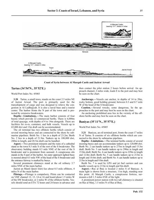
Sector 3. Coasts of Israel, Lebanon, and Syria 37Coast of Syria between Al Marqab Castle and Jazirat ArwadTartus (34˚54'N., 35˚52'E.)World Port Index No. 450033.20 Tartus, a small town, stands on the coast 2.5 miles NEof Jazirat Arwad. The port is primarily used for thetransshipment of cargo and was designed to relieve the congestionat Al Ladhiqiyah. It is also a naval base and a touristcenter. The harbor fronts the N part of the town and is protectedby extensive breakwaters.3.20 Depths—Limitations.—The main harbor consists of fourbasins which provide 22 commercial berths. There is 6,000mof total quayage, with depths of 4 to 14m alongside. There arefacilities for ro-ro, container, and bulk vessels. Vessels up to65,000 dwt and 13m draft can be accommodated.3.20 The oil terminal has two offshore berths which consist ofseveral mooring buoys and are connected to the shore by submarinepipelines. Berth No. 1 lies in a depth of 23.2m; BerthNo. 2 lies in a depth of 21.9m. Tankers up to 100,000 dwt,280m in length, and 20.5m draft can be handled.3.20 Aspect.—Two prominent minarets and the ruins of a cathedralstand in the town 0.3 mile S of the root of the S breakwater. Theobservatory building stands 0.3 mile NNE of the root of the Sbreakwater and is prominent from seaward. A conspicuous silostands in the S part of the harbor. An outer approach lighted buoyis moored about 0.5 mile NW of the head of the S breakwater andthe entrance fairway is marked by buoys.3.20 Several prominent chimneys stand at the oil refinery 3.7miles NNE of the main harbor.3.20 Jazirat an Maml (Ipsiri Islet) lies about 0.5 mile offshore, 4miles N of the main harbor.3.20 Pilotage.—Pilotage is compulsory. Pilots can be contactedon VHF channel 12, 13, 14 or 16 and board about 1.5 miles Wof the SW breakwater, or 2 miles W of the offshore berths. Vesselsshould send an ETA 72 hours and 24 hours in advance andthen contact the pilot station 2 hours before arrival. An approachchannel, 2 miles wide, leads E to the port and may bestbe seen on the chart.3.20 Anchorage.—Vessels can anchor, in depths of 14 to 20m,rocky bottom, good holding ground, between 0.3 and 0.7 mileW of the head of the S breakwater.3.20 Caution.—Several wrecks, some dangerous, lie the approachesto the port and may best be seen on the chart.3.20 An anchoring prohibited area lies in the vicinity of the offshoreberths and may best be seen on the chart.Baniyas (35˚11'N., 35˚57'E.)World Port Index No. 450053.21 Baniyas, an oil terminal port, fronts the coast 17 milesN of Tartus. It consists of six offshore berths which are connectedto the shore by submarine pipelines.3.21 Depths—Limitations.—The terminal berths consist of severalmooring buoys and can accommodate tankers up to 120,000 dwt.Berth No. 2 can handle tankers up to 275m in length and 15.5mdraft; Berth No. 3 can handle tankers up to 290m in length and15.8m draft; Berth No. 4 can handle tankers up to 229m in lengthand 12.8m draft; Berth No. 5 can handle tankers up to 213m inlength and 10.4m draft; and Berth No. 6 can handle tankers up to213m in length and 9.8m draft.3.21 Berth No. 7 is used by LPG and jet fuel carriers and canhandle vessels up to 213m in length and 8m draft.3.21 Aspect.—Ras al Burj is located 2 miles S of Baniyas. Amain light is shown from a structure, 11m high, standing nearthis point. Al Marqab Castle, a conspicuous fortress, surmountsa hill 1.5 miles ENE of the light.3.21 A prominent power station with two tall chimneys is situatedon Ras al Marj, 1.5 miles N of Ras al Burj.Pub. 132
- Page 1 and 2: PUB.132SAILING DIRECTIONS(ENROUTE)
- Page 3 and 4: Preface0.0 Pub. 132, Sailing Direct
- Page 5 and 6: ContentsHow to Keep this Book Corre
- Page 7 and 8: 0.0SECTOR LIMITS—PUB. 132Pub. 132
- Page 9: AbbreviationsThe following abbrevia
- Page 13 and 14: 3SECTOR 1COAST OF LIBYA1.0 Plan.—
- Page 15 and 16: Sector1.CoastofLibya 51.5 Pilotage.
- Page 17 and 18: Sector1.CoastofLibya 71.12 Caution.
- Page 19 and 20: Sector1.CoastofLibya 91.17 Jabal La
- Page 21 and 22: Sector1.CoastofLibya 111.21 Tukrah
- Page 23: Sector1.CoastofLibya 131.28 Aspect.
- Page 27 and 28: 17SECTOR 2COAST OF EGYPT2.0 Plan.
- Page 29 and 30: Sector2.CoastofEgypt 19a depth of 2
- Page 31 and 32: Sector2.CoastofEgypt 212.10 Several
- Page 33 and 34: Sector2.CoastofEgypt 232.17 Local v
- Page 35: Sector2.CoastofEgypt 25high, stands
- Page 39 and 40: 29SECTOR 3COASTS OF ISRAEL, LEBANON
- Page 41 and 42: Sector 3. Coasts of Israel, Lebanon
- Page 43 and 44: Sector 3. Coasts of Israel, Lebanon
- Page 45: Sector 3. Coasts of Israel, Lebanon
- Page 49: 4.CyprusPub. 1324.0Additional chart
- Page 52 and 53: 42 Sector4.Cyprusthe village. Ancho
- Page 54 and 55: 44 Sector4.Cyprus4.10 A conspicuous
- Page 56 and 57: 46 Sector4.Cyprus4.18 Kakoskaliou I
- Page 59 and 60: 49SECTOR 5SOUTH COAST OF TURKEY—K
- Page 61 and 62: Sector 5. South Coast of Turkey—K
- Page 63 and 64: Sector 5. South Coast of Turkey—K
- Page 65 and 66: Sector 5. South Coast of Turkey—K
- Page 67: Sector 5. South Coast of Turkey—K
- Page 71 and 72: 61SECTOR 6RODHOS (RHODES), NISOS KA
- Page 73 and 74: Sector 6. Rodhos (Rhodes), Nisos Ka
- Page 75 and 76: Sector 6. Rodhos (Rhodes), Nisos Ka
- Page 77 and 78: Sector 6. Rodhos (Rhodes), Nisos Ka
- Page 79 and 80: Sector 6. Rodhos (Rhodes), Nisos Ka
- Page 81 and 82: Sector 6. Rodhos (Rhodes), Nisos Ka
- Page 83: 7.West Coast of Greece and Dhiorix
- Page 86 and 87: 76 Sector 7. West Coast of Greece a
- Page 88 and 89: 78 Sector 7. West Coast of Greece a
- Page 90 and 91: 80 Sector 7. West Coast of Greece a
- Page 93: 8.West Coasts of Greece and Albania
- Page 96 and 97:
86 Sector 8. West Coasts of Greece
- Page 98 and 99:
88 Sector 8. West Coasts of Greece
- Page 100 and 101:
90 Sector 8. West Coasts of Greece
- Page 102 and 103:
92 Sector 8. West Coasts of Greece
- Page 105:
9.Coasts of Albania, Montenegro, an
- Page 108 and 109:
98 Sector 9. Coasts of Albania, Mon
- Page 110 and 111:
100 Sector 9. Coasts of Albania, Mo
- Page 112 and 113:
102 Sector 9. Coasts of Albania, Mo
- Page 114 and 115:
104 Sector 9. Coasts of Albania, Mo
- Page 117:
10.Coasts of Croatia and Bosnia-Her
- Page 120 and 121:
110 Sector 10. Coasts of Croatia an
- Page 122 and 123:
112 Sector 10. Coasts of Croatia an
- Page 124 and 125:
114 Sector 10. Coasts of Croatia an
- Page 126 and 127:
116 Sector 10. Coasts of Croatia an
- Page 128 and 129:
118 Sector 10. Coasts of Croatia an
- Page 131 and 132:
121SECTOR 11COAST OF CROATIA—RT M
- Page 133 and 134:
Sector 11. Coast of Croatia—Rt Mo
- Page 135 and 136:
Sector 11. Coast of Croatia—Rt Mo
- Page 137 and 138:
Sector 11. Coast of Croatia—Rt Mo
- Page 139 and 140:
Sector 11. Coast of Croatia—Rt Mo
- Page 141 and 142:
Sector 11. Coast of Croatia—Rt Mo
- Page 143:
Sector 11. Coast of Croatia—Rt Mo
- Page 147 and 148:
137SECTOR 12COAST OF GREECE—AKRA
- Page 149 and 150:
Sector 12. Coast of Greece—Akra T
- Page 151 and 152:
Sector 12. Coast of Greece—Akra T
- Page 153 and 154:
Sector 12. Coast of Greece—Akra T
- Page 155:
13.Coast of Greece—Saronikos Kolp
- Page 158 and 159:
148 Sector 13. Coast of Greece—Sa
- Page 160 and 161:
150 Sector 13. Coast of Greece—Sa
- Page 162 and 163:
152 Sector 13. Coast of Greece—Sa
- Page 164 and 165:
154 Sector 13. Coast of Greece—Sa
- Page 167:
14.Greece—Kikladhes Nisoi15714.0A
- Page 170 and 171:
160 Sector14.Greece—KikladhesNiso
- Page 172 and 173:
162 Sector14.Greece—KikladhesNiso
- Page 174 and 175:
164 Sector14.Greece—KikladhesNiso
- Page 176 and 177:
166 Sector14.Greece—KikladhesNiso
- Page 178 and 179:
168 Sector14.Greece—KikladhesNiso
- Page 181:
15.Greece—Channels West of Nisos
- Page 184 and 185:
174 Sector 15. Greece—Channels We
- Page 186 and 187:
176 Sector 15. Greece—Channels We
- Page 188 and 189:
178 Sector 15. Greece—Channels We
- Page 191:
16.Greece—Nisoi Vorioi Sporadhes
- Page 194 and 195:
184 Sector 16. Greece—Nisoi Vorio
- Page 196 and 197:
186 Sector 16. Greece—Nisoi Vorio
- Page 199:
17.Coast of Greece—Thermaikos Kol
- Page 202 and 203:
192 Sector 17. Coast of Greece—Th
- Page 204 and 205:
194 Sector 17. Coast of Greece—Th
- Page 206 and 207:
196 Sector 17. Coast of Greece—Th
- Page 209:
18.Greece—Dhodhekanisos and South
- Page 212 and 213:
202 Sector 18. Greece—Dhodhekanis
- Page 214 and 215:
204 Sector 18. Greece—Dhodhekanis
- Page 216 and 217:
206 Sector 18. Greece—Dhodhekanis
- Page 219:
19.West Coast of Turkey—Samos Str
- Page 222 and 223:
212 Sector 19. West Coast of Turkey
- Page 224 and 225:
214 Sector 19. West Coast of Turkey
- Page 226 and 227:
216 Sector 19. West Coast of Turkey
- Page 229:
20.The Dardanelles Approach and Adj
- Page 232 and 233:
222 Sector 20. The Dardanelles Appr
- Page 234 and 235:
224 Sector 20. The Dardanelles Appr
- Page 236 and 237:
226 Sector 20. The Dardanelles Appr
- Page 238 and 239:
228 Sector 20. The Dardanelles Appr
- Page 240 and 241:
230 GlossariesArabicARABICEnglishAR
- Page 242 and 243:
232 GlossariesARABICEnglishARABICEn
- Page 244 and 245:
234 GlossariesHebrewHEBREWEnglishHE
- Page 246 and 247:
236 GlossariesTURKISHEnglishTURKISH
- Page 249 and 250:
How to use the Index—Gazetteer239
- Page 251 and 252:
Index—Gazetteer 241PositionSec.˚
- Page 253 and 254:
Index—Gazetteer 243PositionSec.˚
- Page 255 and 256:
Index—Gazetteer 245PositionSec.˚
- Page 257 and 258:
Index—Gazetteer 247PositionSec.˚