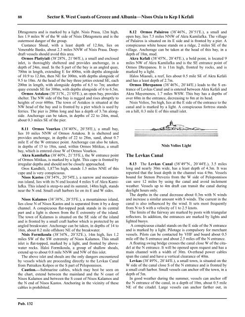
88 Sector 8. West Coasts of Greece and Albania—Nisos Oxia to Kep I KefaliDhragonera and is marked by a light. Nisis Prasa, 12m high,lies 1.9 miles W of the W side of Nisis Dhragonera and is theoutermost danger of the group.8.10 Custance Shoal, with a least depth of 12.8m, lies onVenerable Banks, about 2.3 miles NNW of Nisis Prasa. Deepdraftvessels should avoid this area.8.10 Ormos Platiyiali (38˚28'N., 21˚06'E.), a small and enclosedinlet, is thoroughly sheltered and provides anchorage, in adepth of 24m, mud. In the S part of the bay is an angled quay,700m in length, extending E for 400m, with depths alongsideof 10.9 to 12.8m, then NE for 300m, with depths alongside of9.5 to 10m. At the head of the bay three jetties extend SE, each200m in length, with alongside depths of 6.5 to 7m; anotherquay extends SE for 300m, with depths alongside of 6 to 6.5m.8.10 Ormos Astakou (38˚31'N., 21˚05'E.), an open bay, providesshelter. The NW side of the bay is rugged and rises abruptly toheights of over 600m. The town of Astakos is situated at theNW head of the bay and is fronted by a pier which is used byferries. The pier is 200m long and has a depth of 3.7m alongside.Anchorage can be taken, in depths of 22 to 24m, mud,about 0.3 miles SE of the pier.8.11 Ormos Vourkos (38˚40'N., 20˚58'E.), a small bay,lies 10 miles NNW of Ormos Astakou. It is sheltered andprovides anchorage, in depths of 22 to 28m, sand, about 0.7mile E of the W entrance point. Anchorage can also be taken,in depths of 15 to 18m, sand, within Ormos Mitikas, a smallbay, which is entered close W of Ormos Vourkos.8.11 Akra Kamilafka (38˚40'N., 21˚55'E.), the W entrance pointof Ormos Mitikas, is marked by a light. This cape is fronted byirregular depths and should not be closely approached.8.11 Oros Kandhili, 1,877m high, stands 1.5 miles NNE of thiscape and is very conspicuous.8.11 Nisos Kastos (38˚34'N., 20˚54'E.), a narrow and mountainousisland, lies with its N end located 4 miles S of Akra Kamilafka.This island is steep-to and its summit, 148m high, standsnear the N end. Small craft harbors lie on its E and W sides.8.11 Nisos Kalamos (38˚38'N., 20˚55'E.), a mountainous island,lies close N of Nisos Kastos and is separated from it by a deepchannel. A conspicuous flat-topped peak stands in its centralpart and a light is shown from the E extremity of the island.The town of Kalamos is situated on the SE side of the islandand is fronted by a small craft harbor which is protected by anangled breakwater. Anchorage can be taken, in depths of 14 to16m, about 0.2 mile offshore NE of the breakwater.8.11 Nisis Formikoula (38˚34'N., 20˚52'E.), 14m high, lies 1.2miles SW of the SW extremity of Nisos Kalamos. This smallislet is flat-topped, marked by a light, and fronted by abovewaterrocks. Ifaloi Formikoula, a group of shallow shoals,extend up to about 0.8 mile NNW and NW of this islet.8.11 The above islet and shoals are the only dangers encounteredby vessels which are proceeding directly to the Levkas Canalfrom Patraikos Kolpos or the S part of Peloponnisos.8.11 Caution.—Submarine cables, which may best be seen onthe chart, extend between the mainland and the N coast ofNisos Kalamos and between the S coast of Nisos Kalamos andthe N end of Nisos Kastos. Anchoring in the vicinity of thesecables is prohibited.8.12 Ormos Palairou (38˚46'N., 20˚51'E.), a small andopen bay, lies 7.5 miles NNW of Akra Kamilafka. The villageof Palairos is situated on its E side and is fronted by a pier. Aconspicuous white house stands on a ridge, 2 miles SE of thevillage. Anchorage can be taken at the head of this bay, in adepth of 18m, mud.8.12 Akra Kefali (38˚45'N., 20˚45'E.), a bold point, is located 9miles NW of Akra Kamilafka and is the SE entrance point ofOrmos Dhrepanou. It is 11m high, fronted by rocks, and ismarked by a light.8.12 Ifalos Miaouli, a reef, lies about 0.5 mile SE of Akra Kefaliand has a least depth of 2.7m.8.12 Ormos Dhrepanou (38˚46'N., 20˚44'E.) leads to the S entranceof Levkas Canal and is entered between Akra Kefali andAkra Mayemenos, 1.7 miles WSW. This bay has a depths ofover 60m in the entrance, decreasing to 8m at its head.8.12 Nisis Volios, 5m high, lies at the E side of the entrance to thecanal and is marked by a light. A conspicuous fortress standson a hill, 0.3 mile E of this small islet.The Levkas CanalNisis Volios Light8.13 The Levkas Canal (38˚49”N., 20˚44'E.), 3.5 mileslong and nearly 30m wide, has a least depth of 4.3m. It wasreported that the least depth in the channel was 4.9m. Vesselsbound for Stenon Prevezis from the W side of Peloponnisoscan save 12 miles by using the canal and avoid inclementweather. Vessels up to 4m draft can transit the canal duringdaylight hours only.8.13 The depths in the canal decrease about 0.3m with N windsand increase a similar amount with S winds. The current in thecanal is also influenced by the wind. It sets most frequentlyfrom N to S with a velocity of 1 to 2.5 knots.8.13 The limits of the fairway are marked by posts with triangularreflectors. In addition, the entrances are marked by lights andlighted buoys.8.13 A conspicuous citadel stands on the E side of the N entranceand is marked by a light. Pilotage is compulsory for merchantvessels. Pilots can be contacted by VHF and board about 0.5mile off the S entrance and about 2.5 miles off the N entrance.8.13 A floating swing bridge crosses the canal close W of the citadelat the N entrance. It will be opened upon request and has amain channel with a width of 30m. Overhead power cablesspan the canal and have a vertical clearance of 40m.8.13 Levkas (38˚49'N., 20˚44'E.), a small town, is situated on theW side of the canal close S of the N entrance and is fronted bya small craft harbor. Small vessels can anchor off the town, in adepth of 5m.8.13 In good weather during the summer, vessels can anchor offthe N entrance of the canal, in a depth of 10m, about 0.5 mileNE of the citadel. Large vessels can anchor farther out, inPub. 132
Sector 8. West Coasts of Greece and Albania—Nisos Oxia to Kep I Kefali 89Light on the citadel at the N end of the Levkas Canaldepths of 16 to 18m. This roadstead is exposed to N and NWwinds which usually raise a heavy sea.8.13 Vessels may also anchor on the W side of the S entrance ofthe canal. This roadstead provides good holding ground, in adepth of 12m, mud and weeds, about 150m offshore.8.13 Caution.—Anchoring is prohibited within the fairway of thecanal.8.13 The N entrance of the canal is reported to be subject to silting.Stenon Prevezis8.14 Stenon Prevezis (38˚55'N., 20¢44'E.), a narrow andtortuous channel, leads into Amvrakikos Kolpos (Gulf ofAmvrakia). It is entered between Akra Skilla (Akra Kokala), alow promontory, and an unnamed point, 1.2 miles NW, whichis surmounted by the ruins of Fort Pandokrator.8.14 An extensive bar, consisting of coarse sand and gravelcovered with weed, lies across the entrance to this channel.8.14 Ifalavlax Alexandrou Chrisanthi, a dredged fairway, leadsENE across the bar and into depths of more than 11m. Thisfairway has a width of 60m and is dredged to a depth of 8.8m.It is indicated by a lighted range and marked by lighted buoyswhich may best be seen on the chart.8.15 Preveza (38˚57'N., 20˚45'E.) (World Port Index No.41730), a small town, stands on the W side of Ormos Prevezis, abay, which lies at the inner end of Stenon Prevezis. This town isfronted by a small harbor which is protected by an angled breakwater.Large vessels may anchor in the harbor to work cargo.8.15 Tides—Currents.—The currents in Stenon Prevezis,although mainly tidal, are irregular and strong. The ebbcurrent, when accompanied by a N wind, sometimes attains arate of 3.5 knots.8.15 The tidal currents usually set along the axis of the channel inthe central part. They set E and W at the W end of the channeland NE and SW at the E end. Vessels entering the channel withthe current on their port sides will have the current on theirstarboard sides when leaving it, and vice versa.8.15 Depths—Limitations.—Entry is controlled by the dredgedchannel which leads through Stenon Prevezis. The main commercialfacilities include a pier, 250m long, with a depth of13m alongside; a pier, 100m long, with depths of 11 to 13malongside; a pier, 110m long, with depths of 6 to 12m alongside;and a pier, 100m long, with depths of 4 to 9m alongside.Vessels up to 165m in length and 8.5m draft can be accommodated.8.15 Aspect.—Fort Aktion, white and conspicuous, stands on theE side of the channel, 1.4 miles NE of Akra Skilla. Fort AyiosYeoryios, consisting of high buildings, is situated in the N partof Preveza, 1 mile NNW of Fort Aktion.8.15 Pilotage.— Pilotage is not compulsory for foreign merchantvessels. The port can be contacted on VHF channel 12 or 18.The pilot boards about 1 mile seaward of the outer lightedchannel buoys. Vessels must inform the harbor authority atPreveza before entering or leaving Stenon Prevezis.8.15 Anchorage.—Vessels awaiting a pilot may anchor, in depthsof 14 to 16m, about 1 mile SW of the ruins of Fort Pandokrator.Larger vessels, or those intending to remain for any length oftime, should anchor farther out, in a depth of 20m, mud.8.15 Anchorage can be taken in the harbor, in a depth of 12m,mud, about 0.2 mile off the center of the town.8.15 Caution.—Several submarine cables and pipelines, whichmay best be seen on the chart, lie across Stenon Prevezis. Anchorageis prohibited in their vicinity.8.15 Ferries frequently cross Stenon Prevezis.Amvrakikos Kolpos8.16 Amvrakikos Kolpos (38˚58'N., 20˚58'E.), an extensivelandlocked body of water, is entered N of Akra Akra,which is located at the NE end of Stenon Prevezis. A buoymarks the extreme N boundary of shoals NE of Cape AkraAkra. Caution should be exercised while navigating in this areadue to numerous shoals and depths less than 5m in the vicinityof the N coast of Cape Akra Akra. The shoreline of this gulf isvery irregular, being indented by numerous coves and smallbays. The S and E coasts are fairly steep-to, but the N coast ofthe gulf is formed by an irregular stretch of swampy land andlagoons. Several villages stand along the shores, but are only oflocal importance.8.16 The W end of the gulf is divided by a large peninsula thatextends in a SE direction from the shore to the N of Preveza.The main part of the gulf is entered between this peninsula andAkra Panayia, the outer extremity of a bold and steep tongue ofland, which extends N from the S shore.8.16 Ormos Salaoras (39˚01'N., 20˚48'E.), a large and fairlydeep bay, lies in the NW part of the gulf. A coastal bank, withdepths of less than 8m, fronts the N shore of this bay and extendsup to 2 miles S. Akra Salaora, marked by a light, is the Sextremity of an island-like peninsula which extends from the Nshore. Anchorage can be taken, in depths of 6 to 7m, about 0.7mile S of this point.8.16 The N coast of the gulf to the E of Ormos Salaoras is frontedalmost extensively by a series of projecting shoals. Inland, thelow and swampy shore is intersected by several rivers andcanals of no commercial significance.8.16 Ormos Koprainis (39˚01'N., 21˚06'E.), an open bay, lies inthe NE corner of the gulf. The small village of Aliki is situatedin its NW part and the village of Menidi, a resort, is situated inits NE corner. Anchorage can be obtained, in depths of 12 to18m, mud, about 0.7 mile NE of the W entrance point of thebay.Pub. 132
- Page 1 and 2:
PUB.132SAILING DIRECTIONS(ENROUTE)
- Page 3 and 4:
Preface0.0 Pub. 132, Sailing Direct
- Page 5 and 6:
ContentsHow to Keep this Book Corre
- Page 7 and 8:
0.0SECTOR LIMITS—PUB. 132Pub. 132
- Page 9:
AbbreviationsThe following abbrevia
- Page 13 and 14:
3SECTOR 1COAST OF LIBYA1.0 Plan.—
- Page 15 and 16:
Sector1.CoastofLibya 51.5 Pilotage.
- Page 17 and 18:
Sector1.CoastofLibya 71.12 Caution.
- Page 19 and 20:
Sector1.CoastofLibya 91.17 Jabal La
- Page 21 and 22:
Sector1.CoastofLibya 111.21 Tukrah
- Page 23:
Sector1.CoastofLibya 131.28 Aspect.
- Page 27 and 28:
17SECTOR 2COAST OF EGYPT2.0 Plan.
- Page 29 and 30:
Sector2.CoastofEgypt 19a depth of 2
- Page 31 and 32:
Sector2.CoastofEgypt 212.10 Several
- Page 33 and 34:
Sector2.CoastofEgypt 232.17 Local v
- Page 35:
Sector2.CoastofEgypt 25high, stands
- Page 39 and 40:
29SECTOR 3COASTS OF ISRAEL, LEBANON
- Page 41 and 42:
Sector 3. Coasts of Israel, Lebanon
- Page 43 and 44:
Sector 3. Coasts of Israel, Lebanon
- Page 45 and 46:
Sector 3. Coasts of Israel, Lebanon
- Page 47 and 48: Sector 3. Coasts of Israel, Lebanon
- Page 49: 4.CyprusPub. 1324.0Additional chart
- Page 52 and 53: 42 Sector4.Cyprusthe village. Ancho
- Page 54 and 55: 44 Sector4.Cyprus4.10 A conspicuous
- Page 56 and 57: 46 Sector4.Cyprus4.18 Kakoskaliou I
- Page 59 and 60: 49SECTOR 5SOUTH COAST OF TURKEY—K
- Page 61 and 62: Sector 5. South Coast of Turkey—K
- Page 63 and 64: Sector 5. South Coast of Turkey—K
- Page 65 and 66: Sector 5. South Coast of Turkey—K
- Page 67: Sector 5. South Coast of Turkey—K
- Page 71 and 72: 61SECTOR 6RODHOS (RHODES), NISOS KA
- Page 73 and 74: Sector 6. Rodhos (Rhodes), Nisos Ka
- Page 75 and 76: Sector 6. Rodhos (Rhodes), Nisos Ka
- Page 77 and 78: Sector 6. Rodhos (Rhodes), Nisos Ka
- Page 79 and 80: Sector 6. Rodhos (Rhodes), Nisos Ka
- Page 81 and 82: Sector 6. Rodhos (Rhodes), Nisos Ka
- Page 83: 7.West Coast of Greece and Dhiorix
- Page 86 and 87: 76 Sector 7. West Coast of Greece a
- Page 88 and 89: 78 Sector 7. West Coast of Greece a
- Page 90 and 91: 80 Sector 7. West Coast of Greece a
- Page 93: 8.West Coasts of Greece and Albania
- Page 96 and 97: 86 Sector 8. West Coasts of Greece
- Page 100 and 101: 90 Sector 8. West Coasts of Greece
- Page 102 and 103: 92 Sector 8. West Coasts of Greece
- Page 105: 9.Coasts of Albania, Montenegro, an
- Page 108 and 109: 98 Sector 9. Coasts of Albania, Mon
- Page 110 and 111: 100 Sector 9. Coasts of Albania, Mo
- Page 112 and 113: 102 Sector 9. Coasts of Albania, Mo
- Page 114 and 115: 104 Sector 9. Coasts of Albania, Mo
- Page 117: 10.Coasts of Croatia and Bosnia-Her
- Page 120 and 121: 110 Sector 10. Coasts of Croatia an
- Page 122 and 123: 112 Sector 10. Coasts of Croatia an
- Page 124 and 125: 114 Sector 10. Coasts of Croatia an
- Page 126 and 127: 116 Sector 10. Coasts of Croatia an
- Page 128 and 129: 118 Sector 10. Coasts of Croatia an
- Page 131 and 132: 121SECTOR 11COAST OF CROATIA—RT M
- Page 133 and 134: Sector 11. Coast of Croatia—Rt Mo
- Page 135 and 136: Sector 11. Coast of Croatia—Rt Mo
- Page 137 and 138: Sector 11. Coast of Croatia—Rt Mo
- Page 139 and 140: Sector 11. Coast of Croatia—Rt Mo
- Page 141 and 142: Sector 11. Coast of Croatia—Rt Mo
- Page 143: Sector 11. Coast of Croatia—Rt Mo
- Page 147 and 148: 137SECTOR 12COAST OF GREECE—AKRA
- Page 149 and 150:
Sector 12. Coast of Greece—Akra T
- Page 151 and 152:
Sector 12. Coast of Greece—Akra T
- Page 153 and 154:
Sector 12. Coast of Greece—Akra T
- Page 155:
13.Coast of Greece—Saronikos Kolp
- Page 158 and 159:
148 Sector 13. Coast of Greece—Sa
- Page 160 and 161:
150 Sector 13. Coast of Greece—Sa
- Page 162 and 163:
152 Sector 13. Coast of Greece—Sa
- Page 164 and 165:
154 Sector 13. Coast of Greece—Sa
- Page 167:
14.Greece—Kikladhes Nisoi15714.0A
- Page 170 and 171:
160 Sector14.Greece—KikladhesNiso
- Page 172 and 173:
162 Sector14.Greece—KikladhesNiso
- Page 174 and 175:
164 Sector14.Greece—KikladhesNiso
- Page 176 and 177:
166 Sector14.Greece—KikladhesNiso
- Page 178 and 179:
168 Sector14.Greece—KikladhesNiso
- Page 181:
15.Greece—Channels West of Nisos
- Page 184 and 185:
174 Sector 15. Greece—Channels We
- Page 186 and 187:
176 Sector 15. Greece—Channels We
- Page 188 and 189:
178 Sector 15. Greece—Channels We
- Page 191:
16.Greece—Nisoi Vorioi Sporadhes
- Page 194 and 195:
184 Sector 16. Greece—Nisoi Vorio
- Page 196 and 197:
186 Sector 16. Greece—Nisoi Vorio
- Page 199:
17.Coast of Greece—Thermaikos Kol
- Page 202 and 203:
192 Sector 17. Coast of Greece—Th
- Page 204 and 205:
194 Sector 17. Coast of Greece—Th
- Page 206 and 207:
196 Sector 17. Coast of Greece—Th
- Page 209:
18.Greece—Dhodhekanisos and South
- Page 212 and 213:
202 Sector 18. Greece—Dhodhekanis
- Page 214 and 215:
204 Sector 18. Greece—Dhodhekanis
- Page 216 and 217:
206 Sector 18. Greece—Dhodhekanis
- Page 219:
19.West Coast of Turkey—Samos Str
- Page 222 and 223:
212 Sector 19. West Coast of Turkey
- Page 224 and 225:
214 Sector 19. West Coast of Turkey
- Page 226 and 227:
216 Sector 19. West Coast of Turkey
- Page 229:
20.The Dardanelles Approach and Adj
- Page 232 and 233:
222 Sector 20. The Dardanelles Appr
- Page 234 and 235:
224 Sector 20. The Dardanelles Appr
- Page 236 and 237:
226 Sector 20. The Dardanelles Appr
- Page 238 and 239:
228 Sector 20. The Dardanelles Appr
- Page 240 and 241:
230 GlossariesArabicARABICEnglishAR
- Page 242 and 243:
232 GlossariesARABICEnglishARABICEn
- Page 244 and 245:
234 GlossariesHebrewHEBREWEnglishHE
- Page 246 and 247:
236 GlossariesTURKISHEnglishTURKISH
- Page 249 and 250:
How to use the Index—Gazetteer239
- Page 251 and 252:
Index—Gazetteer 241PositionSec.˚
- Page 253 and 254:
Index—Gazetteer 243PositionSec.˚
- Page 255 and 256:
Index—Gazetteer 245PositionSec.˚
- Page 257 and 258:
Index—Gazetteer 247PositionSec.˚