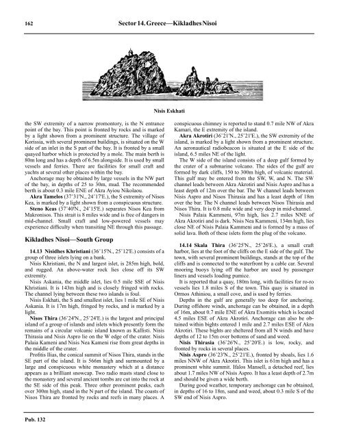
162 Sector14.Greece—KikladhesNisoiNisis Eskhatithe SW extremity of a narrow promontory, is the N entrancepoint of the bay. This point is fronted by rocks and is markedby a light shown from a prominent structure. The village ofKorissia, with several prominent buildings, is situated on the Wside of an inlet in the S part of the bay. It is fronted by a smallquayed harbor which is protected by a mole. The main berth is80m long and has a depth of 6.5m alongside. It is used by smallvessels and ferries. There are facilities for small craft andyachts at several other places within the bay.14.12 Anchorage may be obtained by large vessels in the NW partof the bay, in depths of 25 to 30m, mud. The recommendedberth is about 0.3 mile ENE of Akra Ayiou Nikolaou.14.12 Akra Tamelos (37˚31'N., 24˚17'E.), the S extremity of NisosKea, is marked by a light shown from a conspicuous structure.14.12 Steno Keas (37˚40'N., 24˚15'E.) separates Nisos Kea fromMakronisos. This strait is 8 miles wide and is free of dangers inmid-channel. Small craft and low-powered vessels mayexperience difficulty when transiting NE through this passage.Kikladhes Nisoi—South Group14.13 Nisidhes Khristiani (36˚15'N., 25˚12'E.) consists of agroup of three islets lying on a bank.14.13 Nisis Khristiani, the N and largest islet, is 285m high, bold,and rugged. An above-water rock lies close off its SWextremity.14.13 Nisis Askania, the middle islet, lies 0.5 mile SSE of NisisKhristiani. It is 143m high and is closely fringed with rocks.The channel lying between these two islands is foul.14.13 Nisis Eskhati, the S and smallest islet, lies 1 mile SE of NisisAskania. It is 17m high, fringed by rocks, and is marked by alight.14.13 Nisos Thira (36˚24'N., 25˚24'E.) is the largest and principalisland of a group of islands and islets which presently form theremains of a circular volcanic island known as Kallisti. NisisThirasia and Nisis Aspro lie on the W edge of the crater. NisisPalaia Kameni and Nisis Nea Kameni rise from great depths inthe middle of the crater.14.13 Profitis Ilias, the conical summit of Nisos Thira, stands in theSE part of the island. It is 566m high and surmounted by alarge and conspicuous white monastery which at a distanceappears as a brilliant snowcap. Two radio masts stand close tothe monastery and several ancient tombs are cut into the rock atthe SE side of this peak. Three other prominent peaks, eachover 300m high, stand in the N part of the island. The coasts ofNisos Thira are fronted by rocks and reefs in many places. Aconspicuous chimney is reported to stand 0.7 mile NW of AkraKamari, the E extremity of the island.14.13 Akra Akrotiri (36˚21'N., 25˚21'E.), the SW extremity of theisland, is marked by a light shown from a prominent structure.An aeronautical radiobeacon is situated at the E side of theisland, 6.5 miles NE of the light.14.13 The W side of the island consists of a deep gulf formed bythe crater of a submarine volcano. The sides of the gulf areformed by dark cliffs, 150 to 300m high, of volcanic material.This gulf may be entered from the SW, W, and N. The SWchannel leads between Akra Akrotiri and Nisis Aspro and has aleast depth of 12m over the bar. The W channel leads betweenNisis Aspro and Nisos Thirasia and has a least depth of 18mover the bar. The N channel leads between Nisos Thirasia andNisos Thira. It is 0.8 mile wide and very deep in mid-channel.14.13 Nisis Palaia Kammeni, 97m high, lies 2.7 miles NNE ofAkra Akrotiri and is dark. Nisis Nea Kammeni, 134m high, liesclose NE of Nisis Palaia Kammeni and is formed by a mass ofsolid lava. Both of these islets form the plug of the volcano.14.14 Skala Thira (36˚25'N., 25˚26'E.), a small craftharbor, lies at the foot of the cliffs on the E side of the gulf. Thetown, with several prominent buildings, stands at the top of thecliffs and is connected to the waterfront by a cable car. Severalmooring buoys lying off the harbor are used by passengerliners and vessels loading pumice.14.14 It is reported that a quay, 180m long, with facilities for ro-rovessels lies 1.8 miles S of the town. This quay is situated inOrmos Athiniou, a small cove, and is used by ferries.14.14 Depths in the gulf are generally too deep for anchoring.During offshore winds, anchorage can be obtained, in a depthof 16m, about 0.7 mile ENE of Akra Exomitis which is located4.5 miles ESE of Akra Akrotiri. Anchorage can also be obtainedwithin bights entered 1 mile and 2.7 miles ESE of AkraAkrotiri. These bights are sheltered from all N winds and havedepths of 12 to 15m over bottoms of sand and weed.14.14 Nisis Thirasia (36˚26'N., 25˚20'E.) is low, rocky, andfronted by rocks in several places.14.14 Nisis Aspro (36˚23'N., 25˚21'E.), fronted by shoals, lies 1.6miles NNW of Akra Akrotiri. This islet is 61m high and has aprominent white summit. Ifalos Mansell, a detached reef, liesabout 1.7 miles NW of Nisis Aspro. It has a least depth of 2.7mand should be given a wide berth.14.14 During good weather, temporary anchorage can be obtained,in depths of 16 to 18m, sand and weed, about 0.3 mile S of theSW end of Nisis Aspro.Pub. 132
Sector14.Greece—KikladhesNisoi 16314.14 Ifalos Kolombos (36˚31'N., 25˚28'E.), an isolated shoal, lies3.5 miles NE of Akra Kolomvos, the NE extremity of NisosThira. It has a least depth of 18m, consists of cinders, and is theremains of a volcanic island.14.15 Nisos Anafi (36˚22'N., 25˚47'E.) is hilly, barren, andfronted by shoals and rocks. Ayios Elias, 579m high, is thesummit of the island and stands close N of the center.14.15 The village of Anafi is situated close inland at the middle ofthe S coast of the island. It is fronted by a small craft harborwhich is protected from the W by a breakwater extending200m S to a small islet. A jetty in the harbor is used by localferries and fishing boats. Small craft can anchor, in a depth of3m, sand, good holding ground, off the harbor.14.15 Vrakhonisis Ftena, 15m high, and Vrakhonisis Flini, 18mhigh, are two small islets which lie 2.3 miles SSE of the harborand are surrounded by rocks and foul ground.14.15 Nisis Pakhia (36˚16'N., 25˚50'E.), a small island 223m high,lies 5 miles SSW of the E extremity of Nisos Anafi.14.15 Nisis Makra (36˚16'N., 25˚53'E.), another small island, lies5 miles SSE of the E extremity of Nisos Anafi. It is 128m highand fronted by rocks and shoals which extend up to 1 mileseaward.14.15 Caution.—A submarine cable, which may best be seen onthe chart, extends between Nisos Thira and Nisis Thirasia andanchoring is prohibited in its vicinity.Kikladhes Nisoi—South Central Group14.16 Nisos Folegandros (36˚38'N., 24˚54'E.) is a barrenand hilly island with high and precipitous coasts. It consists oftwo parts which are joined by a narrow neck. Korifi AyiosEleutherios, the summit of the island, is 415m high and standsin the S part. The NW part of the island is 311m high.14.16 Ormos Vathi, a small bay, indents the SW side of the islandand is open to the SW. It is sometimes used as a refuge in Nand E winds. Anchorage can be taken, in a depth of 15m, sandand weed, about 300m SSW of a small promontory locatednear the head of the bay. A reef, with a depth of 3.5m, liesmidway between this berth and the promontory. Local knowledgeis advised. A light is shown from a prominent structurestanding on the S coast of the island, 2 miles SE of the Wextremity.14.16 Karavostasi (36˚37'N., 24˚57'E.), a settlement, is situated atthe head of Ormos Karavostasi at the SE end of the island. Thissettlement is fronted by a small craft harbor and the village ofFolegandros stands 1.7 miles NW of it. A small islet, with achapel situated near its center, lies close offshore in the Sapproach to the bay and two small islets, fronted by shoals, lieclose offshore in the N approach. Small vessels can anchor inthe center of the bay, in a depth of 12m. Local knowledge isrequired.14.16 The passage between Nisos Folegandros and Nisos Sikinosis partly obstructed by islets and shoals, but depths in most ofthe narrow channels are deep. Vrakhonisidhes Adhelfia, consistingof two small islets, lies 1.5 miles NE of the SE extremityof Nisos Folegandros and is fronted by rocks. The Eislet is 93m high and the W islet is 55m high. A detachedshoal, with a least depth of 4.5m, lies 0.4 mile NW of the Wislet.14.16 Nisis Kardhiotissa, 154m high, lies 1.6 miles NE ofVrakhonisidhes Adhelfia and is the largest islet in the passage.Nisis Kaloyeros, a small islet, lies 1.1 miles E of the NE end ofNisis Kardhiotissa and 0.3 mile SW of the SW end of NisosSikinos. An above-water rock lies close off the NW end of thisislet. A shoal, with a least depth of 6.7m, lies in mid-channelabout 0.6 mile WSW of Nisis Kaloyeros. This shoal is usuallyindicated by a sudden change in the color of the water andvessels are advised to pass to the W of it.14.17 Nisos Sikinos (36˚41'N., 25˚07'E.), 552m high, is arocky and barren island which is fronted by small islets androcks in several places. Ormos Skala, a small bay, indents themiddle of the SE coast and a light is shown from the E entrancepoint. A settlement stands around the bay and is fronted by asmall craft harbor. Small craft can anchor in the center of thebay, in a depth of 6m.14.17 Stenon Sikinou Iou (36˚43'N., 25˚13'E.) separates the NEextremity of Nisos Sikinos from the W extremity of Nisos Ios.This strait is 3 miles wide, deep, and clear.14.17 Nisos Ios (36˚44'N., 25˚20'E.) is a rocky and mountainousisland. Korifi Pirgos, the summit, is 713m high and stands nearthe center. Some of the land is fertile and cultivated with olivegroves and orchards. The shores of the island are fronted inplaces by several small islets and rocks and vessels should stayat least 1 mile from the coast.14.17 Ormos Manganari, a small bay, indents the S side of theisland and is open to the S. It is entered between AkraAkhladhi, the S extremity of the island, and Akra Pirgari, 1.2miles ENE. This bay provides anchorage, in depths of 10 to20m, firm sand. The best berth is in a depth of 11m about 250mSSW of Nisis Pori, an islet lying at the head.14.17 Ormos Tris Klisies, a small bay, is entered 1.5 miles NNE ofOrmos Manganari and offers shelter in N and W winds. Vesselswith local knowledge can anchor, in a depth of 20m, mudand sand, about 0.3 mile W of Akra Louka, the N entrancepoint of the bay.14.17 Ormos Kalamos, on the SE side of the island, is entered 2miles N of Ormos Tris Klisies. Temporary anchorage, duringW winds, can be taken, in depths of 10 to 18m, in the middle ofthis bay, but the shores are fringed with rocks.14.18 Ormos Iou (36˚43'N., 25˚16'E.) indents the NW partof the island and a small quayed harbor lies on its E side. Asmall promontory projects from the head of this bay, close N ofthe harbor, and is surmounted by several prominent buildings.The town of Ios stands 0.5 mile E of the harbor. There aredepths of 2 to 6m alongside the quays which are mostly usedby small craft, yachts, and ferries. Small vessels can anchorwithin the bay, in depths of 10 to 20m. Local knowledge isadvised. Akra Fanari, the W entrance point of the bay, ismarked by a light and fronted by a reef. A prominent smallchurch stands 0.7 mile NE of the light.14.18 Nisis Anidhros (36˚38'N., 25˚41'E.), an uninhabited islet,lies 15.7 miles E of the S extremity of Nisos Iou and is 194mhigh. A rock, almost awash, lies 0.7 mile SW of its S end and aconical rock lies close off its SE end.14.18 Nisos Amorgos (36˚50'N., 25˚55'E.) is mountainousthroughout and has cliffs rising sheer from the sea in places.The surface of the island is broken into detached rocky peaksPub. 132
- Page 1 and 2:
PUB.132SAILING DIRECTIONS(ENROUTE)
- Page 3 and 4:
Preface0.0 Pub. 132, Sailing Direct
- Page 5 and 6:
ContentsHow to Keep this Book Corre
- Page 7 and 8:
0.0SECTOR LIMITS—PUB. 132Pub. 132
- Page 9:
AbbreviationsThe following abbrevia
- Page 13 and 14:
3SECTOR 1COAST OF LIBYA1.0 Plan.—
- Page 15 and 16:
Sector1.CoastofLibya 51.5 Pilotage.
- Page 17 and 18:
Sector1.CoastofLibya 71.12 Caution.
- Page 19 and 20:
Sector1.CoastofLibya 91.17 Jabal La
- Page 21 and 22:
Sector1.CoastofLibya 111.21 Tukrah
- Page 23:
Sector1.CoastofLibya 131.28 Aspect.
- Page 27 and 28:
17SECTOR 2COAST OF EGYPT2.0 Plan.
- Page 29 and 30:
Sector2.CoastofEgypt 19a depth of 2
- Page 31 and 32:
Sector2.CoastofEgypt 212.10 Several
- Page 33 and 34:
Sector2.CoastofEgypt 232.17 Local v
- Page 35:
Sector2.CoastofEgypt 25high, stands
- Page 39 and 40:
29SECTOR 3COASTS OF ISRAEL, LEBANON
- Page 41 and 42:
Sector 3. Coasts of Israel, Lebanon
- Page 43 and 44:
Sector 3. Coasts of Israel, Lebanon
- Page 45 and 46:
Sector 3. Coasts of Israel, Lebanon
- Page 47 and 48:
Sector 3. Coasts of Israel, Lebanon
- Page 49:
4.CyprusPub. 1324.0Additional chart
- Page 52 and 53:
42 Sector4.Cyprusthe village. Ancho
- Page 54 and 55:
44 Sector4.Cyprus4.10 A conspicuous
- Page 56 and 57:
46 Sector4.Cyprus4.18 Kakoskaliou I
- Page 59 and 60:
49SECTOR 5SOUTH COAST OF TURKEY—K
- Page 61 and 62:
Sector 5. South Coast of Turkey—K
- Page 63 and 64:
Sector 5. South Coast of Turkey—K
- Page 65 and 66:
Sector 5. South Coast of Turkey—K
- Page 67:
Sector 5. South Coast of Turkey—K
- Page 71 and 72:
61SECTOR 6RODHOS (RHODES), NISOS KA
- Page 73 and 74:
Sector 6. Rodhos (Rhodes), Nisos Ka
- Page 75 and 76:
Sector 6. Rodhos (Rhodes), Nisos Ka
- Page 77 and 78:
Sector 6. Rodhos (Rhodes), Nisos Ka
- Page 79 and 80:
Sector 6. Rodhos (Rhodes), Nisos Ka
- Page 81 and 82:
Sector 6. Rodhos (Rhodes), Nisos Ka
- Page 83:
7.West Coast of Greece and Dhiorix
- Page 86 and 87:
76 Sector 7. West Coast of Greece a
- Page 88 and 89:
78 Sector 7. West Coast of Greece a
- Page 90 and 91:
80 Sector 7. West Coast of Greece a
- Page 93:
8.West Coasts of Greece and Albania
- Page 96 and 97:
86 Sector 8. West Coasts of Greece
- Page 98 and 99:
88 Sector 8. West Coasts of Greece
- Page 100 and 101:
90 Sector 8. West Coasts of Greece
- Page 102 and 103:
92 Sector 8. West Coasts of Greece
- Page 105:
9.Coasts of Albania, Montenegro, an
- Page 108 and 109:
98 Sector 9. Coasts of Albania, Mon
- Page 110 and 111:
100 Sector 9. Coasts of Albania, Mo
- Page 112 and 113:
102 Sector 9. Coasts of Albania, Mo
- Page 114 and 115:
104 Sector 9. Coasts of Albania, Mo
- Page 117:
10.Coasts of Croatia and Bosnia-Her
- Page 120 and 121:
110 Sector 10. Coasts of Croatia an
- Page 122 and 123: 112 Sector 10. Coasts of Croatia an
- Page 124 and 125: 114 Sector 10. Coasts of Croatia an
- Page 126 and 127: 116 Sector 10. Coasts of Croatia an
- Page 128 and 129: 118 Sector 10. Coasts of Croatia an
- Page 131 and 132: 121SECTOR 11COAST OF CROATIA—RT M
- Page 133 and 134: Sector 11. Coast of Croatia—Rt Mo
- Page 135 and 136: Sector 11. Coast of Croatia—Rt Mo
- Page 137 and 138: Sector 11. Coast of Croatia—Rt Mo
- Page 139 and 140: Sector 11. Coast of Croatia—Rt Mo
- Page 141 and 142: Sector 11. Coast of Croatia—Rt Mo
- Page 143: Sector 11. Coast of Croatia—Rt Mo
- Page 147 and 148: 137SECTOR 12COAST OF GREECE—AKRA
- Page 149 and 150: Sector 12. Coast of Greece—Akra T
- Page 151 and 152: Sector 12. Coast of Greece—Akra T
- Page 153 and 154: Sector 12. Coast of Greece—Akra T
- Page 155: 13.Coast of Greece—Saronikos Kolp
- Page 158 and 159: 148 Sector 13. Coast of Greece—Sa
- Page 160 and 161: 150 Sector 13. Coast of Greece—Sa
- Page 162 and 163: 152 Sector 13. Coast of Greece—Sa
- Page 164 and 165: 154 Sector 13. Coast of Greece—Sa
- Page 167: 14.Greece—Kikladhes Nisoi15714.0A
- Page 170 and 171: 160 Sector14.Greece—KikladhesNiso
- Page 174 and 175: 164 Sector14.Greece—KikladhesNiso
- Page 176 and 177: 166 Sector14.Greece—KikladhesNiso
- Page 178 and 179: 168 Sector14.Greece—KikladhesNiso
- Page 181: 15.Greece—Channels West of Nisos
- Page 184 and 185: 174 Sector 15. Greece—Channels We
- Page 186 and 187: 176 Sector 15. Greece—Channels We
- Page 188 and 189: 178 Sector 15. Greece—Channels We
- Page 191: 16.Greece—Nisoi Vorioi Sporadhes
- Page 194 and 195: 184 Sector 16. Greece—Nisoi Vorio
- Page 196 and 197: 186 Sector 16. Greece—Nisoi Vorio
- Page 199: 17.Coast of Greece—Thermaikos Kol
- Page 202 and 203: 192 Sector 17. Coast of Greece—Th
- Page 204 and 205: 194 Sector 17. Coast of Greece—Th
- Page 206 and 207: 196 Sector 17. Coast of Greece—Th
- Page 209: 18.Greece—Dhodhekanisos and South
- Page 212 and 213: 202 Sector 18. Greece—Dhodhekanis
- Page 214 and 215: 204 Sector 18. Greece—Dhodhekanis
- Page 216 and 217: 206 Sector 18. Greece—Dhodhekanis
- Page 219: 19.West Coast of Turkey—Samos Str
- Page 222 and 223:
212 Sector 19. West Coast of Turkey
- Page 224 and 225:
214 Sector 19. West Coast of Turkey
- Page 226 and 227:
216 Sector 19. West Coast of Turkey
- Page 229:
20.The Dardanelles Approach and Adj
- Page 232 and 233:
222 Sector 20. The Dardanelles Appr
- Page 234 and 235:
224 Sector 20. The Dardanelles Appr
- Page 236 and 237:
226 Sector 20. The Dardanelles Appr
- Page 238 and 239:
228 Sector 20. The Dardanelles Appr
- Page 240 and 241:
230 GlossariesArabicARABICEnglishAR
- Page 242 and 243:
232 GlossariesARABICEnglishARABICEn
- Page 244 and 245:
234 GlossariesHebrewHEBREWEnglishHE
- Page 246 and 247:
236 GlossariesTURKISHEnglishTURKISH
- Page 249 and 250:
How to use the Index—Gazetteer239
- Page 251 and 252:
Index—Gazetteer 241PositionSec.˚
- Page 253 and 254:
Index—Gazetteer 243PositionSec.˚
- Page 255 and 256:
Index—Gazetteer 245PositionSec.˚
- Page 257 and 258:
Index—Gazetteer 247PositionSec.˚