38 Sector 3. Coasts of Israel, Lebanon, and Syria3.21 A prominent minaret stands on the NW side of the town, and aconspicuous military camp is situated on the N side of the town.3.21 A prominent tank farm backs the oil terminal; a radiobeaconis situated in its vicinity. A conspicuous signal station standson the shore in the N part of the terminal.3.21 An outer lighted buoy is moored about 2 miles NW of thetown and SSW of the offshore berths.3.21 Pilotage.—Pilotage is compulsory. Pilots and mooring masterscan be contacted on VHF channel 16 and board about 1.3 milesNW of Markab Lighted Buoy. Vessels must send an ETA toBaniyas (YKM5) 72 hours, 48 hours, and 24 hours in advance. Anapproach channel, 3 miles wide, leads E to the port and may bestbe seen on the chart.3.21 Anchorage.—Vessels awaiting a berth are advised to anchor, indepths of 14 to 18m, about 1.7 miles NW of the town and S of theoffshore berths. The bottom is rock, coral, and sand.3.21 Caution.—Due to excessive depths, vessels are not advisedto anchor seaward of the offshore berths.Baniyas to Al Ladhiqiyah3.22 Ras Baldat al Malik (35˚16'N., 35˚55'E.) is locatedat the S side of the entrance to Nahr Sinn, close N of the oilterminal at Baniyas. A group of rocks and shoals extends up to0.8 mile seaward in this vicinity and is marked by a lightedbuoy.3.22 Jablah (35˚22'N., 35˚55'E.), a town surrounded by gardens,is situated 6 miles N of Ras Baldat al Malik and is fronted by asmall craft harbor. A prominent mosque, with three domes anda minaret, stands on the N side of this town.3.22 Tall Sukas, a hill, stands on the coast 3.2 miles S of the town.It is 40m high and conspicuous from seaward.3.22 Ras Ziyarah (35˚31'N., 35˚46'E.), a rocky promontory,forms the S side of the approach to Al Ladhiqiyah. A light isshown from a structure standing on the S extremity of thispromontory. A prominent stranded wreck is reported (1983) tolie about 0.2 mile SW of the light.Al Ladhiqiyah (Latakia) (35˚32'N., 35˚47'E.)World Port Index No. 450103.23 Al Ladhiqiyah is situated on the Ras Ziyarahpromontory. The harbor fronts the N side of the town and isprotected from the W by a breakwater.3.23 Winds—Weather.—The prevailing winds are from the SW,but gales from the NE have been experienced with winds attainingspeeds of 55 knots at times. During winter storms (Novemberthrough March), heavy seas and rain are frequent and may last for2 or 3 days. At such times, the port may become inaccessible andcargo operations at the roadstead are halted.3.23 Tides—Currents.—The tidal rise is small, being only 0.6mat springs.3.23 Currents at the harbor entrance are reported to be weak.3.23 Depths—Limitations.—The main commercial facilities inthe inner part of the harbor include Khahaleh Quay, 600m long,with a depth of 9.5m alongside; Silo Quay, 185m long, with adepth of 8.5m alongside; and Passenger Quay, 260m long, withdepths of 7 to 9.5m alongside. In addition, there is also 700mof berthing space with depths of 2.5 to 7m alongside.3.23 The new facilities at the outer part of the harbor include2,150m of total quayage, with depth of 7 to 13.3m alongside.Vessels up to 123,400 dwt, 260m in length, and 13m draft canbe accommodated.3.23 An offshore oil berth, consisting of several mooring buoys, issituated in the outer part of the harbor. It lies in a depth of12.2m and is connected to the shore by a submarine pipeline.3.23 Aspect.—A large and prominent tank farm is situated at theN end of the town. A prominent cathedral, with two belfries,stands 0.8 miles NE of the root of the breakwater. A conspicuoussilo, 65m high, stands in the vicinity of the root of thebreakwater.3.23 A main light is reported (1994) to be shown from a structurestanding in the SE part of the harbor, 0.5 mile NNE of the rootof the breakwater.3.23 Pilotage.—Pilotage is compulsory for vessels over 1,000tons and for all vessels during inclement weather. Pilots andmooring masters can be contacted on VHF channels 12, 14,and 16 and board about 1.5 miles WSW of the head of thebreakwater.3.23 An approach route channel, 2 miles wide, leads E to the portand may best be seen on the chart.3.23 Anchorage.—A designated Anchoring/Waiting Area, withdepths of 18 to 22m, is best seen on the chart.3.23 Caution.—Dangerous wrecks lie about 1.4 miles W and 1.6miles WSW of the head of the breakwater.Al Ladhiqiyah to Ras Al Basit3.24 Ras Ibn Hani (35˚35'N., 35˚43'E.), the NW extremityof a low peninsula, is surmounted by the remains of a temple.When viewed from a distance to the S, this peninsula appearsas a chain of rocky islets. A main light is shown from a prominentstructure standing on the point.3.24 Several small and shallow bays lie in the vicinity of thepeninsula and are obstructed by reefs.3.24 Minet El Beida (35˚37'N., 35˚46'E.), a small harbor, lies onthe SW side of a bay and is protected by a breakwater. It provides475m of berthing space with depths of less than 5.5malongside.3.24 Ras al Fasuri (35˚40'N., 35˚46'E.), a conspicuous promontory,consists of steep-to bold cliffs. A light is shown from astructure standing on the point. Considerable deep depths lieclose off this point.3.24 Borj Islam Terminal (35˚41'N., 35˚47'E.), an LPG loadingberth, lies close NE of Ras al Fasuri. A conspicuous cementfactory, with a prominent chimney, stands near the terminal.LPG carriers and tankers, up to 5,000 tons, berth close inshorewith anchors down ahead and their sterns secured by lines tothe shore. Local pilots are provided from Al Ladhiqiyah.3.24 Ras al Basit (35˚52'N., 35˚48'E.), a projecting low headland, issurmounted by a flat-topped limestone hill, 50m high. A mainlight is shown from a tower, 12m high, standing on the point.3.24 A prominent point, surmounted by the ruins of a tower, islocated 1 mile S of the light.3.24 The coastal boundary between Syria and Turkey lies in thevicinity of Kassab Bay, about 7 miles NE of Ras al Basit.Pub. 132
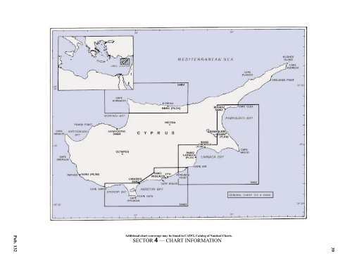
4.CyprusPub. 1324.0Additional chart converage may be found in CATP2, Catalog of Nautical Charts.SECTOR 4 — CHART INFORMATION39
- Page 1 and 2: PUB.132SAILING DIRECTIONS(ENROUTE)
- Page 3 and 4: Preface0.0 Pub. 132, Sailing Direct
- Page 5 and 6: ContentsHow to Keep this Book Corre
- Page 7 and 8: 0.0SECTOR LIMITS—PUB. 132Pub. 132
- Page 9: AbbreviationsThe following abbrevia
- Page 13 and 14: 3SECTOR 1COAST OF LIBYA1.0 Plan.—
- Page 15 and 16: Sector1.CoastofLibya 51.5 Pilotage.
- Page 17 and 18: Sector1.CoastofLibya 71.12 Caution.
- Page 19 and 20: Sector1.CoastofLibya 91.17 Jabal La
- Page 21 and 22: Sector1.CoastofLibya 111.21 Tukrah
- Page 23: Sector1.CoastofLibya 131.28 Aspect.
- Page 27 and 28: 17SECTOR 2COAST OF EGYPT2.0 Plan.
- Page 29 and 30: Sector2.CoastofEgypt 19a depth of 2
- Page 31 and 32: Sector2.CoastofEgypt 212.10 Several
- Page 33 and 34: Sector2.CoastofEgypt 232.17 Local v
- Page 35: Sector2.CoastofEgypt 25high, stands
- Page 39 and 40: 29SECTOR 3COASTS OF ISRAEL, LEBANON
- Page 41 and 42: Sector 3. Coasts of Israel, Lebanon
- Page 43 and 44: Sector 3. Coasts of Israel, Lebanon
- Page 45 and 46: Sector 3. Coasts of Israel, Lebanon
- Page 47: Sector 3. Coasts of Israel, Lebanon
- Page 52 and 53: 42 Sector4.Cyprusthe village. Ancho
- Page 54 and 55: 44 Sector4.Cyprus4.10 A conspicuous
- Page 56 and 57: 46 Sector4.Cyprus4.18 Kakoskaliou I
- Page 59 and 60: 49SECTOR 5SOUTH COAST OF TURKEY—K
- Page 61 and 62: Sector 5. South Coast of Turkey—K
- Page 63 and 64: Sector 5. South Coast of Turkey—K
- Page 65 and 66: Sector 5. South Coast of Turkey—K
- Page 67: Sector 5. South Coast of Turkey—K
- Page 71 and 72: 61SECTOR 6RODHOS (RHODES), NISOS KA
- Page 73 and 74: Sector 6. Rodhos (Rhodes), Nisos Ka
- Page 75 and 76: Sector 6. Rodhos (Rhodes), Nisos Ka
- Page 77 and 78: Sector 6. Rodhos (Rhodes), Nisos Ka
- Page 79 and 80: Sector 6. Rodhos (Rhodes), Nisos Ka
- Page 81 and 82: Sector 6. Rodhos (Rhodes), Nisos Ka
- Page 83: 7.West Coast of Greece and Dhiorix
- Page 86 and 87: 76 Sector 7. West Coast of Greece a
- Page 88 and 89: 78 Sector 7. West Coast of Greece a
- Page 90 and 91: 80 Sector 7. West Coast of Greece a
- Page 93: 8.West Coasts of Greece and Albania
- Page 96 and 97: 86 Sector 8. West Coasts of Greece
- Page 98 and 99:
88 Sector 8. West Coasts of Greece
- Page 100 and 101:
90 Sector 8. West Coasts of Greece
- Page 102 and 103:
92 Sector 8. West Coasts of Greece
- Page 105:
9.Coasts of Albania, Montenegro, an
- Page 108 and 109:
98 Sector 9. Coasts of Albania, Mon
- Page 110 and 111:
100 Sector 9. Coasts of Albania, Mo
- Page 112 and 113:
102 Sector 9. Coasts of Albania, Mo
- Page 114 and 115:
104 Sector 9. Coasts of Albania, Mo
- Page 117:
10.Coasts of Croatia and Bosnia-Her
- Page 120 and 121:
110 Sector 10. Coasts of Croatia an
- Page 122 and 123:
112 Sector 10. Coasts of Croatia an
- Page 124 and 125:
114 Sector 10. Coasts of Croatia an
- Page 126 and 127:
116 Sector 10. Coasts of Croatia an
- Page 128 and 129:
118 Sector 10. Coasts of Croatia an
- Page 131 and 132:
121SECTOR 11COAST OF CROATIA—RT M
- Page 133 and 134:
Sector 11. Coast of Croatia—Rt Mo
- Page 135 and 136:
Sector 11. Coast of Croatia—Rt Mo
- Page 137 and 138:
Sector 11. Coast of Croatia—Rt Mo
- Page 139 and 140:
Sector 11. Coast of Croatia—Rt Mo
- Page 141 and 142:
Sector 11. Coast of Croatia—Rt Mo
- Page 143:
Sector 11. Coast of Croatia—Rt Mo
- Page 147 and 148:
137SECTOR 12COAST OF GREECE—AKRA
- Page 149 and 150:
Sector 12. Coast of Greece—Akra T
- Page 151 and 152:
Sector 12. Coast of Greece—Akra T
- Page 153 and 154:
Sector 12. Coast of Greece—Akra T
- Page 155:
13.Coast of Greece—Saronikos Kolp
- Page 158 and 159:
148 Sector 13. Coast of Greece—Sa
- Page 160 and 161:
150 Sector 13. Coast of Greece—Sa
- Page 162 and 163:
152 Sector 13. Coast of Greece—Sa
- Page 164 and 165:
154 Sector 13. Coast of Greece—Sa
- Page 167:
14.Greece—Kikladhes Nisoi15714.0A
- Page 170 and 171:
160 Sector14.Greece—KikladhesNiso
- Page 172 and 173:
162 Sector14.Greece—KikladhesNiso
- Page 174 and 175:
164 Sector14.Greece—KikladhesNiso
- Page 176 and 177:
166 Sector14.Greece—KikladhesNiso
- Page 178 and 179:
168 Sector14.Greece—KikladhesNiso
- Page 181:
15.Greece—Channels West of Nisos
- Page 184 and 185:
174 Sector 15. Greece—Channels We
- Page 186 and 187:
176 Sector 15. Greece—Channels We
- Page 188 and 189:
178 Sector 15. Greece—Channels We
- Page 191:
16.Greece—Nisoi Vorioi Sporadhes
- Page 194 and 195:
184 Sector 16. Greece—Nisoi Vorio
- Page 196 and 197:
186 Sector 16. Greece—Nisoi Vorio
- Page 199:
17.Coast of Greece—Thermaikos Kol
- Page 202 and 203:
192 Sector 17. Coast of Greece—Th
- Page 204 and 205:
194 Sector 17. Coast of Greece—Th
- Page 206 and 207:
196 Sector 17. Coast of Greece—Th
- Page 209:
18.Greece—Dhodhekanisos and South
- Page 212 and 213:
202 Sector 18. Greece—Dhodhekanis
- Page 214 and 215:
204 Sector 18. Greece—Dhodhekanis
- Page 216 and 217:
206 Sector 18. Greece—Dhodhekanis
- Page 219:
19.West Coast of Turkey—Samos Str
- Page 222 and 223:
212 Sector 19. West Coast of Turkey
- Page 224 and 225:
214 Sector 19. West Coast of Turkey
- Page 226 and 227:
216 Sector 19. West Coast of Turkey
- Page 229:
20.The Dardanelles Approach and Adj
- Page 232 and 233:
222 Sector 20. The Dardanelles Appr
- Page 234 and 235:
224 Sector 20. The Dardanelles Appr
- Page 236 and 237:
226 Sector 20. The Dardanelles Appr
- Page 238 and 239:
228 Sector 20. The Dardanelles Appr
- Page 240 and 241:
230 GlossariesArabicARABICEnglishAR
- Page 242 and 243:
232 GlossariesARABICEnglishARABICEn
- Page 244 and 245:
234 GlossariesHebrewHEBREWEnglishHE
- Page 246 and 247:
236 GlossariesTURKISHEnglishTURKISH
- Page 249 and 250:
How to use the Index—Gazetteer239
- Page 251 and 252:
Index—Gazetteer 241PositionSec.˚
- Page 253 and 254:
Index—Gazetteer 243PositionSec.˚
- Page 255 and 256:
Index—Gazetteer 245PositionSec.˚
- Page 257 and 258:
Index—Gazetteer 247PositionSec.˚