the gauteng spatial development framework - Gauteng Online
the gauteng spatial development framework - Gauteng Online
the gauteng spatial development framework - Gauteng Online

You also want an ePaper? Increase the reach of your titles
YUMPU automatically turns print PDFs into web optimized ePapers that Google loves.
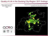
SECTION 2: THE GSDF AS A CONCEPTA SUMMARY OF THE DEVELOPMENT TREND ANALYSIS FORGAUTENGThe intention of G2055 is to set out a long-term planning and <strong>development</strong> programme.Over an eight-month period, various engagements were held with municipal representatives,provincial officials, politicians, labour and business representatives, academics andconsultants. Reports and trend papers were also commissioned on a wide range oftopics, in order to distil <strong>the</strong> G2055 vision.‘The Development Trend Analysis and Drivers, Impacts and Resulting Spatial Patterns for<strong>the</strong> <strong>Gauteng</strong> Department of Economic Development’ provides a comprehensive overviewof <strong>development</strong> intentions and outcomes of municipalities and <strong>the</strong> focus areas and actionsof developers in <strong>Gauteng</strong> Province. This report highlights <strong>the</strong> following:• The land <strong>development</strong> landscape of <strong>Gauteng</strong> Province indicates: (1) <strong>the</strong> remnantsof <strong>the</strong> structural expression of apar<strong>the</strong>id <strong>spatial</strong> planning still dominate <strong>the</strong> builtenvironment; (2) <strong>the</strong> inability of all spheres of government to comprehensively andcollectively plan for urbanisation (including property market dynamics); (3) <strong>the</strong> inabilityof government to measure <strong>the</strong> extent of urban <strong>development</strong> and growthuniversally – with specific reference to <strong>the</strong> property market; (4) <strong>the</strong> absenceof a centralised database; (5) <strong>the</strong> dysfunctional location and consequent ineffectivelinkages of urban functions and economic opportunities in relation to one ano<strong>the</strong>r;(6) <strong>the</strong> dominant effect of geomorphologic conditions and mining activities on<strong>spatial</strong> layout, e.g. dolomite conditions, fragmented settlements; (7) an overregulated<strong>development</strong> environment driving office and industrial developers to locate inmunicipalities that process <strong>the</strong> ra<strong>the</strong>r cumbersome <strong>development</strong> application systemswithin reasonable timeframes; (8) <strong>the</strong> much more vigorous growth of <strong>the</strong> tertiarysector of <strong>the</strong> economy in locations far from low-income areas, and <strong>the</strong> inability of <strong>the</strong>tertiary sector to offer job opportunities to <strong>the</strong> unskilled; (9) <strong>the</strong> higher land pricesclose to tertiary job opportunities, which make <strong>development</strong> of low-income housingin <strong>the</strong>se areas impractical; (10) a current approach to urban management and<strong>spatial</strong> planning portrayed in Spatial Development Frameworks which could, ifcorrectly implemented and monitored, deliver <strong>the</strong> desired urban configuration.• Property <strong>development</strong> by <strong>the</strong> private sector has, by and large, followed itsown logic and not that of <strong>the</strong> municipalities or <strong>the</strong> province. Where <strong>development</strong>has taken place in <strong>the</strong> form and location as envisaged by <strong>the</strong> municipalities, it tendedto be far less as a result of <strong>the</strong> municipal wishes, and more so that it made sensefrom a market perspective, or as a result of a lack of alternatives. The result ofthis is that, with <strong>the</strong> exception of (a) some upward filtering of black middleincome households to former white suburbs and into new greenfield residential<strong>development</strong>s, and (b) <strong>the</strong> <strong>development</strong> of shopping centres and malls informer peripheral townships, <strong>the</strong> inherited apar<strong>the</strong>id cityscape by and large stillprevails. Again, <strong>the</strong> report alludes to <strong>the</strong> possibility that speed of decisionmakingacross municipalities may be a key factor in determining where developersinvest, and not necessarily only rational site selection criteria or <strong>the</strong> <strong>development</strong>alobjectives of municipalities or <strong>the</strong> provincial authorities.• Dominant trends in <strong>the</strong> property <strong>development</strong> market are: (1) <strong>the</strong> residentialmarket is experiencing a decline off a high base sustained over a long period;(2) residential densities, especially in <strong>the</strong> three metropolitan municipalities, haveundergone an increase in <strong>the</strong> period 2001-2007, albeit not at a rate that outstrips<strong>the</strong> growth in single-dwelling housing during <strong>the</strong> same period; (3) <strong>the</strong> industrial,office and, to a lesser extent, retail sectors are still experiencing growth; (4) infrastructuralconstraints, especially in <strong>the</strong> area of bulk infrastructure, are hampering <strong>development</strong>;and (5) <strong>the</strong> Gautrain and Rapid Bus Transport systems are promoting <strong>the</strong><strong>development</strong> of transit-oriented <strong>development</strong> and <strong>the</strong> streng<strong>the</strong>ning of public transportnodes.• In terms of <strong>the</strong> <strong>spatial</strong> location of specific land-uses: (1) <strong>the</strong> areas that have seen<strong>the</strong> bulk of new property investment are <strong>the</strong> central, nor<strong>the</strong>rn and north-westernparts of <strong>the</strong> City of Johannesburg (CoJ), <strong>the</strong> eastern, sou<strong>the</strong>rn and south-easternparts of <strong>the</strong> City of Tshwane (CoT) and <strong>the</strong> western parts of <strong>the</strong> EkurhuleniMetropolitan Municipality especially along <strong>the</strong> M2, <strong>the</strong> R21 and within <strong>the</strong> nodestretching from OR Tambo International Airport to <strong>the</strong> East Rand Mall; (2) residential09 GAUTENG SPATIAL DEVELOPMENT FRAMEWORK 2011 GAUTENG GROWTH AND DEVELOPMENT AGENCY