

Walker - 1967 - A geography of Italy
Walker - 1967 - A geography of Italy
Walker - 1967 - A geography of Italy

You also want an ePaper? Increase the reach of your titles
YUMPU automatically turns print PDFs into web optimized ePapers that Google loves.
THE ALPS<br />
rugged and the valleys, though <strong>of</strong>ten steep, are less restricted; most <strong>of</strong> the cols<br />
connecting the Val Seriana and the Val Brembana are also developed on marls.<br />
The limestones, on whose surface karst phenomena frequently occur, are extensively<br />
forested while the marls are used for hay and hardy crops. The main ridge<br />
<strong>of</strong> the Alpi Orobie, topping 3000m in Pizzo di Coca, is carved in gneisses, micaschists<br />
and Permian conglomerates; the same rocks extend over wide areas to the<br />
north o f the Brescian Pre-Alps, which are structurally a continuation o f the<br />
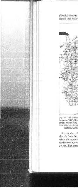
Bergamasque Pre-Alps (fig. 22).<br />
The crystalline zone o f the Alpine core is deeply trenched by the Tonale fault<br />
line into which numerous transverse valleys from the main watershed find their<br />
way. Prolonged denudation punctuated by rejuvenation has produced a complex<br />
drainage pattern with several captures; thus the upper Oglio once flowed into the<br />
Adda through the Aprica col but was captured by the Ogho as it cut back northwards.<br />
The commonest rocks exposed are gneisses, mica-schists and granites<br />
with occasional outcrops oipietre verdi’, any tendency towards differential erosion<br />
is usually reduced to insignificance by the overwhelming ferocity o f glacial action.<br />
The Adula and Bernina (4055m) groups on the main watershed and the Ortles<br />
(3763m) and Adamello-Presanella groups to the south o f it are high enough to<br />
support extensively permanent snowfields and a number o f small glaciers.<br />
In the case o f the western Alps a distinction was made between the agriculture<br />
<strong>of</strong> the deep, low-level valleys and that o f the higher valleys; this distinction is<br />
equally valid for the central Alps. In the Valtellina, for example, fodder, cereals<br />
and fruit, <strong>of</strong>ten grown with the assistance o f irrigation, cover much o f the alluvial<br />
valley floor; on the lower solatia slopes the chestnut zone has been widely<br />
replaced by terraced vineyards whose names and reputations are well known in<br />
the industry. Further up, the slopes are shared between chestnut woodlands and<br />
small peasant holdings created and maintained at immense pains; such units,<br />
many <strong>of</strong> which are now being abandoned, clearly reflect the population pressures<br />
<strong>of</strong> the recent past. Except on the lowest slopes, where hardy crops and hay are<br />
cultivated, the ombria side o f the Valtellina is clothed with coniferous forests<br />
broken here and there by high pastures. Outside the main valleys and the lake<br />
shores (where delicate tree crops assume a modest importance) the rural economy<br />
depends on forestry and animal rearing. Transhumance is on the decline generally<br />
and is now in the hands o f pr<strong>of</strong>essional cowherds.<br />
The main industrial resources o f the area lie in its water and in its hydroelectric<br />
power (21% o f <strong>Italy</strong>’s output in 1964). Both have been fully exploited,<br />
although the Alps themselves get less than their fair share o f the benefits. The<br />
traditional extractive industries are still o f some importance in the Pre-Alps; the<br />
cement industry is served by a number o f large quarries, and lead and fluorspar<br />
are mined in the Val Brembana and the Val Trompia. Metal working has been a<br />
traditional activity in Brescia province since the Middle Ages and there are still a<br />
number <strong>of</strong> small iron works in operation using local ore. The most productive<br />
mining zone is in the Val di Scalve and the biggest iron and steel plant is sited at<br />
105


