- Page 1 and 2:
D. S. WALKER A Geography of Italy 4
- Page 3 and 4:
Contents P A R T I : S O M E G E O
- Page 5 and 6:
List of Plates — ^•anAJVkr|y0/a
- Page 7 and 8:
Maps and Diagrams 1 Spheres o f inf
- Page 9:
Acknowledgements The writer gratefu
- Page 13 and 14:
SOME GEOGRAPHY AND HISTORY Geograph
- Page 15 and 16:
SETTLEMENT AND COLONIZATION the mos
- Page 17 and 18:
SETTLEMENT AND COLONIZATION tion, t
- Page 19 and 20:
SETTLEMENT AND COLONIZATION and mil
- Page 21 and 22:
ROMAN GEOGRAPHY shipping bringing t
- Page 23 and 24:
ROMAN GEOGRAPHY add their share to
- Page 25 and 26:
ROMAN GEOGRAPHY not unlike serfdom
- Page 27 and 28:
ROMAN GEOGRAPHY it is generally tru
- Page 29 and 30:
ITALY DURING THE DARK AGES Danubian
- Page 31 and 32:
ITALY DURING THE DARK AGES ‘hosts
- Page 33 and 34:
ITALY DURING THE MIDDLE AGES develo
- Page 35 and 36:
ITALY DURING THE MIDDLE AGES Amalfi
- Page 37 and 38:
ITALY DURING THE MIDDLE AGES O f th
- Page 40 and 41:
PART i: SOME GEOGRAPHY AND HISTORY
- Page 42 and 43:
PART i: SOME GEOGRAPHY AND HISTORY
- Page 44 and 45:
PART l: SOME GEOGRAPHY AND HISTORY
- Page 46 and 47:
' M ' ' PART l ; SOME GEOGRAPHY AND
- Page 48 and 49:
PART i : SOME GEOGRAPHY AND HISTORY
- Page 50 and 51:
PART l: SOME GEOGRAPHY AND HISTORY
- Page 52 and 53:
PART i : SOME GEOGRAPHY AND HISTORY
- Page 54:
h í '‘A ''k - r - í ' í ’ -'
- Page 58:
PART i : SOME GEOGRAPHY AND HISTORY
- Page 62 and 63:
PART II : SOME PH YSICAL GEOGRAPHY
- Page 64 and 65:
PART II : SOME PH YSIC A L GEOGRAPH
- Page 66:
PART I I : SOME PHYSICAL GEOGRAPHY
- Page 69 and 70:
WWOiW W i 1 PART I I : SOME PH YSIC
- Page 71 and 72:
PART I i : SOME P H YSIC A L GEOGRA
- Page 73 and 74:
PART I I ; SOME PH YSIC A L GEOGRAP
- Page 75 and 76:
PART I I : SOME P H YSIC A L GEOGRA
- Page 77 and 78:
PART I I : SOME P H YSIC A L GEOGRA
- Page 79 and 80:
V , ’•,.zJí-‘í*r'.‘‘'T
- Page 81 and 82:
THE MOUNTAIN ZONE. The chestnut hor
- Page 83 and 84:
PART II : SOM E P H YSIC A L GEOGRA
- Page 85 and 86:
PART I I : SOME P H YSIC A L GEOGRA
- Page 87 and 88:
PART I I : SOME PHYSICAL GEOGRAPHY
- Page 89 and 90:
PART I I ; SOME PH YSIC A L GEOGRAP
- Page 91 and 92: PART I I : SOME PHYSICAL GEOGRAPHY
- Page 93 and 94: PART I I : SOME PHYSICAL GEOGRAPHY
- Page 95 and 96: PART I I : SOME PHYSICAL GEOGRAPHY
- Page 97 and 98: PART I I : SOME PHYSICAL GEOGRAPHY
- Page 99 and 100: ' . «S. PART I I : SOME PHYSICAL G
- Page 101 and 102: PART I I : SOME PHYSICAL GEOGRAPHY
- Page 103 and 104: PART I I : SOME PHYSICAL GEOGRAPHY
- Page 106 and 107: R E G IO N A L G EO G RAPH Y The re
- Page 108 and 109: II. The Northern Lowlands. III. Lig
- Page 110 and 111: THE ALPS plained by the absence o f
- Page 112 and 113: THE ALPS carries the main line from
- Page 114: THE ALPS the frontier in the Lugano
- Page 117 and 118: PART III : REGIONAL GEOGRAPHY » i
- Page 119 and 120: i*^ '••*t ' ' í S I PART I I I
- Page 121 and 122: PART I I I : REGIONAL GEOGRAPHY nor
- Page 123 and 124: PART I I I ; REGION A L GEOGRAPHY ,
- Page 125 and 126: PART I I I : REGIONAL GEOGRAPHY 3«
- Page 127 and 128: « ■ t PART III: REGIONAL GEOGRAP
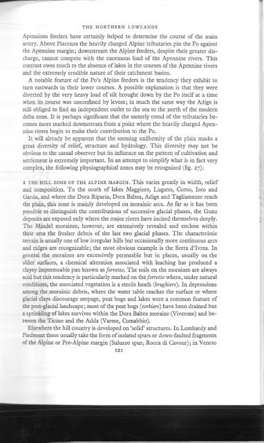
- Page 130 and 131: THE N ORTH ERN LOW LANDS namely pap
- Page 132 and 133: THE N ORTH ERN LOW LANDS Apennines
- Page 134 and 135: 1 THE N ORTH ERN LOW LANDS they app
- Page 136: 8 THE EM ILIAN P L A IN . This form
- Page 139 and 140: PART i n : REGIONAL GEOGRAPHY over
- Page 141: PART I I I : REGION A L GEOGRAPHY s
- Page 145 and 146: PART I I I : REGION A L GEOGRAPHY t
- Page 147 and 148: PART I I I : REGION A L GEOGRAPHY s
- Page 149 and 150: PART I I I : REGION A L GEOGRAPHY c
- Page 151 and 152: PART n i : REGION A L GEOGRAPHY The
- Page 153 and 154: Si ü V O *0 H I « TJ 13 „ a g
- Page 155 and 156: PART ni: REGIONAL G E O G R A P H Y
- Page 157 and 158: PART III: REGIONAL G E O G R A P H
- Page 159 and 160: If 11 PART III: REGIONAL G E O G R
- Page 161: PART I I I : REGION A L GEOGRAPHY *
- Page 164 and 165: CENTRAL ITA LY Apennine foretrench
- Page 166 and 167: CENTRAL ITA LY Terni lake, remnants
- Page 168: CENTRAL ITA LY the interests o f gr
- Page 171 and 172: PART I I I : REGIONAL GEOGRAPHY sou
- Page 173 and 174: PART I I i : REGION A L GEOGRAPHY i
- Page 175 and 176: IV[d] Tuscany PART I I i : REG IO N
- Page 177 and 178: PART i n : REGIONAL GEOGRAPHY **v -
- Page 179 and 180: mm PART I I I : REGION A L GEOGRAPH
- Page 181 and 182: PART III: REGIONAL GEOGRAPHY m iWM
- Page 183 and 184: PART I I I : REGION A L GEOGRAPHY b
- Page 185 and 186: PART I I I : REGION A L GEOGRAPHY F
- Page 187 and 188: PART III: REGIONAL GEOGRAPHY they a
- Page 189 and 190: iP A R IO L I: V ILLA BORGHESE . P-
- Page 191 and 192: PART I I I : REGIONAL GEOGRAPHY s>9
- Page 193 and 194:
PART I I i : REGION A L GEOGRAPHY t
- Page 195 and 196:
PART I I I : REGION A L GEOGRAPHY e
- Page 197 and 198:
J '7- 1 PART I I I : REGION A L GEO
- Page 199 and 200:
PART I I I : REGION A L GEOGRAPHY a
- Page 201 and 202:
PART i n : REGIONAL GEOGRAPHY M any
- Page 203 and 204:
PART I I I : REGION A L GEOGRAPHY "
- Page 205 and 206:
PART I I I ; REGION A L GEOGRAPHY m
- Page 207 and 208:
PART I I i : REGION A L GEOGRAPHY s
- Page 209 and 210:
i-ÍSs. . ■ í I f ' l PART I I I
- Page 211 and 212:
PART I I I : REGION A L GEOGRAPHY m
- Page 213 and 214:
PART I I I : REGION A L GEOGRAPHY C
- Page 215 and 216:
PART I I I : REGION A L GEOGRAPHY t
- Page 217 and 218:
PART III: REGIONAL G E O G R A P H
- Page 219 and 220:
PART III: REGIONAL GEOGRAPHY featur
- Page 221 and 222:
PART III: REGIONAL G E O G R A P H
- Page 223 and 224:
PART i n : REGIONAL GEOGRAPHY The S
- Page 225 and 226:
PART I I I : REGION A L GEOGRAPHY S
- Page 227 and 228:
PART I I I : REGIONAL GEOGRAPHY if
- Page 230 and 231:
SICILY 1 2 V B S'I 9 S S 2 bo O c 4
- Page 232 and 233:
SIC IL Y the economy o f the extens
- Page 234 and 235:
SARDINIA ‘huertas’ comparable w
- Page 236 and 237:
Caprera Gulf of Orosei C- Carboitar
- Page 238 and 239:
1 SARDINIA immediate hinterland o f
- Page 240:
I SARDINIA useful minerals produced
- Page 244 and 245:
P O PU LA TIO N TABLE 2 Defacto pop
- Page 246 and 247:
1 2 0 0 1100 1000 900
- Page 248 and 249:
EMIGRATION A N D INTERNAL MIGRATION
- Page 250 and 251:
EMIGRATION A N D INTERNAL M I GRATI
- Page 252 and 253:
AGRICULTURE over four-fifths of her
- Page 254 and 255:
AGRICULTURE {non-appoderata) common
- Page 256 and 257:
- : :*Év 1« - • J '- t ^ ^ ; -
- Page 258:
Il i a Intensive viticulture in the
- Page 262:
Td a tí o ’Eo . tH o • O tí ,
- Page 266 and 267:
X ia The Baize di Volterra (Pliocen
- Page 268 and 269:
- II xnia Gorge cut in the tufo of
- Page 270 and 271:
XV The medieval plan of Siena (A) a
- Page 272 and 273:
' I xvna Gully erosion in the Mioce
- Page 274:
xixa The rounded summits and pinewo
- Page 278:
; '■ 'i' I ' i iv;“® ' f o 'f'
- Page 281 and 282:
PART IV: ECONOMIC GEOGRAPHY < : I 1
- Page 283 and 284:
PART IV: ECONOMIC GEOGRAPHY irrigat
- Page 285 and 286:
T-^ V-*- III U. PART IV : ECONOMIC
- Page 287 and 288:
PART IV: ECONOMIC GEOGRAPHY Fuels a
- Page 289 and 290:
PART IV ; ECONOM IC GEOGRAPHY rubbe
- Page 291 and 292:
PART IV : ECON OM IC GEOGRAPHY pote
- Page 293 and 294:
esulted, naturally enough, in a mar
- Page 295 and 296:
PART IV : ECONOM IC GEOGRAPHY : ■
- Page 297 and 298:
PART I V : ECONOM IC GEOGRAPHY i. I
- Page 299 and 300:
PART iv : ECONOMIC GEOGRAPHY i m 3
- Page 301 and 302:
PART IV: ECONOMIC GEOGRAPHY Sr-Sf-:
- Page 303 and 304:
PART iv : ECONOMIC GEOGRAPHY years
- Page 305 and 306:
PART iv : ECONOMIC GEOGRAPHY I': IN
- Page 307 and 308:
PART iv : ECONOMIC GEOGRAPHY Europe
- Page 311:
TABLE 6 EMPLOYED LABOUR FORCE (iN T
- Page 314 and 315:
Percentage of provincial productive
- Page 316 and 317:
TABLE II ITALIAN MINERAL PRODUCTION
- Page 320 and 321:
I l Bibliography L. BARZINI: The It
- Page 322 and 323:
B IB LIO G R A PH Y E. MIGLIORINI :
- Page 324 and 325:
Index —^wx/to/tiVlyQ/^lRRRAA/^i
- Page 326 and 327:
Cremona, 135, 136 Crete senesi, 166
- Page 328 and 329:
Massa Marittima, 157 Masserie, 188,
- Page 330 and 331:
INDEX Maira, 995 — Meduna, 140;
- Page 332:
i 53j 165; Val di Sole, 64, 103, 10


