
Create successful ePaper yourself
Turn your PDF publications into a flip-book with our unique Google optimized e-Paper software.
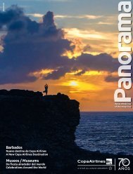
La exhibición contiene, por ejemplo, un mapa de<br />
1503 elaborado por Bartolomé Colón —hermano<br />
de Cristóbal— que muestra por primera vez<br />
territorios de lo que luego se llamaría Panamá:<br />
Bastimento, Bel Porto, Veragnia… Pero Cristóbal<br />
y Bartolomé creían que estaban en Asia, por<br />
eso dibujaron, al otro lado de esas tierras, el mar<br />
de China. También hay mapas en donde se presenta<br />
por primera vez el ovus undus —con<br />
los años, los navegantes y cartógrafos se dieron<br />
cuenta de que no era Asia sino un mundo nuevo—,<br />
la palabra “América” y se insinúa la existencia<br />
de un paso hacia un nuevo mar.<br />
There is, for example, a map created in 1503 by<br />
Bartholomew Columbus, Christopher’s brother,<br />
which includesfor the first timethe territories<br />
of what would later be called Panama:<br />
Bastimento, Bel Porto, Veragnia... But Christoher<br />
and artholomew believed that they<br />
were in Asia, which explains why they drew the<br />
China Sea on the other side of these territories.<br />
n other mas, we see the first resentations<br />
of the ovus undus navigators and cartographers<br />
had realized that this was not Asia, but a<br />
new world. They began to use the word “America”<br />
and hint at the existence of a new sea.<br />
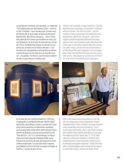
Es el caso de uno confeccionado en 1507 por<br />
el geógrafo y cartógrafo alemán Martin Waldseemüller,<br />
que dibuja un paso a través de lo que<br />
sería Centroamérica; un elemento revelador<br />
porque apareció varios años antes de que Vasco<br />
Núñez de Balboa comunicara la existencia del<br />
“Mar del Sur”, en 1513. Sin embargo, la mayor<br />
relevancia del mapa de Waldseemüller para<br />
Panamá es el hecho de que allí aparece la costa<br />
chilena explorada. “Lo que dice este mapa es<br />
que Balboa no fue el primer europeo en llegar al<br />
Pacífico”, recalca Araúz Torres.<br />
Such is the case of one map drawn in 1507 by<br />
German geographer and cartographer Martin<br />
Waldseemüller, which includes a passage through<br />
what would become Central America. This is<br />
articularly interesting since it was drawn several<br />
years before Vasco Núñez de Balboa announced<br />
the existence of the “South Sea” in 1513. Most<br />
relevant to anama, however, is the fact that<br />
Waldseemüller’s map shows the Chilean coast<br />
as already having been elored. hat this ma<br />
tells us is that alboa was not the first uroean<br />
to reach the acific, oints out ra orres.<br />
43