- Page 1 and 2:
BOARD OF COUNTY COMMISSIONERS LEON
- Page 3 and 4:
Board of County Commissioners Regul
- Page 5 and 6:
Board of County Commissioners Regul
- Page 7 and 8:
Board of County Commissioners Regul
- Page 9 and 10:
Board of County Commissioners Regul
- Page 11 and 12:
Board of County Commissioners Regul
- Page 13 and 14:
Board of County Commissioners Regul
- Page 15 and 16:
Leon County Board of County Commiss
- Page 17 and 18:
The requested change would provide
- Page 19 and 20:
Text - Clean up of Policies 1.1.10[
- Page 21 and 22:
BOARD OF COUNTY COMMISSIONERS LEON
- Page 23 and 24:
9. Acceptance of the 2012 Annual Re
- Page 25 and 26:
Commissioner Discussion Items Commi
- Page 27 and 28:
Leon County Board of County Commiss
- Page 29 and 30:
Title: Ratification of Commissioner
- Page 31 and 32:
Title: Ratification of Commissioner
- Page 33 and 34:
From: Catherine Jones To: Coble, Ch
- Page 35 and 36:
Bond Counsel: Robert Reid Bryant, M
- Page 38 and 39:
ADVISORY COMMITTEE APPLICATION FOR
- Page 40 and 41:
Responsibility: Library Advisory Bo
- Page 42 and 43:
Dear Chairman Abberger, Please acce
- Page 44 and 45:
References (you must provide at lea
- Page 46 and 47:
References (you must provide at lea
- Page 48 and 49:
Williams, Frank Florida Development
- Page 50 and 51:
ADVISORY COMMITTEE APPLICATION FOR
- Page 52 and 53:
RESOLUTION NO. /3-0Z A RESOLUTION O
- Page 54 and 55:
Attachment #13 Page 3 of 3 DONE, AD
- Page 56 and 57:
References (you must provide at lea
- Page 58 and 59:
Administrator FL Department of Heal
- Page 60 and 61:
Other Relevant Experience More than
- Page 62 and 63:
In the space below briefly describe
- Page 64 and 65:
ADVISORY COMMITTEE APPLICATION FOR
- Page 66 and 67:
Kimberly J. Galbán-Countryman 3248
- Page 68 and 69:
Attachment #16 Page 5 of 7 Responsi
- Page 70 and 71:
AWARDS President’s List, Barry Un
- Page 72 and 73:
To: Leon County Board of County Com
- Page 74 and 75:
Title: Approval of the Capital Regi
- Page 76 and 77:
WHEREAS, on January 12, 2009, the C
- Page 78 and 79:
(b) To develop transportation plans
- Page 80 and 81:
Section 3.05. Submission of proceed
- Page 82 and 83:
Section 5.02. Specific authority an
- Page 84 and 85:
Section 6.02. Administrative Suppor
- Page 86 and 87:
Section 8.04. Notices. All notices,
- Page 88 and 89:
Passed and adopted by the Board of
- Page 90 and 91:
Passed and adopted by the Board of
- Page 92 and 93:
Passed and adopted by the Gretna Ci
- Page 94 and 95:
Passed and adopted by the Quincy Ci
- Page 96 and 97:
Passed and adopted by the Greensbor
- Page 98 and 99:
Passed and adopted by the School Bo
- Page 100 and 101:
APPROVED AS TO FORM AND LEGALITY: C
- Page 102 and 103:
To: Leon County Board of County Com
- Page 104 and 105:
Leon County Board of County Commiss
- Page 106 and 107:
Title: Approval of the First Amendm
- Page 108 and 109:
FIRST AMENDMENT TO CONTRACT Attachm
- Page 110 and 111:
DONE AND EXECUTED this _____ day of
- Page 112 and 113:
LIP Letter of Agreement for SFY 201
- Page 114 and 115:
Local Government Intergovernmental
- Page 116 and 117:
iii. The removal of inpatient and o
- Page 118 and 119:
Candice Wilson - follow up From: To
- Page 120 and 121:
To: Leon County Board of County Com
- Page 122 and 123:
Title: Approval to Submit 2013 Flor
- Page 124 and 125:
To: Leon County Board of County Com
- Page 126 and 127:
Title: Approval of a Resolution to
- Page 128 and 129:
COMMISSIONERS OF LEON COUNTY, FLORI
- Page 130 and 131:
To: Leon County Board of County Com
- Page 132 and 133:
Title: Approval of Proposed Staffin
- Page 134 and 135:
FISCAL YEAR 2012/2013 BUDGET AMENDM
- Page 136 and 137:
To: Leon County Board of County Com
- Page 138 and 139:
Title: Approve the First Amendment
- Page 140 and 141:
and any modifications thereto as pr
- Page 142 and 143:
Leon County Board of County Commiss
- Page 144 and 145:
Agenda Title: Request to Schedule a
- Page 146 and 147:
Tax Item Number PROPERTY DESCRIPTIO
- Page 149 and 150:
Leon County Board of County Commiss
- Page 151 and 152:
Agenda Title: Request to Schedule a
- Page 153 and 154:
Tax Item Number 21-12-12-000-0010 P
- Page 155 and 156:
Tax Item Number PROPERTY DESCRIPTIO
- Page 157 and 158:
Leon County Board of County Commiss
- Page 159 and 160:
Title: Adoption of a Resolution Sup
- Page 161 and 162:
DATED this ________day of April 201
- Page 163 and 164:
To: Leon County Board of County Com
- Page 165 and 166:
Title: Acceptance of a Status Repor
- Page 167 and 168:
Title: Acceptance of a Status Repor
- Page 169 and 170:
Attachment #1 Page 4 of 8 Attachmen
- Page 171 and 172:
Josh McSwain - Fwd: RE: Lake Improv
- Page 174 and 175:
Leon County Board of County Commiss
- Page 176 and 177:
Title: Acceptance of Status Report
- Page 178 and 179:
Huntington Oaks Public Workshop 04.
- Page 180 and 181:
Huntington Oaks Public Workshop 04.
- Page 182 and 183:
Leon County Board of County Commiss
- Page 184 and 185:
Title: Acceptance of the Status Rep
- Page 186 and 187:
To: Leon County Board of County Com
- Page 188:
Title: Acceptance of a Status Repor
- Page 193 and 194:
Leon County Board of County Commiss
- Page 195 and 196:
Title: Consideration of Full Board
- Page 197 and 198:
Responsibility: Affordable Housing
- Page 199 and 200:
Vacant Category: Citizen who Attach
- Page 201 and 202:
FROM THERE, I BECAME INVOLVED WITH
- Page 203 and 204:
Enterprise Zone Agency Development
- Page 205 and 206:
In the space below briefly describe
- Page 207 and 208:
the area of small business. Territo
- Page 209 and 210:
RESOLUTION __________ RESOLUTION OF
- Page 211 and 212:
THE BOARD OF COUNTY COMMISSIONERS,
- Page 213 and 214:
References (you must provide at lea
- Page 215 and 216:
References (you must provide at lea
- Page 217 and 218:
TRANSMITTAL PUBLIC HEARING MATERIAL
- Page 219 and 220:
Transmittal Public Hearing Agenda A
- Page 221 and 222:
2 Attachment #1 Page 2 of 3 Woodvil
- Page 223 and 224:
Summary Chart of Recommendations Pa
- Page 225 and 226:
Item # Amendment To: Nature of Prop
- Page 227 and 228:
NI CK LA US D R OCK CT TOFF PAUL RU
- Page 229 and 230:
MONDAY RD DUCHAINE DR ORANGE AVE E
- Page 231 and 232:
MAP AMENDMENT #: PCM130101 PCM13010
- Page 233 and 234:
PCM130101 Monday Rd. near Capital C
- Page 235 and 236:
ST DELAWARE ST R ST DOVER ST AY XHA
- Page 237 and 238:
N WOODWARD AVE N WOODWARD AVE DADE
- Page 239 and 240:
MAP AMENDMENT #: PCM130102 APPLICAN
- Page 241 and 242:
PCM130102 West Brevard Street 1. Re
- Page 243 and 244:
PCM130102 West Brevard Street E. EN
- Page 245 and 246:
FOREST LAIR M C UTOFF BL OUNT STOWN
- Page 247 and 248:
UM UM CT CT FOREST LAIR RD TRILLIUM
- Page 249 and 250:
MAP AMENDMENT: PCM130104 APPLICANT:
- Page 251 and 252:
PCM130104 Timberlane Road near the
- Page 253 and 254:
PCM130104 Timberlane Road near the
- Page 255 and 256:
PCM130104 Timberlane Road near the
- Page 257 and 258:
PCM130104 Timberlane Road near the
- Page 259 and 260:
PCM130104 Timberlane Road near the
- Page 261 and 262:
PCM130104 Subject Property Tax Iden
- Page 263 and 264:
OR BK 4401 PG 1260 WHEREAS, to enco
- Page 267 and 268:
OR BK 4401 PG 1264 EXHIBIT"A" COMME
- Page 269 and 270:
DEVELOPMENT STANDARDS 4. Minimum Lo
- Page 271 and 272:
N JUNCTURE DR TERS CT M CUTOFF BLUE
- Page 273 and 274:
C EM ETER Y AVE SON C EME TERY AV E
- Page 275 and 276:
MAP AMENDMENT: PCM130105 APPLICANT:
- Page 277 and 278:
PCM130105 DISC Village Originally e
- Page 279 and 280:
PCM130105 DISC Village (1) Promote
- Page 281 and 282:
PCM130105 DISC Village Final school
- Page 283 and 284:
PCM130105 DISC Village Current Allo
- Page 285 and 286:
PCM130105 DISC Village CRTPA Board
- Page 287 and 288:
URAL BRIDGE RD HICKO R Y LN SHADY W
- Page 289 and 290:
Attachment #2 Page 2 of 2 exempt fr
- Page 291 and 292:
SABLE CT OXFORD RD BERKSHIRE DR LEI
- Page 293 and 294:
SABLE CT OXFORD RD BERKSHIRE DR MR-
- Page 295 and 296:
PCM130106 Jackson Bluff/Ausley Rd.
- Page 297 and 298:
PCM130106 Jackson Bluff/Ausley Rd.
- Page 299 and 300:
5. Optional Sustainable Development
- Page 301:
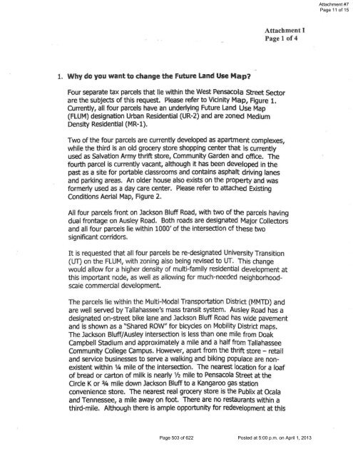
Attachment I Page 2 of 4 node, the
- Page 305 and 306:
R M CUTOFF OFFICER PONCE WAY BL OUN
- Page 307 and 308:
N MERIDIAN RD E 7TH AVE N MERIDIAN
- Page 309 and 310:
MAP AMENDMENT #: PCM130107 APPLICAN
- Page 311 and 312:
PCM130107 9 th and Thomasville Rd.
- Page 313 and 314:
PCM130107 9 th and Thomasville Rd.
- Page 315 and 316:
PCM130107 9 th and Thomasville Rd.
- Page 317 and 318:
PCM130107 9 th and Thomasville Rd.
- Page 320 and 321:
Zoning History History Attachment #
- Page 322 and 323:
Attachment #2 Page 3 of 4 1) Prepar
- Page 324 and 325:
20120069149 RECORDED IN PUBLIC RECO
- Page 328 and 329:
N \ ·•· 8 W PENSACoLA ST • OR
- Page 330 and 331:
RLENE CT T WESTBURY DR CIR EVANW OO
- Page 332 and 333:
E CIR RY DR CORRIE ADRIAN LN CIR TB
- Page 334 and 335:
MAP AMENDMENT: PCM130108 APPLICANT:
- Page 336 and 337:
PCM130108 Fred George and Old Bainb
- Page 338 and 339:
PCM130108 Fred George and Old Bainb
- Page 340 and 341:
PCM130108 Fred George and Old Bainb
- Page 342 and 343:
FRED GEORGE RD CSX Railroad GEARHAR
- Page 344 and 345:
TEXT AMENDMENT #: PCT130109 APPLICA
- Page 346 and 347:
History PCT130109 Steep Grades Sinc
- Page 348 and 349:
Analysis of Proposed Text PCT130109
- Page 350 and 351:
PCT130109 Steep Grades The second a
- Page 352 and 353:
PCT130109 Steep Grades steep grades
- Page 354 and 355:
CONSERVATION AREAS Policy 1.3.1: [C
- Page 356 and 357:
Attachment #1 Page 3 of 13 Staff No
- Page 358 and 359:
Closed basin Density per land use D
- Page 360 and 361:
Attachment #1 Page 7 of 13 Developm
- Page 362 and 363:
Attachment #1 Page 9 of 13 that per
- Page 364 and 365:
Areas of environmental Significance
- Page 366 and 367:
Policy 1.3.15: [C] (Effective 7/1/0
- Page 368 and 369:
1 2 3 4 5 6 7 8 9 10 11 12 13 14 15
- Page 370 and 371:
1 2 3 4 5 6 7 8 9 10 11 12 13 14 15
- Page 372 and 373:
1 2 3 4 5 6 7 8 9 10 11 12 13 14 15
- Page 374 and 375:
1 2 3 4 5 6 7 8 9 10 11 12 13 14 15
- Page 376 and 377:
1 2 3 4 5 6 7 8 9 10 Version 10‐0
- Page 378 and 379:
the Red Hills area, which is under
- Page 380 and 381:
animal habitat or even flooding. If
- Page 382 and 383:
those root mass pathways decay and
- Page 384 and 385:
It seems to me that the main reason
- Page 386 and 387:
2005 County Blue Ribbon Committee W
- Page 388 and 389:
Minimum Countywide Environmental St
- Page 390 and 391:
Leon County Code Related to Topogra
- Page 392 and 393:
Attachment #6 Page 3 of 3 topograph
- Page 394 and 395:
C. EXISTING TEXT/POLICIES: See Atta
- Page 396 and 397:
GLOSSARY Attachment #1 Page 1 of 2
- Page 398 and 399:
TEXT AMENDMENT #: PCT130111 APPLICA
- Page 400 and 401:
PCT130111 Policy Cleanup Policy 2.2
- Page 402 and 403:
TEXT AMENDMENT #: PCT130112 APPLICA
- Page 404 and 405:
PCT130112 Addition of Paul Russell
- Page 406 and 407:
Effective with the 13-01 Comprehens
- Page 408 and 409:
C. EXISTING TEXT/POLICIES: See Atta
- Page 410 and 411:
PCT130113 Thornton Road c) Results
- Page 412 and 413:
Citizen Comments Page 412 of 622 Po
- Page 414 and 415:
ecent plant permitting required sig
- Page 416 and 417:
From: Hodges, Steven M To: CMP_PLN_
- Page 418 and 419:
2. Reinstates, but limits, commerci
- Page 420 and 421:
TRANSMITTAL PUBLIC HEARING MATERIAL
- Page 422 and 423:
Transmittal Public Hearing Agenda A
- Page 424 and 425:
2 Attachment #1 Page 2 of 3 Woodvil
- Page 426 and 427:
Summary Chart of Recommendations Pa
- Page 428 and 429:
Item # Amendment To: Nature of Prop
- Page 430 and 431:
NI CK LA US D R OCK CT TOFF PAUL RU
- Page 432 and 433:
MONDAY RD DUCHAINE DR ORANGE AVE E
- Page 434 and 435:
MAP AMENDMENT #: PCM130101 PCM13010
- Page 436 and 437:
PCM130101 Monday Rd. near Capital C
- Page 438 and 439:
ST DELAWARE ST R ST DOVER ST AY XHA
- Page 440 and 441:
N WOODWARD AVE N WOODWARD AVE DADE
- Page 442 and 443:
MAP AMENDMENT #: PCM130102 APPLICAN
- Page 444 and 445:
PCM130102 West Brevard Street 1. Re
- Page 446 and 447:
PCM130102 West Brevard Street E. EN
- Page 448 and 449:
FOREST LAIR M C UTOFF BL OUNT STOWN
- Page 450 and 451:
UM UM CT CT FOREST LAIR RD TRILLIUM
- Page 452 and 453: MAP AMENDMENT: PCM130104 APPLICANT:
- Page 454 and 455: PCM130104 Timberlane Road near the
- Page 456 and 457: PCM130104 Timberlane Road near the
- Page 458 and 459: PCM130104 Timberlane Road near the
- Page 460 and 461: PCM130104 Timberlane Road near the
- Page 462 and 463: PCM130104 Timberlane Road near the
- Page 464 and 465: PCM130104 Subject Property Tax Iden
- Page 466 and 467: OR BK 4401 PG 1260 WHEREAS, to enco
- Page 470 and 471: OR BK 4401 PG 1264 EXHIBIT"A" COMME
- Page 472 and 473: DEVELOPMENT STANDARDS 4. Minimum Lo
- Page 474 and 475: N JUNCTURE DR TERS CT M CUTOFF BLUE
- Page 476 and 477: C EM ETER Y AVE SON C EME TERY AV E
- Page 478 and 479: MAP AMENDMENT: PCM130105 APPLICANT:
- Page 480 and 481: PCM130105 DISC Village Originally e
- Page 482 and 483: PCM130105 DISC Village (1) Promote
- Page 484 and 485: PCM130105 DISC Village Final school
- Page 486 and 487: PCM130105 DISC Village Current Allo
- Page 488 and 489: PCM130105 DISC Village CRTPA Board
- Page 490 and 491: URAL BRIDGE RD HICKO R Y LN SHADY W
- Page 492 and 493: Attachment #2 Page 2 of 2 exempt fr
- Page 494 and 495: SABLE CT OXFORD RD BERKSHIRE DR LEI
- Page 496 and 497: SABLE CT OXFORD RD BERKSHIRE DR MR-
- Page 498 and 499: PCM130106 Jackson Bluff/Ausley Rd.
- Page 500 and 501: PCM130106 Jackson Bluff/Ausley Rd.
- Page 504: Attachment I Page 2 of 4 node, the
- Page 508 and 509: R M CUTOFF OFFICER PONCE WAY BL OUN
- Page 510 and 511: N MERIDIAN RD E 7TH AVE N MERIDIAN
- Page 512 and 513: MAP AMENDMENT #: PCM130107 APPLICAN
- Page 514 and 515: PCM130107 9 th and Thomasville Rd.
- Page 516 and 517: PCM130107 9 th and Thomasville Rd.
- Page 518 and 519: PCM130107 9 th and Thomasville Rd.
- Page 520 and 521: PCM130107 9 th and Thomasville Rd.
- Page 523 and 524: Zoning History History Attachment #
- Page 525 and 526: Attachment #2 Page 3 of 4 1) Prepar
- Page 527 and 528: 20120069149 RECORDED IN PUBLIC RECO
- Page 531 and 532: N \ ·•· 8 W PENSACoLA ST • OR
- Page 533 and 534: RLENE CT T WESTBURY DR CIR EVANW OO
- Page 535 and 536: E CIR RY DR CORRIE ADRIAN LN CIR TB
- Page 537 and 538: MAP AMENDMENT: PCM130108 APPLICANT:
- Page 539 and 540: PCM130108 Fred George and Old Bainb
- Page 541 and 542: PCM130108 Fred George and Old Bainb
- Page 543 and 544: PCM130108 Fred George and Old Bainb
- Page 545 and 546: FRED GEORGE RD CSX Railroad GEARHAR
- Page 547 and 548: TEXT AMENDMENT #: PCT130109 APPLICA
- Page 549 and 550: History PCT130109 Steep Grades Sinc
- Page 551 and 552: Analysis of Proposed Text PCT130109
- Page 553 and 554:
PCT130109 Steep Grades The second a
- Page 555 and 556:
PCT130109 Steep Grades steep grades
- Page 557 and 558:
CONSERVATION AREAS Policy 1.3.1: [C
- Page 559 and 560:
Attachment #1 Page 3 of 13 Staff No
- Page 561 and 562:
Closed basin Density per land use D
- Page 563 and 564:
Attachment #1 Page 7 of 13 Developm
- Page 565 and 566:
Attachment #1 Page 9 of 13 that per
- Page 567 and 568:
Areas of environmental Significance
- Page 569 and 570:
Policy 1.3.15: [C] (Effective 7/1/0
- Page 571 and 572:
1 2 3 4 5 6 7 8 9 10 11 12 13 14 15
- Page 573 and 574:
1 2 3 4 5 6 7 8 9 10 11 12 13 14 15
- Page 575 and 576:
1 2 3 4 5 6 7 8 9 10 11 12 13 14 15
- Page 577 and 578:
1 2 3 4 5 6 7 8 9 10 11 12 13 14 15
- Page 579 and 580:
1 2 3 4 5 6 7 8 9 10 Version 10‐0
- Page 581 and 582:
the Red Hills area, which is under
- Page 583 and 584:
animal habitat or even flooding. If
- Page 585 and 586:
those root mass pathways decay and
- Page 587 and 588:
It seems to me that the main reason
- Page 589 and 590:
2005 County Blue Ribbon Committee W
- Page 591 and 592:
Minimum Countywide Environmental St
- Page 593 and 594:
Leon County Code Related to Topogra
- Page 595 and 596:
Attachment #6 Page 3 of 3 topograph
- Page 597 and 598:
C. EXISTING TEXT/POLICIES: See Atta
- Page 599 and 600:
GLOSSARY Attachment #1 Page 1 of 2
- Page 601 and 602:
TEXT AMENDMENT #: PCT130111 APPLICA
- Page 603 and 604:
PCT130111 Policy Cleanup Policy 2.2
- Page 605 and 606:
TEXT AMENDMENT #: PCT130112 APPLICA
- Page 607 and 608:
PCT130112 Addition of Paul Russell
- Page 609 and 610:
Effective with the 13-01 Comprehens
- Page 611 and 612:
C. EXISTING TEXT/POLICIES: See Atta
- Page 613 and 614:
PCT130113 Thornton Road c) Results
- Page 615 and 616:
Citizen Comments Page 615 of 622 Po
- Page 617 and 618:
ecent plant permitting required sig
- Page 619 and 620:
From: Hodges, Steven M To: CMP_PLN_
- Page 621 and 622:
2. Reinstates, but limits, commerci