Download the Tutorial
Download the Tutorial
Download the Tutorial
You also want an ePaper? Increase the reach of your titles
YUMPU automatically turns print PDFs into web optimized ePapers that Google loves.
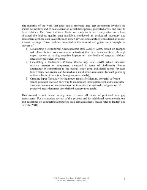
The majority of <strong>the</strong> work that goes into a protected area gap assessment involves <strong>the</strong>spatial delineation and critical evaluation of habitats/species, protected areas, and risks tofocal habitats. The Protected Area Tools are ready to be used only after users haveobtained <strong>the</strong> highest quality data available, conducted an ecological inventory andassessment of <strong>the</strong>se data layers through expert review, and carefully considered all modelscenario settings. Three modules presented in this tutorial will guide users through <strong>the</strong>process of1) Developing a customized Environmental Risk Surface (ERS) based on mappedrisk elements (i.e. socio-economic activities) that have been identified throughexpert review as having negative impacts on <strong>the</strong> health of targeted habitats,species or ecological systems;2) Calculating a landscape’s Relative Biodiversity Index (RBI), which measuresrelative rareness or uniqueness, measured in terms of biodiversity featureabundance in comparison to <strong>the</strong> overall study area. Individual scores for eachbiodiversity occurrence can be used as a stand alone assessment for each planningunit or subsets of units (e.g. hexagons, watersheds);3) Creating input files and viewing model results for Marxan, powerful softwarewhich provides users an easy way to manipulate input parameters and test/reviewvarious conservation scenarios in order to achieve an optimal configuration ofprotected areas that meet user defined conservation goals.This tutorial is not meant in any way to cover all facets of protected area gapassessments. For a complete review of this process and for additional recommendationsand guidelines on conducting a protected area gap assessment, please refer to Dudley andParrish (2004).TNC Protected Area Tools (PAT) Version 3.0The Nature Conservancy, August 20099


