

mag

Create successful ePaper yourself
Turn your PDF publications into a flip-book with our unique Google optimized e-Paper software.
Malaysia Water Research Journal<br />
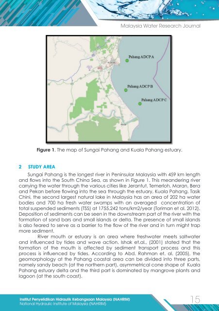
Figure 1. The map of Sungai Pahang and Kuala Pahang estuary.<br />
2 STUDY AREA<br />
Sungai Pahang is the longest river in Peninsular Malaysia with 459 km length<br />
and flows into the South China Sea, as shown in Figure 1. This meandering river<br />
carrying the water through the various cities like Jerantut, Temerloh, Maran, Bera<br />
and Pekan before flowing into the sea through the estuary, Kuala Pahang. Tasik<br />
Chini, the second largest natural lake in Malaysia has an area of 202 ha water<br />
bodies and 700 ha fresh water swamps with an averaged concentration of<br />
total suspended sediments (TSS) at 1755,242 tons/km2/year (Toriman et al. 2012).<br />
Deposition of sediments can be seen in the downstream part of the river with the<br />
formation of sand bars and small islands or delta. The presence of small islands<br />
is also feared to serve as a barrier to the flow of the river and in turn might trap<br />
more sediment.<br />
River mouth or estuary is an area where freshwater meets saltwater<br />
and influenced by tides and wave action. Ishak et.al., (2001) stated that the<br />
formation of the mouth is affected by sediment transport process and this<br />
process is influenced by tides. According to Abd. Rahman et. al. (2005), the<br />
geomorphology at the Pahang coastal area can be divided into three parts,<br />
namely sandy beach (at the northern part), asymmetrical cone shape of Kuala<br />
Pahang estuary delta and the third part is dominated by mangrove plants and<br />
lagoon (at the south coast).<br />
Institut Penyelidikan Hidraulik Kebangsaan Malaysia (NAHRIM)<br />
15<br />
National Hydraulic Institute of Malaysia (NAHRIM)