mag
Create successful ePaper yourself
Turn your PDF publications into a flip-book with our unique Google optimized e-Paper software.
Malaysia Water Research Journal<br />
2 PROJECT SITES<br />
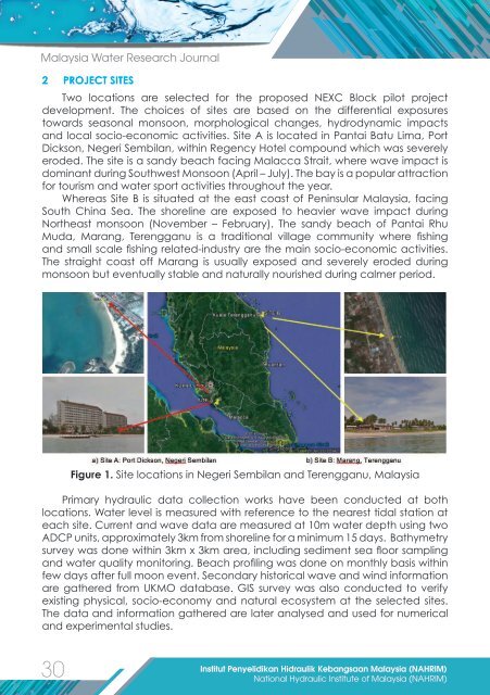
Two locations are selected for the proposed NEXC Block pilot project<br />
development. The choices of sites are based on the differential exposures<br />
towards seasonal monsoon, morphological changes, hydrodynamic impacts<br />
and local socio-economic activities. Site A is located in Pantai Batu Lima, Port<br />
Dickson, Negeri Sembilan, within Regency Hotel compound which was severely<br />
eroded. The site is a sandy beach facing Malacca Strait, where wave impact is<br />
dominant during Southwest Monsoon (April – July). The bay is a popular attraction<br />
for tourism and water sport activities throughout the year.<br />
Whereas Site B is situated at the east coast of Peninsular Malaysia, facing<br />
South China Sea. The shoreline are exposed to heavier wave impact during<br />
Northeast monsoon (November – February). The sandy beach of Pantai Rhu<br />
Muda, Marang, Terengganu is a traditional village community where fishing<br />
and small scale fishing related-industry are the main socio-economic activities.<br />
The straight coast off Marang is usually exposed and severely eroded during<br />
monsoon but eventually stable and naturally nourished during calmer period.<br />
Figure 1. Site locations in Negeri Sembilan and Terengganu, Malaysia<br />
Primary hydraulic data collection works have been conducted at both<br />
locations. Water level is measured with reference to the nearest tidal station at<br />
each site. Current and wave data are measured at 10m water depth using two<br />
ADCP units, approximately 3km from shoreline for a minimum 15 days. Bathymetry<br />
survey was done within 3km x 3km area, including sediment sea floor sampling<br />
and water quality monitoring. Beach profiling was done on monthly basis within<br />
few days after full moon event. Secondary historical wave and wind information<br />
are gathered from UKMO database. GIS survey was also conducted to verify<br />
existing physical, socio-economy and natural ecosystem at the selected sites.<br />
The data and information gathered are later analysed and used for numerical<br />
and experimental studies.<br />
30<br />
Institut Penyelidikan Hidraulik Kebangsaan Malaysia (NAHRIM)<br />
National Hydraulic Institute of Malaysia (NAHRIM)


