

mag

Create successful ePaper yourself
Turn your PDF publications into a flip-book with our unique Google optimized e-Paper software.
3 EXPERIMENTAL SETUP<br />
Malaysia Water Research Journal<br />
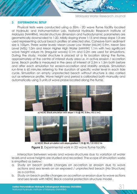
Physical tests were conducted using a 50m - 2D wave flume facility located<br />
at Hydraulic and Instrumentation Lab, National Hydraulic Research Institute of<br />
Malaysia (NAHRIM). Model structure dimension and hydrodynamic parameters are<br />
geometrically downscaled to 1:20. Mildly sloping shore 1:15 and steep slope 1:3 are<br />
used representing actual beach profiles at selected sites. Cohesive-form sediment<br />
size is 100µm. Three water levels; Mean Lower Low Water (MLLW) 0.9m, Mean Sea<br />
Level (MSL) 1.0m and Mean Higher High Water (MHHW) 1.1m with two significant<br />
wave height values Hs (irregular waves) 0.1m and 0.2m are used for simulations.<br />
During the study, model structure is placed at a fix location along the flume,<br />
approximately at the centre of interest study area i.e. in active erosion / accretion<br />
zone. Beach profile is measured in the area of interest of 2.5m x 1.5m both before<br />
and after each simulation for erosion-accretion and stability analysis. Simulation<br />
run-time is 60 minutes referring to the duration of specific water level in each tide<br />
cycle. Simulation on empty unprotected beach without structure is also carried<br />
out as reference profile. Wave height and period is calibrated both manually and<br />
automatically using 3 units of wave probe located along the flume.<br />
Figure 2. Experimental work in 2D wave flume facility<br />
Interaction between waves and waves-structures due to variation of water<br />
levels and wave heights are studied and recorded. The scope of simulation works<br />
is simplified as below:<br />
a. Study on beach profile changes on accretion or erosion due to wave<br />
actions and sea levels on an exposed / unprotected beach (No Structure)<br />
as a control,<br />
b. Study on beach profile changes on accretion or erosion due to wave actions<br />
and sea levels with NEXC Block coastal protection structure model ,<br />
Institut Penyelidikan Hidraulik Kebangsaan Malaysia (NAHRIM)<br />
31<br />
National Hydraulic Institute of Malaysia (NAHRIM)