No. 2 - Its Gran Canaria Magazine
Rutas, recomendaciones y noticias de Gran Canaria Routes, tips and news about Gran Canaria
Rutas, recomendaciones y noticias de Gran Canaria
Routes, tips and news about Gran Canaria
You also want an ePaper? Increase the reach of your titles
YUMPU automatically turns print PDFs into web optimized ePapers that Google loves.
68
DISCOVER GRAN CANARIA I DESCUBRE GRAN CANARIA Nº 2
SOUTHWEST ROUTE
The southwest region offers the most emblematic images of Gran Canaria, offering stark
contrasts between its green hilly areas down to its warm coastline. This area is the favourate
holiday destination for thousands of tourists thanks to its amazing beaches and exquisite
tourist facilities. For this reason, it is necessary we learn about everything that symbolises our
land, which includes the sun and the beach, but by also looking further afield to other locations
that are in no way inferior to the coast.
So we start our route in Santa Lucía de Tirajana before going around the municipalities of San
Bartolomé, Mogán and La Aldea.
1. Santa Lucía de Tirajana ■ 2. San Bartolomé de Tirajana ■ 3. Mogán ■ 4. La Aldea de San Nicolás
Puerto de Mogán
1. Santa Lucía de Tirajana
Santa Lucía de Tirajana is on the way
down to the south. Our starting point
is the Church of Santa Lucía, where
its unique quarry stone façade and
dome attract the attention of all visitors.
Close by is the El Hao Fortress Museum,
of great archaeological interest,
which displays remains found
at the region's settlements and is
surrounded by an attractive garden
with endemic plant species.
As we go down to the coast we come
to the Castillo de la Fortaleza Museum
and the archaeological settlement
of Fortaleza de Ansite, belonging to
Barranco de Tirajana, a ravine containing
house caves and burial caves
plus a huge array of archaeological
material which, according to legend,
was one of the last dwelling areas of
the pre-Hispanic inhabitants. In the
surrounding area we can make out
the Tirajana and Sorrueda reservoirs,
along with a number of palm groves
and beautiful landscapes that we can
admire from one of the strategically
placed viewing points at Guriete, El
Ingenio and La Sorrueda.
From here we can access any of the
municipality's three main towns, namely
Sardina del Sur, El Doctoral and
Vecindario. The latter is a highly developed
shopping and industrial area,
home to the Zafra Museum, which
provides a fascinating insight into the
region's agricultural traditions.
Down at the coast, Pozo Izquierdo
beach comes into view, an internationally
famous beach for windsurfing
enthusiasts and a regular venue for
many world championship events.
This coastal fishing resort is also famous
for its fine local gastronomy.
2. San Bartolomé de Tirajana
Having enjoyed the wonders of Santa
Lucía we move into the largest municipality
on the island in terms of land
surface area, San Bartolomé de Tirajana.
The contrast between its historic
interior and its coastal tourist resort
is highly apparent.
Our route takes us inland which,
thanks to its priviledged position
at the heart of Caldera de Tirajana,
boasts being a top location for sports
and mountain tourism. We come into
the village of Tunte, with its Church
of San Bartolomé de Tirajana and the
Los Yánez House Museum opposite,
where we take a welcome break to
sample the exquisite wines from the
Bodega de las Tirajanas.
The hills and summit area are home
to some breathtaking ravines such
as Tirajana, Arguineguín, Fataga, Los
Vicentes, La Data and Barranco de
Chamoriscan, which open out in Maspalomas.
At Fataga ravine, described
as a place “where Canarians said that
no Christian would ever set foot” according
to the chronicles by Governor
Pedro de Vera and Captain Miguel
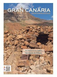
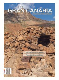
Muxica, we can contemplate the Arteara
Necropolis, the largest aboriginal
cemetery in Gran Canaria and one
of the largest in the Archipelago.
On our descent down to the coast,
we stop off at the Vista de Fataga
viewpoint, the small hamlet of the
same name and the viewpoint at Degollada
de las Yeguas, to take in some
superb panoramic views, which allow
for calm reflection.
However, the main tourist resort now
awaits us on its shimmering coast,
which begins at Playa de Tarajalillo
and ends at Pasito Blanco. Strung out
between these two points are Bahía
Feliz Residential Area, Playa del Águila,
San Agustín, Las Burras, Playa del
Inglés, Maspalomas and Meloneras.
The last two constitute what is known
as the Maspalomas Costa Canaria
tourist resort, home to the stunning
sand dunes, the Palmeral palm grove
and the Charca (pond) de Maspalomas,
catalogued as a Special Natural
Reserve. It is a truly unique landscape
and botanical setting in the Canaries,
and one of the favourite spots on the
island for taking that special holiday
snap.
We also come to Faro de Maspalomas,
a lighthouse that rises 60 metres up
from the ground. It is an absolutely
idyllic spot for enjoying a sunset while
we take a stroll along the avenue.
3. Mogán
Following our itinerary we move onto
Mogán, famous for its steep and rugged
terrain, which stretches out
along stunning ravines down to the
sea. The natural spaces not to be missed
are the Soria reservoir, the largest
in Gran Canaria and a haven for cardon
and tabaiba bushes, and the Veneguera
and Mogán ravines, where
we can enjoy green summits topped
with pine trees, an oasis of Canary
palm trees and exotic fruit trees that
create wholly spectacular landscapes.
As for beaches, the ones at Arquineguín,
Patalavaca, Anfi del Mar, Puerto
Rico, Amadores, Tauro, Playa del Cura,
Taurito and Puerto de Mogán are all
quite outstanding. They all feature
promenades for walking along, water
sports facilities and nautical tourism
activities, including cetacean watching.


