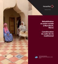
La définition d'une stratégie d'intervention. La ... - RehabiMed
La définition d'une stratégie d'intervention. La ... - RehabiMed
La définition d'une stratégie d'intervention. La ... - RehabiMed

You also want an ePaper? Increase the reach of your titles
YUMPU automatically turns print PDFs into web optimized ePapers that Google loves.
<strong>La</strong> <strong>définition</strong> d’une <strong>stratégie</strong> d’intervention.<br />
<strong>La</strong> definición de una estrategia de intervención<br />
Defining a strategy for intervention<br />
The city shape and its natural context<br />
Maria Rosália Guerreiro<br />
Urban designer and assistant professor<br />
Research interests:<br />
Natural environment and urban morphology, topography and urban<br />
form, ecology and territory, vernacular and regional architecture,<br />
sustainable urban design, bioclimatic design<br />
Adress:<br />
Department of Architecture<br />
ISCTE, Av. das Forças Armadas, 1649-026 Lisbon – Portugal<br />
e-mail<br />
rosalia.guerreiro@iscte.pt<br />
Telephone:<br />
00351 919201737<br />
INTRODUCTION<br />
The subject of the present work is the study of the relationship<br />
between the city’s shape and its natural context. The ‘design’ of cities<br />
over a territory doesn’t happen independently of its natural context.<br />
The surface of the land has already its own form which determines the<br />
pattern of many cities. The climate characteristics also suggest different<br />
sites and forms of occupation.<br />
As a result of these constrains, man has made beautiful and sustainable<br />
urban landscapes over the time, especially those non-planned cities,<br />
called organic, generated, vernacular, spontaneous or geomorphic.<br />
Many of them, like the Mediterranean cities, have so strongly accepted<br />
the natural features, that it is possible to identify urban patterns<br />
according to its natural environment.<br />
The study of the urban form is associated to the idea of rational<br />
planning and the production of a model. The territory, as the base for<br />
our activities, has been seen many times as an element which generates<br />
irregularity to the urban form.<br />
The objective of the proposed paper is to show the relationship<br />
between the structural quality of the Portuguese traditional cities<br />
and its natural context. Starting from this point we try to explain the<br />
genesis and growth of urban forms, especially those called organic or<br />
geomorphic.<br />
THE NATURAL CONTEXT AND THE URBAN FORM<br />
The territory and its natural features (topography, climate, etc.) are<br />
determinant for the configuration of the city. For example, in the middle<br />
of slop, or at the ridge of a mountain occurs a natural concentration of<br />
settlements.<br />
For understanding the genesis and form of these spaces is necessary<br />
to know the elements of urbanization of the territory. The paths, or the<br />
division of the land, which generates the urban matrix are examples of<br />
structures produced by man that are closely related with the natural<br />
environment.<br />
In this way the natural pre-existences participate in the shape of the<br />
urban form by producing a relationship between territorial typology<br />
and urban typology.<br />
THE PATHS AND THE URBANIZATION OF THE TERRITORY<br />
The paths are the most important elements in the urbanization of the<br />
territory. The roads which cross a continent or the link between two<br />
settlements are the first structure created by man. Each building or<br />
groups of buildings are linked by paths, and the paths are always the<br />
antecedents of any urban structure.<br />
The relationship between paths and the topography seems to be<br />
obvious: crossing the less distance with minimum effort. In this way,<br />
itineraries should be traced along the ridge lines, valley lines or parallels<br />
to the contour lines. This typology is more efficient in regions where the<br />
topography is extremely accentuated.<br />
The path works as a guide line for the structure of the settlement. They<br />
are the first step for the construction of the city. The accessibility it’s vital<br />
for its growing or death. Being paths a collective space they function as<br />
the most stable structure over a territory.<br />
PORTUGUESE URBAN SITES: A TYPOLOGY FOR THE ISLAND OF<br />
AÇORES<br />
At Island of Açores the settlements are frequently conditioned by the<br />
topography and climate. The majority of the urban settlements are on the<br />
coast, next to the sea, where they can achieve the bioclimatic comfort.<br />
The follow classification gives us an overview of the existent urban sites<br />
and their morphology. Despite the location of the islands at the Atlantic<br />
sea they present many Mediterranean characteristics.<br />
Coast promontory settlement:<br />
Generally the ridge lines and promontories are the first places to be<br />
settled in a territory. This happened by motives of defence, bioclimatic<br />
comfort or accessibility.<br />
Figure 1 shows the settlement of Vila do Porto located on a promontory<br />
site at the island of Santa Maria. The urban form is linear and shaped by<br />
the land available on the top between two profound valleys. The main<br />
street is the spine of the urban structure and is developed through the<br />
ridge line, perpendicular to the sea coast. This street was constructed<br />
over an old ridge path which guarantees the accessibility to the interior<br />
of the island. Parallel and perpendicular streets are developed to the<br />
main street. The centre of the promontory tends to be the centre of the<br />
system through the location of the plaza and the church.<br />
Mouth of the river settlement:<br />
Valley lines are so important for the establishment of paths over the<br />
territory as the ridge lines. But the bottom of the valleys is less stable<br />
and defensible. The settlements are not permanent and only appear in<br />
periods of peace.<br />
Figure 2 shows the settlement of Faial da Terra located at a bottom of<br />
a valley next to the mouth of the river at the island of São Miguel. The<br />
urban form has the same geometry as figure 1, but this time shaped<br />
by the valley line and by the land available at the river-side. Here the<br />
buildings were placed along the valley path which follows the river<br />
until the sea.<br />
198