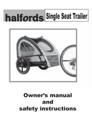
Download instructions here - Halfords
Download instructions here - Halfords
Download instructions here - Halfords

You also want an ePaper? Increase the reach of your titles
YUMPU automatically turns print PDFs into web optimized ePapers that Google loves.
Tip: To further enhance the effect of the night colour scheme, you can instruct<br />
Navsure to decrease the display backlight when the night colours are used. Set the<br />
desired backlight levels for both daylight and night modes.<br />
Note: The colours mentioned and screenshots included in this manual refer to the<br />
default daytime and night colour schemes. They may not look the same in the<br />
schemes you have chosen.<br />
3.3.4 Streets and roads<br />
The similarity of Navsure to paper roadmaps is also convenient when it comes to<br />
streets, the most important elements of the map concerning navigation. Navsure<br />
uses similar colour codes to those you are accustomed to, and the width of the<br />
streets also refers to their importance, so it will not be difficult to tell a highway from a<br />
small street.<br />
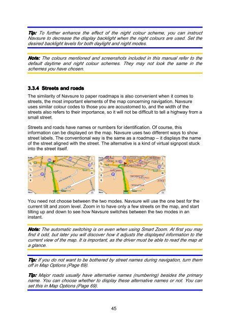
Streets and roads have names or numbers for identification. Of course, this<br />
information can be displayed on the map. Navsure uses two different ways to show<br />
street labels. The conventional way is the same as a roadmap – it displays the name<br />
of the street aligned with the street. The alternative is a kind of virtual signpost stuck<br />
into the street itself.<br />
You need not choose between the two modes. Navsure will use the one best for the<br />
current tilt and zoom level. Zoom in to have only a few streets on the map, and start<br />
tilting up and down to see how Navsure switches between the two modes in an<br />
instant.<br />
Note: The automatic switching is on even when using Smart Zoom. At first you may<br />
find it odd, but later you will discover how it adjusts the displayed information to the<br />
current view of the map. It is important, as the driver must be able to read the map at<br />
a glance.<br />
Tip: If you do not want to be bot<strong>here</strong>d by street names during navigation, turn them<br />
off in Map Options (Page 69).<br />
Tip: Major roads usually have alternative names (numbering) besides the primary<br />
name. You can choose whether to display these alternative names or not. You can<br />
set this in Map Options (Page 69).<br />
45